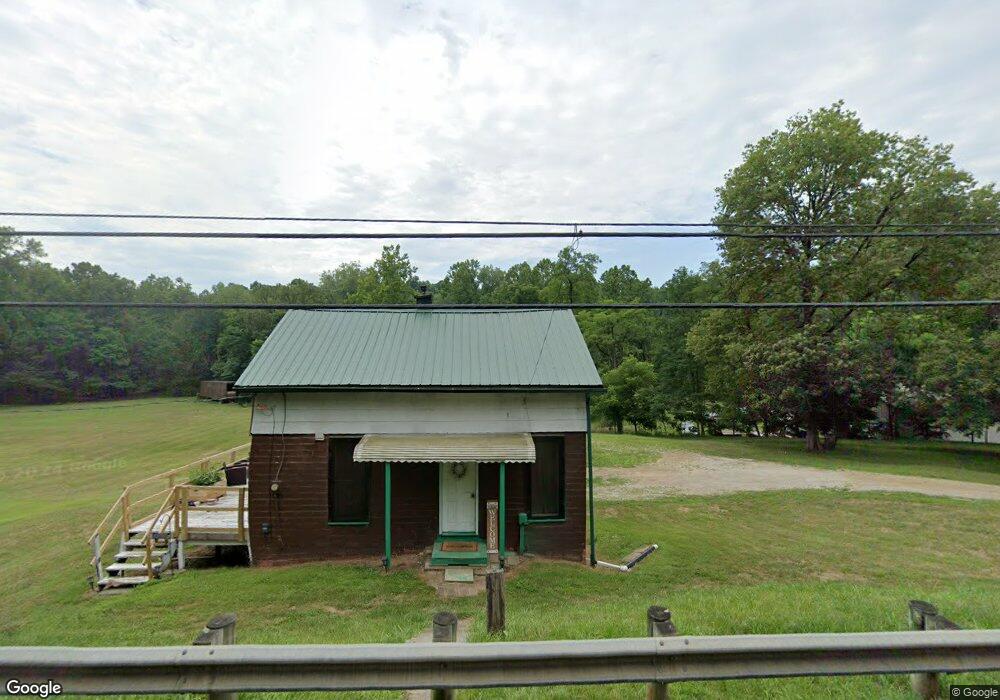
4240 Lattasburg Rd Wooster, OH 44691
Estimated Value: $138,591 - $183,000
1
Bed
1
Bath
756
Sq Ft
$215/Sq Ft
Est. Value
About This Home
This home is located at 4240 Lattasburg Rd, Wooster, OH 44691 and is currently estimated at $162,197, approximately $214 per square foot. 4240 Lattasburg Rd is a home located in Wayne County with nearby schools including Northwestern Elementary School, Northwestern Middle School, and Northwestern High School.
Ownership History
Date
Name
Owned For
Owner Type
Purchase Details
Closed on
Oct 23, 2023
Sold by
Hunter Marvin Ray
Bought by
Myatt Timothy S
Current Estimated Value
Home Financials for this Owner
Home Financials are based on the most recent Mortgage that was taken out on this home.
Original Mortgage
$70,000
Outstanding Balance
$67,140
Interest Rate
8.25%
Mortgage Type
New Conventional
Estimated Equity
$95,057
Purchase Details
Closed on
Jan 1, 1987
Bought by
Hunter Marvin Ray
Create a Home Valuation Report for This Property
The Home Valuation Report is an in-depth analysis detailing your home's value as well as a comparison with similar homes in the area
Home Values in the Area
Average Home Value in this Area
Purchase History
| Date | Buyer | Sale Price | Title Company |
|---|---|---|---|
| Myatt Timothy S | $140,000 | None Listed On Document | |
| Hunter Marvin Ray | -- | -- |
Source: Public Records
Mortgage History
| Date | Status | Borrower | Loan Amount |
|---|---|---|---|
| Open | Myatt Timothy S | $70,000 |
Source: Public Records
Tax History Compared to Growth
Tax History
| Year | Tax Paid | Tax Assessment Tax Assessment Total Assessment is a certain percentage of the fair market value that is determined by local assessors to be the total taxable value of land and additions on the property. | Land | Improvement |
|---|---|---|---|---|
| 2023 | $987 | $37,060 | $20,080 | $16,980 |
| 2022 | $685 | $26,280 | $14,240 | $12,040 |
| 2021 | $687 | $26,280 | $14,240 | $12,040 |
| 2020 | $695 | $26,280 | $14,240 | $12,040 |
| 2019 | $613 | $23,220 | $13,360 | $9,860 |
| 2018 | $599 | $23,220 | $13,360 | $9,860 |
| 2017 | $595 | $23,220 | $13,360 | $9,860 |
| 2016 | $541 | $22,320 | $12,840 | $9,480 |
| 2015 | $534 | $22,320 | $12,840 | $9,480 |
| 2014 | $879 | $22,320 | $12,840 | $9,480 |
| 2013 | $833 | $20,480 | $9,570 | $10,910 |
Source: Public Records
Map
Nearby Homes
- 3125 Henderson Rd
- 3322 Aspen Dr
- 3094 Briarwood Dr
- 2290 Linwood Ct
- 3303 W Smithville Western Rd
- 3283 W Smithville Western Rd
- Tupelo Plan at Clear Creek Run
- Hazel Plan at Clear Creek Run
- 1680 Carlin Trail
- 1633 Carlin Trail
- Aspen Plan at Clear Creek Run
- Spruce Plan at Clear Creek Run
- Cedar Plan at Clear Creek Run
- 5167 Overton Rd
- 2457 Barrington Way Unit 325
- 2457 Barrington Way Unit 327
- 2457 Barrington Way Unit 334
- 1951 Saddle Brook Cir Unit 1951
- 2520 Barrington Way Unit 529
- 4293 Clear Creek Valley Rd
- 4284 Lattasburg Rd
- 4241 Lattasburg Rd
- 4289 Lattasburg Rd
- 4320 Lattasburg Rd
- 4344 Lattasburg Rd
- 4346 Lattasburg Rd
- 4423 Lattasburg Rd
- 4500 Lattasburg Rd
- 4463 Lattasburg Rd
- 4501 Lattasburg Rd
- 4501 Lattasburg Rd
- 1766 N Smyser Rd
- 1943 Congress Rd
- 2015 Congress Rd
- 3951 Lattasburg Rd
- 4539 Lattasburg Rd
- 2103 Congress Rd
- 2079 Congress Rd
- 4536 Lattasburg Rd
- 2165 Congress Rd