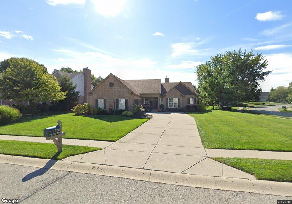
4241 First Flight Cir Zionsville, IN 46077
Estimated Value: $527,000 - $592,000
3
Beds
3
Baths
3,760
Sq Ft
$150/Sq Ft
Est. Value
About This Home
This home is located at 4241 First Flight Cir, Zionsville, IN 46077 and is currently estimated at $565,246, approximately $150 per square foot. 4241 First Flight Cir is a home located in Boone County with nearby schools including Union Elementary School, Zionsville Middle School, and Zionsville Community High School.
Ownership History
Date
Name
Owned For
Owner Type
Purchase Details
Closed on
Jul 2, 2018
Sold by
Morel Donald J and Wentworth Barbara Ann
Bought by
Roper Stephen and Roper Lisa
Current Estimated Value
Home Financials for this Owner
Home Financials are based on the most recent Mortgage that was taken out on this home.
Original Mortgage
$281,700
Outstanding Balance
$244,169
Interest Rate
4.6%
Mortgage Type
Construction
Estimated Equity
$321,077
Purchase Details
Closed on
May 7, 2008
Sold by
Trinity Homes Llc
Bought by
Morel Donald J and Wentworth Barbara Ann
Home Financials for this Owner
Home Financials are based on the most recent Mortgage that was taken out on this home.
Original Mortgage
$169,425
Interest Rate
5.93%
Mortgage Type
New Conventional
Create a Home Valuation Report for This Property
The Home Valuation Report is an in-depth analysis detailing your home's value as well as a comparison with similar homes in the area
Home Values in the Area
Average Home Value in this Area
Purchase History
| Date | Buyer | Sale Price | Title Company |
|---|---|---|---|
| Roper Stephen | -- | None Available | |
| Morel Donald J | -- | -- |
Source: Public Records
Mortgage History
| Date | Status | Borrower | Loan Amount |
|---|---|---|---|
| Open | Roper Stephen | $281,700 | |
| Previous Owner | Morel Donald J | $169,425 |
Source: Public Records
Tax History Compared to Growth
Tax History
| Year | Tax Paid | Tax Assessment Tax Assessment Total Assessment is a certain percentage of the fair market value that is determined by local assessors to be the total taxable value of land and additions on the property. | Land | Improvement |
|---|---|---|---|---|
| 2025 | $4,969 | $470,800 | $48,400 | $422,400 |
| 2024 | $4,969 | $449,600 | $48,400 | $401,200 |
| 2023 | $4,615 | $429,000 | $48,400 | $380,600 |
| 2022 | $4,460 | $403,700 | $48,400 | $355,300 |
| 2021 | $4,015 | $345,300 | $48,400 | $296,900 |
| 2020 | $3,951 | $339,000 | $48,400 | $290,600 |
| 2019 | $3,803 | $335,800 | $48,400 | $287,400 |
| 2018 | $3,692 | $327,600 | $48,400 | $279,200 |
| 2017 | $6,698 | $314,500 | $48,400 | $266,100 |
| 2016 | $6,520 | $311,300 | $48,400 | $262,900 |
| 2014 | $6,512 | $292,500 | $48,400 | $244,100 |
| 2013 | $6,347 | $283,700 | $48,400 | $235,300 |
Source: Public Records
Map
Nearby Homes
- 4150 Huntsman Dr
- 4265 Hamilton Run
- 4155 Hartswick Ct
- 4135 Hartswick Ct
- 4190 Hartswick Ct
- 11218 Hamilton Run
- 11135 Hamilton Run
- 4365 Hamilton Run
- 11211 Hamilton Run
- 4130 Hartswick Ct
- 4292 Alderborough Way
- 4483 Thicket Trace
- 11003 Holliday Farms Blvd
- 5356-B Us Highway 421
- 4580 Strathmore Ln
- 10876 Holliday Farms Blvd
- 4763 Woods Edge Dr
- 11592 Trail Ridge Place
- 11850 Arborhill Dr
- 4295 Riverbirch Run
- 4241 1st Flight Cir
- 4231 First Flight Cir
- 4231 1st Flight Cir
- 4271 Field Master Dr
- 4270 Field Master Dr
- 4240 1st Flight Cir
- 4221 First Flight Cir
- 4260 Field Master Dr
- 4251 Field Master Dr
- 4221 1st Flight Cir
- 4211 1st Flight Cir
- 4350 Brittany Dr
- 4200 1st Flight Cir
- 4211 First Flight Cir
- 4360 Brittany Dr
- 4340 Brittany Dr
- 4210 Huntsman Dr
- lot 99 Brittney Dr
- Lot 99 Brittany Dr
- 4250 Field Master Dr