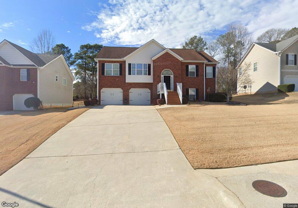
4241 Singletree Dr Unit 1 Douglasville, GA 30135
Anneewakee NeighborhoodEstimated Value: $315,138 - $343,000
3
Beds
2
Baths
1,784
Sq Ft
$183/Sq Ft
Est. Value
About This Home
This home is located at 4241 Singletree Dr Unit 1, Douglasville, GA 30135 and is currently estimated at $326,535, approximately $183 per square foot. 4241 Singletree Dr Unit 1 is a home located in Douglas County with nearby schools including New Manchester Elementary School, Chapel Hill Middle School, and New Manchester High School.
Ownership History
Date
Name
Owned For
Owner Type
Purchase Details
Closed on
Nov 26, 2017
Sold by
Robinson Bobby Herbert
Bought by
Robinson Bobby Herbert and Mullins Robinson Belinda Carol
Current Estimated Value
Purchase Details
Closed on
Aug 5, 2004
Sold by
Apex Homes Inc
Bought by
Robinson Bobby H
Home Financials for this Owner
Home Financials are based on the most recent Mortgage that was taken out on this home.
Original Mortgage
$135,000
Interest Rate
6.19%
Mortgage Type
New Conventional
Create a Home Valuation Report for This Property
The Home Valuation Report is an in-depth analysis detailing your home's value as well as a comparison with similar homes in the area
Home Values in the Area
Average Home Value in this Area
Purchase History
| Date | Buyer | Sale Price | Title Company |
|---|---|---|---|
| Robinson Bobby Herbert | -- | -- | |
| Robinson Bobby H | $168,900 | -- |
Source: Public Records
Mortgage History
| Date | Status | Borrower | Loan Amount |
|---|---|---|---|
| Previous Owner | Robinson Bobby H | $135,000 |
Source: Public Records
Tax History Compared to Growth
Tax History
| Year | Tax Paid | Tax Assessment Tax Assessment Total Assessment is a certain percentage of the fair market value that is determined by local assessors to be the total taxable value of land and additions on the property. | Land | Improvement |
|---|---|---|---|---|
| 2024 | $832 | $127,320 | $25,200 | $102,120 |
| 2023 | $832 | $127,320 | $25,200 | $102,120 |
| 2022 | $864 | $107,160 | $19,240 | $87,920 |
| 2021 | $864 | $74,120 | $16,000 | $58,120 |
| 2020 | $855 | $74,120 | $16,000 | $58,120 |
| 2019 | $621 | $61,320 | $13,680 | $47,640 |
| 2018 | $607 | $59,960 | $13,680 | $46,280 |
| 2017 | $516 | $48,680 | $12,240 | $36,440 |
| 2016 | $520 | $47,200 | $12,240 | $34,960 |
| 2015 | $446 | $45,640 | $12,240 | $33,400 |
| 2014 | $446 | $38,080 | $10,800 | $27,280 |
| 2013 | -- | $36,040 | $10,240 | $25,800 |
Source: Public Records
Map
Nearby Homes
- 3771 Tackett Rd Unit 1
- 3863 Grist Mill
- 3784 Tackett Rd
- 3939 Craggy Perch
- 4159 Birch Bark Way
- 4295 Caroline Ct
- 3675 Buffalo Ct
- 4112 Twig Ct
- 4469 White Hill Place
- 4066 Wedgefield Ct
- 4050 Harvest Ridge Dr
- 3269 N Winds Trail
- 4542 White Rd
- 4015 Soaring Dr
- 4020 Willow Ridge Rd
- 3203 Lower Creek Dr
- 4014 Oak Stone Dr
- 3448 Craggy Perch Unit 4
- 4251 Singletree Dr
- 4231 Singletree Dr Unit 1
- 4221 Singletree Dr
- 4261 Singletree Dr Unit 1
- 4190 Leola Rd
- 4240 Singletree Dr
- 4278 Tillage Path
- 4278 Tillage Path Unit 15
- 4269 Tillage Path
- 4271 Singletree Dr Unit 1
- 4271 Single Tree Dr
- 4250 Singletree Dr Unit 1
- 4211 Singletree Dr Unit 1
- 4260 Singletree Dr Unit 1
- 4228 Leola Rd
- 4230 Singletree Dr Unit 1
- 4210 Singletree Dr Unit 1
- 4281 Singletree Dr
- 4281 Single Tree Dr
- 4214 Leola Rd