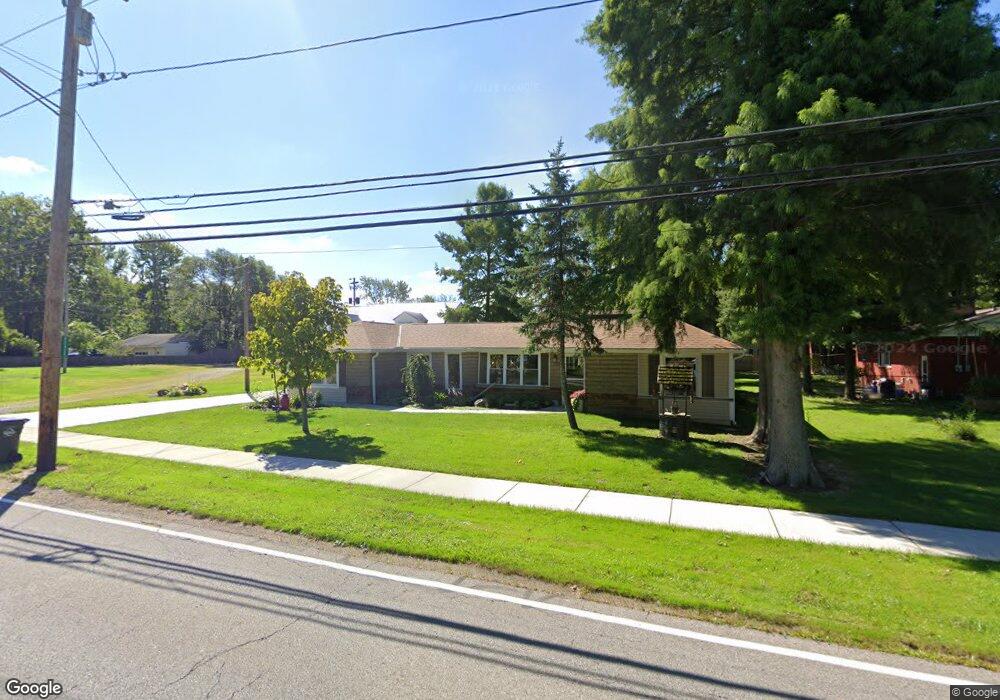
42425 Griswold Rd Elyria, OH 44035
Estimated Value: $202,492 - $233,000
2
Beds
1
Bath
1,703
Sq Ft
$127/Sq Ft
Est. Value
About This Home
This home is located at 42425 Griswold Rd, Elyria, OH 44035 and is currently estimated at $216,623, approximately $127 per square foot. 42425 Griswold Rd is a home located in Lorain County with nearby schools including Crestwood Elementary School, Westwood Middle School, and Elyria High School.
Ownership History
Date
Name
Owned For
Owner Type
Purchase Details
Closed on
Oct 23, 2008
Sold by
James Donald H
Bought by
Us Bank National Association
Current Estimated Value
Purchase Details
Closed on
Jun 9, 2008
Sold by
Us Bank National Association
Bought by
Blaz John E
Purchase Details
Closed on
Nov 29, 2004
Sold by
Estate Of Daniel Brenzo
Bought by
Brenzo Winifred
Home Financials for this Owner
Home Financials are based on the most recent Mortgage that was taken out on this home.
Original Mortgage
$75,000
Interest Rate
8.55%
Mortgage Type
Purchase Money Mortgage
Purchase Details
Closed on
Nov 23, 2004
Sold by
Brenzo Winifred
Bought by
James Donald H
Home Financials for this Owner
Home Financials are based on the most recent Mortgage that was taken out on this home.
Original Mortgage
$75,000
Interest Rate
8.55%
Mortgage Type
Purchase Money Mortgage
Create a Home Valuation Report for This Property
The Home Valuation Report is an in-depth analysis detailing your home's value as well as a comparison with similar homes in the area
Home Values in the Area
Average Home Value in this Area
Purchase History
We collect this data history from publicly available records. To have your information removed, we recommend requesting removal directly through your county’s website.
| Date | Buyer | Sale Price | Title Company |
|---|---|---|---|
| Us Bank National Association | $46,000 | None Available | |
| Blaz John E | $41,000 | Cornerstone Title Svcs Llc | |
| Brenzo Winifred | -- | -- | |
| James Donald H | $75,000 | Landamerica Lawyers Title |
Source: Public Records
Mortgage History
We collect this data history from publicly available records. To have your information removed, we recommend requesting removal directly through your county’s website.
| Date | Status | Borrower | Loan Amount |
|---|---|---|---|
| Previous Owner | James Donald H | $75,000 |
Source: Public Records
Tax History
| Year | Tax Paid | Tax Assessment Tax Assessment Total Assessment is a certain percentage of the fair market value that is determined by local assessors to be the total taxable value of land and additions on the property. | Land | Improvement |
|---|---|---|---|---|
| 2024 | $3,216 | $58,412 | $11,421 | $46,991 |
| 2023 | $2,890 | $45,213 | $7,441 | $37,772 |
| 2022 | $2,880 | $45,213 | $7,441 | $37,772 |
| 2021 | $2,707 | $45,213 | $7,441 | $37,772 |
| 2020 | $2,528 | $37,250 | $6,130 | $31,120 |
| 2019 | $2,522 | $37,250 | $6,130 | $31,120 |
| 2018 | $2,240 | $31,800 | $6,130 | $25,670 |
| 2017 | $2,316 | $32,630 | $5,410 | $27,220 |
| 2016 | $2,234 | $32,630 | $5,410 | $27,220 |
| 2015 | $2,104 | $32,630 | $5,410 | $27,220 |
| 2014 | $1,293 | $33,740 | $5,590 | $28,150 |
| 2013 | $1,293 | $33,740 | $5,590 | $28,150 |
Source: Public Records
Map
Nearby Homes
- 41903 Griswold Rd
- 42009 Adelbert St
- 6635 Lake Ave
- 41796 Adelbert St
- 41819 Emerson Ct
- 259 Samuel St
- 6261 Elyria Ave
- 308 Samuel St
- 136 Sheriff St
- 348 Robin Dr
- 6281 Orchard Meadow Dr
- 6136 Orchard Meadow Dr
- 6280 Orchard Meadow Dr
- 6242 Orchard Meadow Dr
- 41345 Griswold Rd
- 42190 Helen St
- 229 Courtland St
- 468 High St
- 43033 N Ridge Rd
- 975 N Ridge Rd E
- 6913 Amaryllis Dr
- 0 Amaryllis Ct
- 42385 Griswold Rd
- 42420 Griswold Rd
- 6930 Amaryllis Dr
- 42513 Griswold Rd
- 6951 Amaryllis Dr
- 6948 Amaryllis Dr
- 42378 Griswold Rd
- 42356 Griswold Rd
- 6966 Amaryllis Ct
- 6966 Amaryllis Dr
- 42525 Griswold Rd
- 42520 Griswold Rd
- 42325 Griswold Rd
- 42313 Griswold Rd
- 42535 Griswold Rd
- 42310 Griswold Rd
- 42295 Griswold Rd
- 42551 Griswold Rd
Your Personal Tour Guide
Ask me questions while you tour the home.