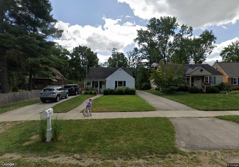
42439 Parkhurst Rd Unit Bldg-Unit Plymouth, MI 48170
Estimated Value: $308,000 - $318,000
--
Bed
2
Baths
1,104
Sq Ft
$282/Sq Ft
Est. Value
About This Home
This home is located at 42439 Parkhurst Rd Unit Bldg-Unit, Plymouth, MI 48170 and is currently estimated at $311,750, approximately $282 per square foot. 42439 Parkhurst Rd Unit Bldg-Unit is a home located in Wayne County with nearby schools including Canton High School, Farrand Elementary School, and West Middle School.
Ownership History
Date
Name
Owned For
Owner Type
Purchase Details
Closed on
Nov 8, 2018
Sold by
Wolf Allen Michael
Bought by
Murphy Sara
Current Estimated Value
Home Financials for this Owner
Home Financials are based on the most recent Mortgage that was taken out on this home.
Original Mortgage
$164,350
Outstanding Balance
$144,217
Interest Rate
4.7%
Mortgage Type
New Conventional
Estimated Equity
$167,533
Purchase Details
Closed on
Nov 12, 2001
Sold by
Paganone James E
Bought by
Wolf Allen M
Create a Home Valuation Report for This Property
The Home Valuation Report is an in-depth analysis detailing your home's value as well as a comparison with similar homes in the area
Home Values in the Area
Average Home Value in this Area
Purchase History
| Date | Buyer | Sale Price | Title Company |
|---|---|---|---|
| Murphy Sara | $173,000 | None Available | |
| Wolf Allen M | $127,000 | -- |
Source: Public Records
Mortgage History
| Date | Status | Borrower | Loan Amount |
|---|---|---|---|
| Open | Murphy Sara | $164,350 | |
| Closed | Wolf Allen M | -- |
Source: Public Records
Tax History Compared to Growth
Tax History
| Year | Tax Paid | Tax Assessment Tax Assessment Total Assessment is a certain percentage of the fair market value that is determined by local assessors to be the total taxable value of land and additions on the property. | Land | Improvement |
|---|---|---|---|---|
| 2025 | $2,390 | $129,400 | $0 | $0 |
| 2024 | $2,390 | $116,600 | $0 | $0 |
| 2023 | $2,277 | $112,700 | $0 | $0 |
| 2022 | $3,026 | $106,400 | $0 | $0 |
| 2021 | $2,936 | $101,200 | $0 | $0 |
| 2019 | $2,849 | $86,310 | $0 | $0 |
| 2018 | $1,143 | $78,470 | $0 | $0 |
| 2017 | $798 | $21,600 | $0 | $0 |
| 2016 | $1,496 | $71,500 | $0 | $0 |
| 2015 | $4,788 | $64,600 | $0 | $0 |
| 2013 | $4,639 | $48,070 | $0 | $0 |
| 2012 | -- | $45,500 | $16,490 | $29,010 |
Source: Public Records
Map
Nearby Homes
- 42265 S Mill Race Ct
- 42424 Bradner Ct
- 42260 Five Mile Rd
- 42030 Schoolcraft Rd
- 42422 Steepleview St
- 15036 Lakewood Dr
- 14420 Northville Rd
- 42550 Clemons Dr
- 42737 Steepleview Ct
- 41718 Ladywood Dr
- 233 N Sydney Ct
- 202 N Sydney Ct
- 42881 Inverness Ct
- 41855 Brentwood Dr
- 14430 Shadywood Ct
- 41363 Greenbriar Ln
- 14537 Huntington Dr
- 41134 Russet Ln
- 40764 Crabtree Ln
- 1066 York St
- 42449 Parkhurst Rd
- 42457 Parkhurst Rd
- 15167 Bradner Ave
- 15149 Bradner Ave
- 42465 Parkhurst Rd
- 42440 Lakeland Ct
- 42450 Lakeland Ct
- 42460 Lakeland Ct
- 42430 Parkhurst Rd
- 42475 Parkhurst Rd
- 42470 Lakeland Ct
- 42420 Parkhurst Rd
- 42440 Parkhurst Rd Unit Bldg-Unit
- 42440 Parkhurst Rd
- 42450 Parkhurst Rd
- 42480 Lakeland Ct
- 42410 Parkhurst Rd
- 42430 Lakeland Ct
- 42485 Parkhurst Rd
- 42458 Parkhurst Rd