Estimated Value: $237,000 - $256,000
4
Beds
3
Baths
2,160
Sq Ft
$116/Sq Ft
Est. Value
About This Home
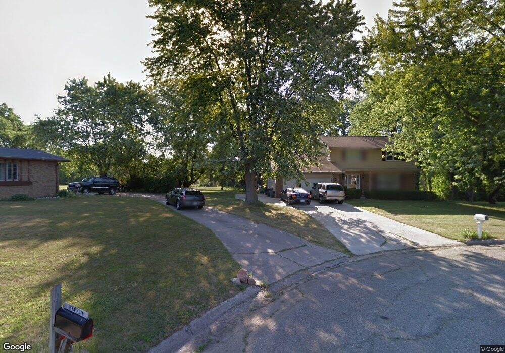
This home is located at 4245 Post Dr, Flint, MI 48532 and is currently estimated at $249,486, approximately $115 per square foot. 4245 Post Dr is a home located in Genesee County with nearby schools including Carman-Ainsworth High School, Genesee STEM Academy, and Linden Charter Academy.
Ownership History
Date
Name
Owned For
Owner Type
Purchase Details
Closed on
Nov 22, 2020
Sold by
Johnson Michael K and Johnson Deborah L
Bought by
Johnson Michael K and Johnson Deborah L
Current Estimated Value
Home Financials for this Owner
Home Financials are based on the most recent Mortgage that was taken out on this home.
Original Mortgage
$256,500
Outstanding Balance
$228,249
Interest Rate
2.8%
Mortgage Type
New Conventional
Estimated Equity
$21,237
Purchase Details
Closed on
Aug 6, 1999
Sold by
Dell Donna Y
Bought by
Johnson Deborah
Create a Home Valuation Report for This Property
The Home Valuation Report is an in-depth analysis detailing your home's value as well as a comparison with similar homes in the area
Home Values in the Area
Average Home Value in this Area
Purchase History
| Date | Buyer | Sale Price | Title Company |
|---|---|---|---|
| Johnson Michael K | -- | None Available | |
| Johnson Deborah | $137,000 | Sargents Title Company Llc |
Source: Public Records
Mortgage History
| Date | Status | Borrower | Loan Amount |
|---|---|---|---|
| Open | Johnson Michael K | $256,500 |
Source: Public Records
Tax History
| Year | Tax Paid | Tax Assessment Tax Assessment Total Assessment is a certain percentage of the fair market value that is determined by local assessors to be the total taxable value of land and additions on the property. | Land | Improvement |
|---|---|---|---|---|
| 2025 | $2,978 | $125,400 | $0 | $0 |
| 2024 | $1,555 | $121,400 | $0 | $0 |
| 2023 | $1,483 | $112,900 | $0 | $0 |
| 2022 | $1,282 | $103,500 | $0 | $0 |
| 2021 | $2,628 | $96,000 | $0 | $0 |
| 2020 | $1,333 | $81,600 | $0 | $0 |
| 2019 | $1,314 | $76,000 | $0 | $0 |
| 2018 | $2,490 | $69,500 | $0 | $0 |
| 2017 | $2,367 | $69,500 | $0 | $0 |
| 2016 | $2,431 | $60,500 | $0 | $0 |
| 2015 | $2,207 | $57,600 | $0 | $0 |
| 2014 | $1,309 | $55,300 | $0 | $0 |
| 2012 | -- | $55,700 | $55,700 | $0 |
Source: Public Records
Map
Nearby Homes
- 1368 Autumn Dr
- 1090 Cabot Dr
- 4075 Townview Dr
- 5021 Forest Side Dr
- 2174 Mill Rd
- 1095 Devenish Ln
- 4022 Beecher Rd
- 000 Devenish Ln
- Graham Rd N Graham Rd
- 1034 Normandy Terrace Dr
- 3528 Beecher Rd
- 1246 Dyemeadow Ln
- 1137 S Graham Rd
- 2008 Beekman Ct
- 2 Charter Dr
- 4199 Sheraton Dr
- 3360 Beecher Rd
- 3350 Beecher Rd
- 0 Charter Dr Unit 50153638
- 3522 Ridgecliffe Dr
- 4255 Post Dr
- 1343 Donal Dr
- 1333 Donal Dr
- 4269 Post Dr
- 4256 Post Dr
- 1245 Westwood Dr
- 1321 Donal Dr
- 1233 Westwood Dr
- 4272 Post Dr
- 1191 Westwood Dr
- 1275 Westwood Dr
- 4283 Post Dr
- 1183 Westwood Dr
- 1225 Westwood Dr
- 1265 Westwood Dr
- 1311 Donal Dr
- 1209 Westwood Dr
- 1306 Donal Dr
- 4288 Hall Mark Ct Unit Bldg-Unit
- 4288 Hall Mark Ct
Your Personal Tour Guide
Ask me questions while you tour the home.