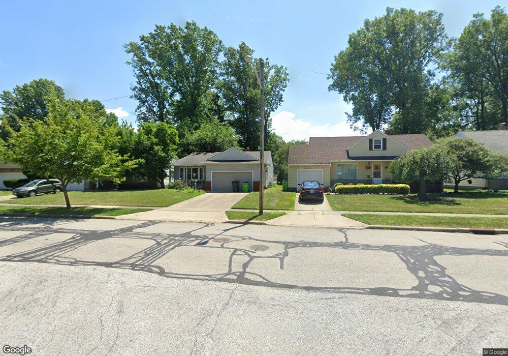
4246 Plymouth Dr South Euclid, OH 44121
Estimated Value: $170,000 - $189,000
3
Beds
2
Baths
1,360
Sq Ft
$132/Sq Ft
Est. Value
About This Home
This home is located at 4246 Plymouth Dr, South Euclid, OH 44121 and is currently estimated at $179,245, approximately $131 per square foot. 4246 Plymouth Dr is a home located in Cuyahoga County with nearby schools including Adrian Elementary School, Greenview Upper Elementary School, and Memorial Junior High School.
Ownership History
Date
Name
Owned For
Owner Type
Purchase Details
Closed on
Jul 11, 2004
Sold by
Hecker Jean Marie and Macharoni Mary D
Bought by
Hecker Jean Marie
Current Estimated Value
Purchase Details
Closed on
Dec 16, 2002
Sold by
Hecker Jean Marie
Bought by
Hecker Jean Marie and Macharoni Mary D
Purchase Details
Closed on
Nov 26, 1991
Sold by
Macharoni Mary D
Bought by
Hecker Jean Marie
Purchase Details
Closed on
Oct 22, 1991
Sold by
Macharoni Mary D
Bought by
Macharoni Mary D
Purchase Details
Closed on
May 21, 1986
Sold by
Podlipsky Alexander
Bought by
Macharoni Mary D
Purchase Details
Closed on
Dec 3, 1980
Sold by
Lepianka Philip D
Bought by
Podlipsky Alexander
Purchase Details
Closed on
Apr 18, 1980
Sold by
Haas William G and C L
Bought by
Lepianka Philip D
Purchase Details
Closed on
Jan 1, 1975
Bought by
Haas William G and C L
Create a Home Valuation Report for This Property
The Home Valuation Report is an in-depth analysis detailing your home's value as well as a comparison with similar homes in the area
Home Values in the Area
Average Home Value in this Area
Purchase History
| Date | Buyer | Sale Price | Title Company |
|---|---|---|---|
| Hecker Jean Marie | -- | -- | |
| Hecker Jean Marie | -- | -- | |
| Hecker Jean Marie | $33,500 | -- | |
| Macharoni Mary D | $33,500 | -- | |
| Macharoni Mary D | $67,000 | -- | |
| Podlipsky Alexander | $65,000 | -- | |
| Lepianka Philip D | $61,000 | -- | |
| Haas William G | -- | -- |
Source: Public Records
Tax History Compared to Growth
Tax History
| Year | Tax Paid | Tax Assessment Tax Assessment Total Assessment is a certain percentage of the fair market value that is determined by local assessors to be the total taxable value of land and additions on the property. | Land | Improvement |
|---|---|---|---|---|
| 2024 | $3,373 | $52,815 | $9,590 | $43,225 |
| 2023 | $2,870 | $38,540 | $7,700 | $30,840 |
| 2022 | $2,892 | $38,535 | $7,700 | $30,835 |
| 2021 | $2,871 | $38,540 | $7,700 | $30,840 |
| 2020 | $2,526 | $31,330 | $6,270 | $25,060 |
| 2019 | $2,315 | $89,500 | $17,900 | $71,600 |
| 2018 | $2,304 | $31,330 | $6,270 | $25,060 |
| 2017 | $2,319 | $29,610 | $6,160 | $23,450 |
| 2016 | $2,305 | $29,610 | $6,160 | $23,450 |
| 2015 | $2,388 | $29,610 | $6,160 | $23,450 |
| 2014 | $2,388 | $31,190 | $6,480 | $24,710 |
Source: Public Records
Map
Nearby Homes
- 963 Chelston Rd
- 4258 Bluestone Rd
- 1114 Piermont Rd
- 1089 Argonne Rd
- 4289 Swaffield Dr
- 1129 Homestead Rd
- 1129 Avondale Rd
- 1105 Winston Rd
- 1164 S Belvoir Blvd
- 1166 Argonne Rd
- 4400 Angela Dr
- 925 Keystone Dr
- 857 Quarry Dr
- 1157 Sylvania Rd
- 1231 Winston Rd
- 4406 Elmwood Rd
- 868 Haywood Dr
- 4532 Anderson Rd
- 1148 Sylvania Rd
- 854 Keystone Dr
- 4250 Plymouth Dr
- 4242 Plymouth Dr
- 4256 Plymouth Dr
- 4238 Plymouth Dr
- 4249 Robert Rd
- 4245 Robert Rd
- 4262 Plymouth Dr
- 4241 Robert Rd
- 4253 Robert Rd
- 4230 Plymouth Dr
- 4249 Plymouth Dr
- 4253 Plymouth Dr
- 4241 Plymouth Dr
- 4226 Plymouth Dr
- 4261 Plymouth Dr
- 4229 Plymouth Dr
- 988 Chelston Rd
- 984 Chelston Rd
- 4237 Robert Rd
- 1000 Chelston Rd