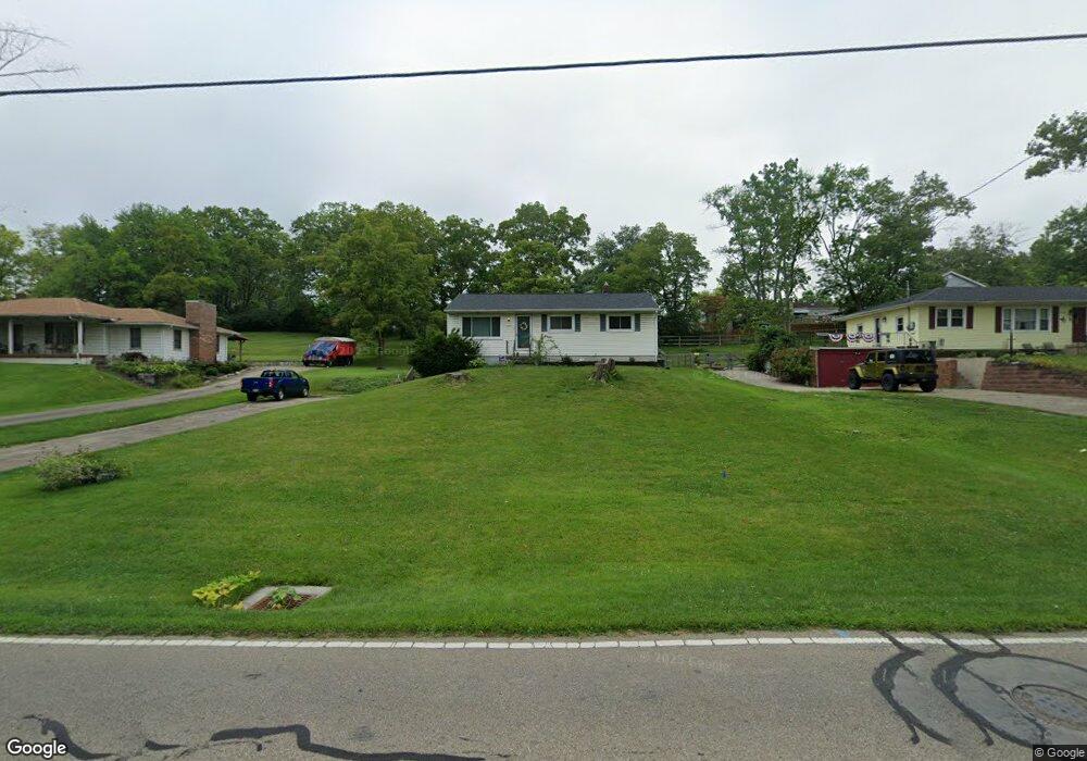
425 Britton Ln Monroe, OH 45050
Estimated Value: $203,993 - $254,000
2
Beds
1
Bath
1,040
Sq Ft
$220/Sq Ft
Est. Value
About This Home
This home is located at 425 Britton Ln, Monroe, OH 45050 and is currently estimated at $228,748, approximately $219 per square foot. 425 Britton Ln is a home located in Butler County with nearby schools including Monroe Primary School, Monroe Elementary School, and Monroe Junior High School.
Ownership History
Date
Name
Owned For
Owner Type
Purchase Details
Closed on
Nov 3, 1997
Sold by
Griffis Ricky T
Bought by
Mclaughlin David P and Stacy Pamela
Current Estimated Value
Home Financials for this Owner
Home Financials are based on the most recent Mortgage that was taken out on this home.
Original Mortgage
$92,945
Outstanding Balance
$13,895
Interest Rate
7.51%
Mortgage Type
FHA
Estimated Equity
$214,853
Purchase Details
Closed on
Mar 1, 1994
Create a Home Valuation Report for This Property
The Home Valuation Report is an in-depth analysis detailing your home's value as well as a comparison with similar homes in the area
Home Values in the Area
Average Home Value in this Area
Purchase History
| Date | Buyer | Sale Price | Title Company |
|---|---|---|---|
| Mclaughlin David P | $93,000 | -- | |
| -- | $77,500 | -- |
Source: Public Records
Mortgage History
| Date | Status | Borrower | Loan Amount |
|---|---|---|---|
| Open | Mclaughlin David P | $92,945 |
Source: Public Records
Tax History
| Year | Tax Paid | Tax Assessment Tax Assessment Total Assessment is a certain percentage of the fair market value that is determined by local assessors to be the total taxable value of land and additions on the property. | Land | Improvement |
|---|---|---|---|---|
| 2025 | $1,850 | $50,600 | $12,290 | $38,310 |
| 2024 | $1,850 | $50,600 | $12,290 | $38,310 |
| 2023 | $1,854 | $46,850 | $12,290 | $34,560 |
| 2022 | $1,525 | $38,890 | $12,290 | $26,600 |
| 2021 | $1,475 | $38,890 | $12,290 | $26,600 |
| 2020 | $1,528 | $38,890 | $12,290 | $26,600 |
| 2019 | $1,866 | $27,220 | $11,890 | $15,330 |
| 2018 | $1,011 | $27,220 | $11,890 | $15,330 |
| 2017 | $1,032 | $27,220 | $11,890 | $15,330 |
| 2016 | $953 | $25,100 | $11,890 | $13,210 |
| 2015 | $942 | $25,100 | $11,890 | $13,210 |
| 2014 | $1,250 | $25,100 | $11,890 | $13,210 |
| 2013 | $1,250 | $30,380 | $11,890 | $18,490 |
Source: Public Records
Map
Nearby Homes
- 415 Brookhurst Dr
- 195 Brittony Woods Dr
- 180 Wexford Dr
- 16 Ridge Wood Dr
- 316 Wellington Ct
- 100 N Main St
- 921 Heritage Green Dr Unit 9302
- 1416 Wilderness Way Unit 7300
- 1753 Weatherstone Cir Unit 13G6
- 220 Gatehouse Ct
- 852 Willowbrook Dr
- 75 Teil Tree Ct
- 132 Village Ct
- VANDERBURGH Plan at Caravel
- SEBASTIAN Plan at Caravel
- ASH LAWN Plan at Caravel
- BENNETT Plan at Caravel
- LYNDHURST Plan at Caravel
- CRESTWOOD Plan at Caravel
- ALDRIDGE Plan at Caravel
- 415 Britton Ln
- 433 Britton Ln
- 443 Britton Ln
- 405 Britton Ln
- 17 Penbrooke Ct
- 25 Deneen Ave
- 432 Britton Ln
- 420 Britton Ln
- 7 Penbrooke Ct
- 27 Penbrooke Ct
- 365 Britton Ln
- 410 Britton Ln
- 442 Britton Ln
- 37 Penbrooke Ct
- 509 Britton Ln
- 370 Britton Ln
- 355 Britton Ln
- 24 Deneen Ave
- 508 Britton Ln
- 20 Penbrooke Ct