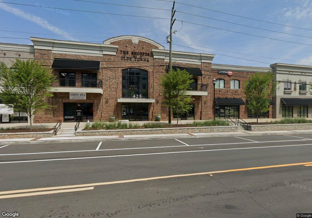
425 Buford Hwy Unit 103 & 104 Suwanee, GA 30024
Estimated Value: $9,465,905
2
Beds
1
Bath
33,387
Sq Ft
$284/Sq Ft
Est. Value
About This Home
This home is located at 425 Buford Hwy Unit 103 & 104, Suwanee, GA 30024 and is currently estimated at $9,465,905, approximately $283 per square foot. 425 Buford Hwy Unit 103 & 104 is a home located in Gwinnett County with nearby schools including Roberts Elementary School, North Gwinnett Middle School, and North Gwinnett High School.
Ownership History
Date
Name
Owned For
Owner Type
Purchase Details
Closed on
Dec 10, 2020
Sold by
Old Towne Enterprises Llc
Bought by
425 Buford Hwy Llc and C/O Shiloh Property Management
Current Estimated Value
Purchase Details
Closed on
Apr 12, 2006
Sold by
Nards Inc
Bought by
Old Towne Ents Llc
Home Financials for this Owner
Home Financials are based on the most recent Mortgage that was taken out on this home.
Original Mortgage
$6,000,000
Interest Rate
8.25%
Mortgage Type
Commercial
Purchase Details
Closed on
Sep 28, 2005
Sold by
Cole Regina H
Bought by
Nards Inc
Home Financials for this Owner
Home Financials are based on the most recent Mortgage that was taken out on this home.
Original Mortgage
$508,810
Interest Rate
7.5%
Mortgage Type
Commercial
Create a Home Valuation Report for This Property
The Home Valuation Report is an in-depth analysis detailing your home's value as well as a comparison with similar homes in the area
Home Values in the Area
Average Home Value in this Area
Purchase History
| Date | Buyer | Sale Price | Title Company |
|---|---|---|---|
| 425 Buford Hwy Llc | $5,900,000 | -- | |
| Old Towne Ents Llc | -- | -- | |
| Nards Inc | $550,000 | -- |
Source: Public Records
Mortgage History
| Date | Status | Borrower | Loan Amount |
|---|---|---|---|
| Previous Owner | Old Towne Ents Llc | $6,000,000 | |
| Previous Owner | Nards Inc | $508,810 |
Source: Public Records
Tax History Compared to Growth
Tax History
| Year | Tax Paid | Tax Assessment Tax Assessment Total Assessment is a certain percentage of the fair market value that is determined by local assessors to be the total taxable value of land and additions on the property. | Land | Improvement |
|---|---|---|---|---|
| 2025 | $66,078 | $2,091,080 | $443,240 | $1,647,840 |
| 2024 | $75,213 | $2,878,080 | $443,240 | $2,434,840 |
| 2023 | $75,213 | $2,350,400 | $322,360 | $2,028,040 |
| 2022 | $92,187 | $2,448,000 | $257,880 | $2,190,120 |
| 2021 | $51,313 | $1,360,000 | $257,880 | $1,102,120 |
| 2020 | $51,653 | $1,360,000 | $257,880 | $1,102,120 |
| 2019 | $44,824 | $1,360,000 | $257,880 | $1,102,120 |
| 2018 | $45,028 | $1,360,000 | $257,880 | $1,102,120 |
| 2016 | $44,970 | $1,360,000 | $257,880 | $1,102,120 |
| 2015 | $40,223 | $1,200,000 | $257,880 | $942,120 |
| 2014 | $40,488 | $1,200,000 | $257,880 | $942,120 |
Source: Public Records
Map
Nearby Homes
- 3908 Charleston Market St
- 0 Mary Lou St Unit 7445497
- 0 Mary Lou St Unit 10365827
- 3971 Savannah Square St
- 320 Town Center Ave Unit 206
- 3862 Memphis Dr
- 3793 Memphis Dr
- 350 Suwanee Ave
- 524 Cypher Dr
- 212 Suwanee Ave
- 645 Stonepark Ln
- The Murray Plan at Old Town Suwanee
- The Telfair Plan at Old Town Suwanee
- 3779 Lawrenceville Suwanee
- 3764 Sage Park Way
- 2459 Richmond Row Dr
- 0 Mohawk Trail Unit 10607084
- 3894 Dollar Cir
- 3880 Brushy Creek Way
- 260 Wildcat Ridge Dr
- 250 Wildcat Ridge Dr
- 625 Lambert Cove Trail
- 4300 Westbrook Rd Unit B
- 4300 Westbrook Rd Unit D
- 4300 Westbrook Rd Unit F
- 4300 Westbrook Rd Unit E
- 4300 Westbrook Rd Unit C
- 220 Wildcat Ridge Dr
- 240 Wildcat Ridge Dr
- 230 Wildcat Ridge Dr
- 400 Buford Hwy
- 400 Buford Hwy
- 437 Main St
- 431 Main St
- 441 Main St
- 350 Town Center Ave
- 350 Town Center Ave Unit 200 & 202
- 350 Town Center Ave Unit 200
- 350 Town Center Ave Unit 201