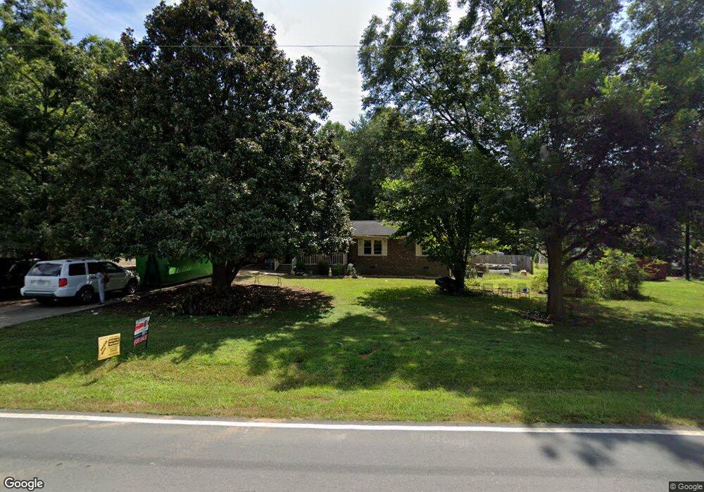
425 E Hanover Rd Graham, NC 27253
East Burlington NeighborhoodEstimated Value: $216,000 - $300,000
3
Beds
2
Baths
1,669
Sq Ft
$165/Sq Ft
Est. Value
About This Home
This home is located at 425 E Hanover Rd, Graham, NC 27253 and is currently estimated at $275,773, approximately $165 per square foot. 425 E Hanover Rd is a home located in Alamance County with nearby schools including Haw River Elementary School, Woodlawn Middle School, and Eastern Alamance High School.
Ownership History
Date
Name
Owned For
Owner Type
Purchase Details
Closed on
Oct 10, 2023
Sold by
Tucker Carter Rhonda and Lee Carter Brian
Bought by
Cruz Isidra and Cruz-Segura Bernardino
Current Estimated Value
Home Financials for this Owner
Home Financials are based on the most recent Mortgage that was taken out on this home.
Original Mortgage
$160,000
Outstanding Balance
$156,338
Interest Rate
7.23%
Mortgage Type
New Conventional
Estimated Equity
$119,435
Purchase Details
Closed on
Apr 30, 1999
Sold by
First Union Natl Bank
Bought by
Carter Brian L
Home Financials for this Owner
Home Financials are based on the most recent Mortgage that was taken out on this home.
Original Mortgage
$77,350
Interest Rate
7.06%
Create a Home Valuation Report for This Property
The Home Valuation Report is an in-depth analysis detailing your home's value as well as a comparison with similar homes in the area
Home Values in the Area
Average Home Value in this Area
Purchase History
| Date | Buyer | Sale Price | Title Company |
|---|---|---|---|
| Cruz Isidra | $160,000 | None Listed On Document | |
| Carter Brian L | $91,000 | -- |
Source: Public Records
Mortgage History
| Date | Status | Borrower | Loan Amount |
|---|---|---|---|
| Open | Cruz Isidra | $160,000 | |
| Previous Owner | Carter Brian L | $77,350 |
Source: Public Records
Tax History
| Year | Tax Paid | Tax Assessment Tax Assessment Total Assessment is a certain percentage of the fair market value that is determined by local assessors to be the total taxable value of land and additions on the property. | Land | Improvement |
|---|---|---|---|---|
| 2025 | $1,250 | $253,023 | $41,375 | $211,648 |
| 2024 | $1,187 | $253,023 | $41,375 | $211,648 |
| 2023 | $1,088 | $253,023 | $41,375 | $211,648 |
| 2022 | $1,728 | $156,868 | $39,456 | $117,412 |
| 2021 | $1,744 | $156,868 | $39,456 | $117,412 |
| 2020 | $1,760 | $156,868 | $39,456 | $117,412 |
| 2019 | $1,765 | $156,868 | $39,456 | $117,412 |
| 2018 | $0 | $156,868 | $39,456 | $117,412 |
| 2017 | $905 | $156,868 | $39,456 | $117,412 |
| 2016 | $1,488 | $143,801 | $35,148 | $108,653 |
| 2015 | $830 | $143,801 | $35,148 | $108,653 |
| 2014 | $758 | $143,801 | $35,148 | $108,653 |
Source: Public Records
Map
Nearby Homes
- 720 Audrey Ln
- 203 E Parker St
- 600 Mendel Terrace
- 609 N Marshall St
- 622 Bentley Ln
- 504 Walker Ave
- 501 Mendel Terrace
- 00 Burke St
- 207 E Parker St
- 2323 Buckingham Rd
- 2107 Martin St
- 511 N Main St
- 2545 Hyde St
- 213 Guthrie St
- 0 Trollinger Rd
- 705 Washington St
- 306 N Maple St
- 625 Columbia Ave
- 201 E Harden St
- 307 Oneida St
- 449 E Hanover Rd
- 503 E Hanover Rd
- 424 E Hanover Rd
- 507 E Hanover Rd
- 416 E Hanover Rd
- 412 E Hanover Rd
- 422 E Hanover Rd
- 508 E Hanover Rd
- 509 E Hanover Rd
- 601 E Hanover Rd Unit 603
- 404 E Hanover Rd
- 512 E Hanover Rd
- 1228 Pyrtle Dr
- 1211 Dixie St
- 600 E Hanover Rd
- 605 E Hanover Rd
- 1229 Pyrtle Dr
- 1220 Vincent Dr
- 1238 Pyrtle Dr
- 1226 Vincent Dr
Your Personal Tour Guide
Ask me questions while you tour the home.