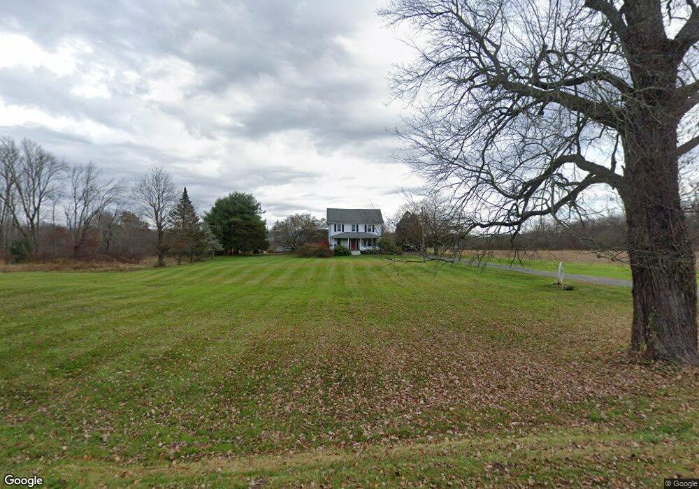
425 East Rd Broad Brook, CT 06016
Estimated Value: $506,000 - $541,011
5
Beds
4
Baths
2,695
Sq Ft
$194/Sq Ft
Est. Value
About This Home
This home is located at 425 East Rd, Broad Brook, CT 06016 and is currently estimated at $523,506, approximately $194 per square foot. 425 East Rd is a home located in Hartford County with nearby schools including Broad Brook Elementary School, East Windsor Middle School, and East Windsor High School.
Ownership History
Date
Name
Owned For
Owner Type
Purchase Details
Closed on
Apr 30, 1997
Sold by
Couture Diane M
Bought by
Gutsfeld Eric A and Levasseur Tammy M
Current Estimated Value
Home Financials for this Owner
Home Financials are based on the most recent Mortgage that was taken out on this home.
Original Mortgage
$55,000
Outstanding Balance
$8,127
Interest Rate
7.85%
Mortgage Type
Purchase Money Mortgage
Estimated Equity
$573,384
Purchase Details
Closed on
Aug 3, 1990
Sold by
Graczewski Robert
Bought by
Gengras Robert
Create a Home Valuation Report for This Property
The Home Valuation Report is an in-depth analysis detailing your home's value as well as a comparison with similar homes in the area
Home Values in the Area
Average Home Value in this Area
Purchase History
| Date | Buyer | Sale Price | Title Company |
|---|---|---|---|
| Gutsfeld Eric A | $58,000 | -- | |
| Gutsfeld Eric A | $58,000 | -- | |
| Gengras Robert | $162,500 | -- |
Source: Public Records
Mortgage History
| Date | Status | Borrower | Loan Amount |
|---|---|---|---|
| Open | Hastillo Edward | $55,000 | |
| Closed | Hastillo Edward | $55,000 | |
| Previous Owner | Hastillo Edward | $49,107 | |
| Closed | Hastillo Edward | $3,000 |
Source: Public Records
Tax History Compared to Growth
Tax History
| Year | Tax Paid | Tax Assessment Tax Assessment Total Assessment is a certain percentage of the fair market value that is determined by local assessors to be the total taxable value of land and additions on the property. | Land | Improvement |
|---|---|---|---|---|
| 2025 | $8,164 | $308,190 | $96,260 | $211,930 |
| 2024 | $7,569 | $308,190 | $96,260 | $211,930 |
| 2022 | $5,694 | $162,940 | $85,680 | $77,260 |
| 2021 | $5,621 | $162,940 | $85,680 | $77,260 |
| 2020 | $5,657 | $162,940 | $85,680 | $77,260 |
| 2019 | $5,581 | $162,940 | $85,680 | $77,260 |
| 2018 | $5,524 | $162,940 | $85,680 | $77,260 |
| 2017 | $6,937 | $211,700 | $92,490 | $119,210 |
| 2016 | $6,548 | $211,700 | $92,490 | $119,210 |
Source: Public Records
Map
Nearby Homes
- 72 Rockville Rd
- 239 Windsorville Rd
- 3 Standish Rd
- 377 Niederwerfer Rd
- 24 Abbott Rd
- 29 Graham Rd
- 5 Ridgeview Dr
- 20 Ellridge Place
- 1 Abbott Rd Unit 136
- 127 Robert Dr
- 24 Wapping Wood Rd
- 70 Robert Dr
- 183 Chamberlain Rd
- 253 East Rd
- 89 Cliffwood Dr
- 126 Gerald Dr
- 4 John Dr
- 32 Linda Ln
- 577 Griffin Rd
- 45 Rockledge Dr
- 428 East Rd
- 10 Matthew Ln
- 11 Matthew Ln
- 6 Matthew Ln
- 99 Rockville Rd
- 153 Rockville Rd
- 4 Matthew Ln
- 143 Rockville Rd
- 135 Rockville Rd
- 149 Rockville Rd
- 139 Rockville Rd
- 97 Rockville Rd
- 133 Rockville Rd
- 2 Matthew Ln
- 9 Matthew Ln
- 5 Matthew Ln
- 140 Rockville Rd
- 140 Rockville Rd
- 279 Windsorville Rd
- 1 Neiderwerfer Rd