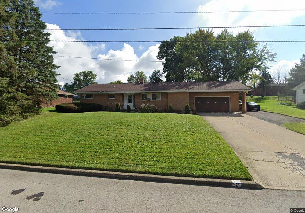
425 Eastern Ave Campbell, OH 44405
Estimated Value: $139,226 - $184,000
4
Beds
2
Baths
1,463
Sq Ft
$106/Sq Ft
Est. Value
About This Home
This home is located at 425 Eastern Ave, Campbell, OH 44405 and is currently estimated at $154,557, approximately $105 per square foot. 425 Eastern Ave is a home located in Mahoning County with nearby schools including Campbell Elementary School, Memorial High School, and Northeast Ohio Impact Academy.
Ownership History
Date
Name
Owned For
Owner Type
Purchase Details
Closed on
Mar 16, 2001
Sold by
Mele Anita and Carano Hilda
Bought by
Miranda Anthony and Miranda Lisa M
Current Estimated Value
Home Financials for this Owner
Home Financials are based on the most recent Mortgage that was taken out on this home.
Original Mortgage
$67,467
Outstanding Balance
$23,349
Interest Rate
7.03%
Mortgage Type
FHA
Estimated Equity
$131,208
Purchase Details
Closed on
Jan 1, 1990
Bought by
Mele Philip A and Mele Anita
Create a Home Valuation Report for This Property
The Home Valuation Report is an in-depth analysis detailing your home's value as well as a comparison with similar homes in the area
Home Values in the Area
Average Home Value in this Area
Purchase History
| Date | Buyer | Sale Price | Title Company |
|---|---|---|---|
| Miranda Anthony | $68,000 | Reliable Title Agency Inc | |
| Mele Philip A | -- | -- |
Source: Public Records
Mortgage History
| Date | Status | Borrower | Loan Amount |
|---|---|---|---|
| Open | Miranda Anthony | $67,467 |
Source: Public Records
Tax History
| Year | Tax Paid | Tax Assessment Tax Assessment Total Assessment is a certain percentage of the fair market value that is determined by local assessors to be the total taxable value of land and additions on the property. | Land | Improvement |
|---|---|---|---|---|
| 2025 | $1,762 | $33,590 | $1,980 | $31,610 |
| 2024 | $1,762 | $33,590 | $1,980 | $31,610 |
| 2023 | $1,741 | $33,590 | $1,980 | $31,610 |
| 2022 | $1,279 | $20,650 | $1,800 | $18,850 |
| 2021 | $1,196 | $20,650 | $1,800 | $18,850 |
| 2020 | $1,215 | $20,650 | $1,800 | $18,850 |
| 2019 | $1,288 | $19,490 | $1,700 | $17,790 |
| 2018 | $1,319 | $19,490 | $1,700 | $17,790 |
| 2017 | $1,442 | $19,490 | $1,700 | $17,790 |
| 2016 | $1,568 | $24,660 | $2,000 | $22,660 |
| 2015 | $1,537 | $24,660 | $2,000 | $22,660 |
| 2014 | $1,532 | $24,660 | $2,000 | $22,660 |
| 2013 | $1,501 | $24,660 | $2,000 | $22,660 |
Source: Public Records
Map
Nearby Homes
- 58 Rutledge Dr
- 214 Hamrock Dr
- 377 Coitsville Rd
- 111 Bassett Ln
- 631 Coitsville Rd
- 369 6th St
- 671 Coitsville Rd
- OL 38 Mccartney Rd
- 311 Park Dr
- 146 Greeley Ln
- 576 Breetz Dr
- 279 Coitsville Rd
- 462 13th St
- 32 Maranatha Dr
- 36 Maranatha Dr
- 24 Maranatha Dr
- 296 Sanderson Ave
- 0 Heidi Dr Unit 5141604
- 103 Gladstone St
- 0 Creed Cir Unit 5189573
- 421 Eastern Ave
- 429 Eastern Ave
- 692 Moore Ave
- 696 Moore Ave
- 688 Moore Ave
- 417 Eastern Ave
- 420 Eastern Ave
- 700 Moore Ave
- 424 Eastern Ave
- 684 Moore Ave
- 416 Eastern Ave
- 428 Eastern Ave
- 413 Eastern Ave
- 704 Moore Ave
- 680 Moore Ave
- 432 Eastern Ave
- 695 Moore Ave
- 408 Eastern Ave
- 699 Moore Ave
- 435 Mccartney Rd
Your Personal Tour Guide
Ask me questions while you tour the home.