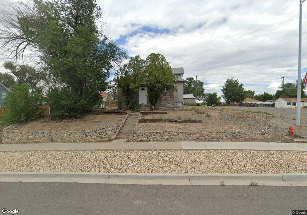
425 Main Olathe, CO 81425
Estimated Value: $147,000 - $194,113
2
Beds
1
Bath
992
Sq Ft
$172/Sq Ft
Est. Value
About This Home
This home is located at 425 Main, Olathe, CO 81425 and is currently estimated at $171,028, approximately $172 per square foot. 425 Main is a home located in Montrose County with nearby schools including Olathe Elementary School, Olathe Middle and High School, and Olathe Middle School.
Ownership History
Date
Name
Owned For
Owner Type
Purchase Details
Closed on
Dec 16, 2011
Sold by
Federal National Mortgage Association
Bought by
Bollinger Carl J
Current Estimated Value
Purchase Details
Closed on
Mar 1, 2011
Sold by
Thomas Eric G
Bought by
Federal National Mortgage Association
Purchase Details
Closed on
Dec 17, 2004
Sold by
Burnett Gary D and Burnett Linda L
Bought by
Thomas Eric G
Purchase Details
Closed on
Dec 20, 2002
Sold by
Smiley Mary Ellen
Bought by
Burnett Gary D and Burnett Linda L
Purchase Details
Closed on
May 1, 1972
Sold by
Gowdy Bonnie L and Campbell Diane L
Bought by
Smiley James William and Smiley Mary Ellen
Create a Home Valuation Report for This Property
The Home Valuation Report is an in-depth analysis detailing your home's value as well as a comparison with similar homes in the area
Purchase History
| Date | Buyer | Sale Price | Title Company |
|---|---|---|---|
| Bollinger Carl J | $20,000 | None Available | |
| Federal National Mortgage Association | -- | None Available | |
| Thomas Eric G | $73,300 | -- | |
| Burnett Gary D | $55,500 | -- | |
| Smiley James William | $7,500 | -- |
Source: Public Records
Tax History
| Year | Tax Paid | Tax Assessment Tax Assessment Total Assessment is a certain percentage of the fair market value that is determined by local assessors to be the total taxable value of land and additions on the property. | Land | Improvement |
|---|---|---|---|---|
| 2024 | $875 | $6,630 | $2,230 | $4,400 |
| 2023 | $525 | $10,700 | $3,600 | $7,100 |
| 2022 | $512 | $6,950 | $2,060 | $4,890 |
| 2021 | $529 | $7,150 | $2,120 | $5,030 |
| 2020 | $388 | $5,330 | $1,690 | $3,640 |
| 2019 | $376 | $5,330 | $1,690 | $3,640 |
| 2018 | $337 | $4,630 | $1,420 | $3,210 |
| 2017 | $331 | $4,630 | $1,420 | $3,210 |
| 2016 | $296 | $4,180 | $1,210 | $2,970 |
| 2015 | $275 | $4,180 | $1,210 | $2,970 |
| 2014 | $269 | $4,330 | $1,210 | $3,120 |
Source: Public Records
Map
Nearby Homes
- Lot 2(TBD) Wilson Ave
- 615 S Church Ave
- 217 N Highway 50 Business Loop
- 59727 U S 50
- 6851 Church Rd
- 6859 Church St
- 6910 High Mesa Rd
- 7528 S River Rd
- 7655 6075 Rd
- 58177 Garner Ln
- 6617 5700 Rd
- TBD (Lot 2) Gunnison Rd
- TBD (Lot 1) Gunnison Rd
- TBD (Lot 3) Gunnison Rd
- 56577 Hawthorne Ln
- 9550 High Mesa Rd
- 57001 Begonia Rd
- 5345 Highway 348
- 9150 6115 Rd
- 7276 5550 Rd
Your Personal Tour Guide
Ask me questions while you tour the home.