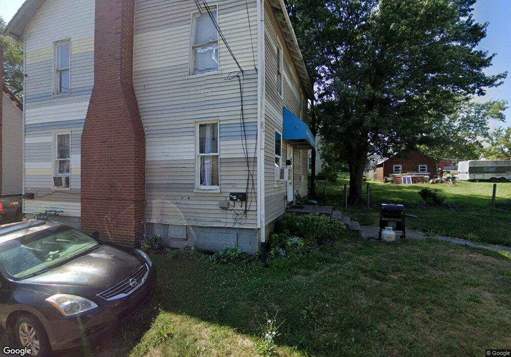
425 Mcnally Ct Alliance, OH 44601
Estimated Value: $51,411 - $108,000
3
Beds
2
Baths
1,560
Sq Ft
$57/Sq Ft
Est. Value
About This Home
This home is located at 425 Mcnally Ct, Alliance, OH 44601 and is currently estimated at $89,353, approximately $57 per square foot. 425 Mcnally Ct is a home located in Stark County with nearby schools including Alliance Intermediate School at Northside, Alliance Elementary School at Rockhill, and Alliance Middle School.
Ownership History
Date
Name
Owned For
Owner Type
Purchase Details
Closed on
May 3, 2010
Sold by
Dickson Joseph E and Dickson Denise S
Bought by
D J Dickson Properties Llc
Current Estimated Value
Purchase Details
Closed on
Apr 25, 2006
Sold by
Mcelroy Bernard T
Bought by
Dickson Joseph E and Dickson Denise S
Purchase Details
Closed on
Apr 25, 2005
Sold by
Mcelroy Bernard and Teli Mary Ann
Bought by
Mcelroy Bernard T
Purchase Details
Closed on
May 16, 1989
Purchase Details
Closed on
May 10, 1988
Create a Home Valuation Report for This Property
The Home Valuation Report is an in-depth analysis detailing your home's value as well as a comparison with similar homes in the area
Home Values in the Area
Average Home Value in this Area
Purchase History
| Date | Buyer | Sale Price | Title Company |
|---|---|---|---|
| D J Dickson Properties Llc | -- | None Available | |
| Dickson Joseph E | $6,500 | None Available | |
| Mcelroy Bernard T | $15,500 | -- | |
| -- | $2,500 | -- | |
| -- | $6,500 | -- |
Source: Public Records
Tax History Compared to Growth
Tax History
| Year | Tax Paid | Tax Assessment Tax Assessment Total Assessment is a certain percentage of the fair market value that is determined by local assessors to be the total taxable value of land and additions on the property. | Land | Improvement |
|---|---|---|---|---|
| 2025 | $759 | $5,740 | $2,800 | $2,940 |
| 2024 | $488 | $5,740 | $2,800 | $2,940 |
| 2023 | $476 | $5,570 | $1,440 | $4,130 |
| 2022 | $228 | $5,570 | $1,440 | $4,130 |
| 2021 | $203 | $5,570 | $1,440 | $4,130 |
| 2020 | $217 | $4,870 | $1,260 | $3,610 |
| 2019 | $34 | $4,870 | $1,260 | $3,610 |
| 2018 | $215 | $4,870 | $1,260 | $3,610 |
| 2017 | $517 | $4,170 | $1,050 | $3,120 |
| 2016 | $314 | $4,170 | $1,050 | $3,120 |
| 2015 | $267 | $4,170 | $1,050 | $3,120 |
| 2014 | $172 | $3,580 | $1,020 | $2,560 |
| 2013 | $86 | $3,580 | $1,020 | $2,560 |
Source: Public Records
Map
Nearby Homes
- 452 E Summit St
- 432 S Linden Ave
- V/L S Fredeom Ave
- 442 S Liberty Ave
- 1005 S Freedom Ave
- 356 E Broadway St
- 1044 S Liberty Ave
- 814 Milner St
- 142 S Seneca Ave
- 807 S Union Ave
- 427 S Union Ave
- 831 Wade Ave
- 1175 S Freedom Ave
- 361 E Main St
- 551 South St
- 140 W Summit St
- 1437 S Linden Ave
- 1395 S Webb Ave
- 729 Waugh St
- 1233 Woodland Ave
- 435 Mcnally Ct
- 430 Mcnally Ct
- 430 E Summit St
- 666 S Linden Ave
- 676 S Linden Ave
- 440 E Summit St
- 442 Mcnally Ct
- 660 S Linden Ave
- 436 E Summit St
- 650 S Linden Ave
- 688 S Linden Ave
- 446 Mcnally Ct
- 636 S Linden Ave
- 450 Mcnally Ct
- 638 S Linden Ave
- 441 E Summit St
- 649 S Freedom Ave
- 706 S Linden Ave
- 683 S Freedom Ave
- 663 S Freedom Ave