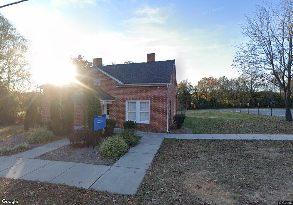
425 N Main St Wingate, NC 28174
Estimated Value: $284,000 - $382,000
3
Beds
1
Bath
2,013
Sq Ft
$170/Sq Ft
Est. Value
About This Home
This home is located at 425 N Main St, Wingate, NC 28174 and is currently estimated at $341,458, approximately $169 per square foot. 425 N Main St is a home located in Union County with nearby schools including Wingate Elementary School, East Union Middle School, and Forest Hills High School.
Ownership History
Date
Name
Owned For
Owner Type
Purchase Details
Closed on
Aug 12, 2014
Sold by
Steele Anne Marie and Furr Barbara
Bought by
Wingate University
Current Estimated Value
Purchase Details
Closed on
Jul 16, 2008
Sold by
Watson Grace C and Furr Barbara Grace Watson
Bought by
Watson Grace C and Watson J L
Purchase Details
Closed on
Dec 30, 2003
Sold by
Watson Lemuel Jackson and Watson Grace
Bought by
Wingate University
Purchase Details
Closed on
Dec 23, 2002
Sold by
Watson Lemuel Jackson and Watson Grace
Bought by
Wingate University Campus
Create a Home Valuation Report for This Property
The Home Valuation Report is an in-depth analysis detailing your home's value as well as a comparison with similar homes in the area
Home Values in the Area
Average Home Value in this Area
Purchase History
| Date | Buyer | Sale Price | Title Company |
|---|---|---|---|
| Wingate University | $105,000 | Chicago Title Insurance Co | |
| Watson Grace C | -- | None Available | |
| Wingate University | -- | -- | |
| Wingate University Campus | -- | -- |
Source: Public Records
Tax History
| Year | Tax Paid | Tax Assessment Tax Assessment Total Assessment is a certain percentage of the fair market value that is determined by local assessors to be the total taxable value of land and additions on the property. | Land | Improvement |
|---|---|---|---|---|
| 2025 | -- | $302,100 | $0 | $0 |
| 2024 | -- | $213,300 | $49,300 | $164,000 |
| 2023 | $0 | $213,300 | $49,300 | $164,000 |
| 2022 | $0 | $213,300 | $49,300 | $164,000 |
| 2021 | $222 | $213,300 | $49,300 | $164,000 |
| 2020 | $222 | $137,690 | $30,090 | $107,600 |
| 2019 | $222 | $137,690 | $30,090 | $107,600 |
| 2018 | $222 | $137,690 | $30,090 | $107,600 |
| 2017 | $232 | $137,700 | $30,100 | $107,600 |
| 2016 | $227 | $137,690 | $30,090 | $107,600 |
| 2015 | $229 | $137,690 | $30,090 | $107,600 |
| 2014 | $1,358 | $128,730 | $41,960 | $86,770 |
Source: Public Records
Map
Nearby Homes
- 1126 Overbrook Place
- 1022 Overbrook Place
- 1133 Overbrook Place
- 1018 Overbrook Place
- 1129 Overbrook Place
- 1107 Overbrook Place
- 4510 U S 74
- 201 Smith St Unit 13
- 410 W Elm St
- 000 U S 74
- 1333 Fremont Dr
- 1342 Fremont Dr
- 1313 Fremont Dr
- 1362 Fremont Dr
- 1334 Fremont Dr
- 1354 Fremont Dr
- 1320 Fremont Dr
- 1350 Fremont Dr
- 1358 Fremont Dr
- 1330 Fremont Dr
- 604 N Main St
- 606 N Main St
- 608 N Main St
- 114 Pearl Cir
- 430 N Main St
- 612 N Main St
- 120 Pearl Cir
- 134 Pearl Cir
- 614 N Main St
- 117 Pearl Cir
- 113 Pearl Cir
- 617 N Main St
- 511 N Camden Rd
- 142 Pearl Cir
- 111 Pearl Cir Unit 111 Pearl Circle
- 111 Pearl Cir Unit 11 Pearl Circle
- 111 Pearl Cir
- 515 N Camden Rd
- 423 N Camden Rd
- 504 N Main St
Your Personal Tour Guide
Ask me questions while you tour the home.