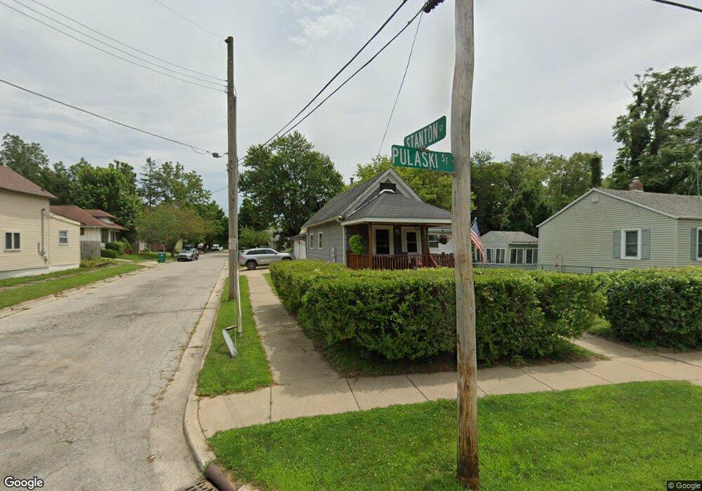
425 Pulaski St La Porte, IN 46350
Estimated Value: $101,000 - $141,069
2
Beds
1
Bath
704
Sq Ft
$170/Sq Ft
Est. Value
About This Home
This home is located at 425 Pulaski St, La Porte, IN 46350 and is currently estimated at $119,517, approximately $169 per square foot. 425 Pulaski St is a home located in LaPorte County with nearby schools including Carver Elementary School, Hailmann Elementary School, and La Porte High School.
Ownership History
Date
Name
Owned For
Owner Type
Purchase Details
Closed on
Oct 13, 2011
Sold by
Samuelson Gene R
Bought by
Lower Michael B
Current Estimated Value
Home Financials for this Owner
Home Financials are based on the most recent Mortgage that was taken out on this home.
Original Mortgage
$47,975
Outstanding Balance
$4,541
Interest Rate
4.12%
Mortgage Type
FHA
Estimated Equity
$114,976
Purchase Details
Closed on
Jan 6, 2009
Sold by
Samuelson Gene R and Samuelson Barbara A
Bought by
Samuelson Gene R and Samuelson Barbara A
Create a Home Valuation Report for This Property
The Home Valuation Report is an in-depth analysis detailing your home's value as well as a comparison with similar homes in the area
Home Values in the Area
Average Home Value in this Area
Purchase History
| Date | Buyer | Sale Price | Title Company |
|---|---|---|---|
| Lower Michael B | -- | Meridian Title Corp | |
| Samuelson Gene R | -- | None Available |
Source: Public Records
Mortgage History
| Date | Status | Borrower | Loan Amount |
|---|---|---|---|
| Open | Lower Michael B | $47,975 |
Source: Public Records
Tax History Compared to Growth
Tax History
| Year | Tax Paid | Tax Assessment Tax Assessment Total Assessment is a certain percentage of the fair market value that is determined by local assessors to be the total taxable value of land and additions on the property. | Land | Improvement |
|---|---|---|---|---|
| 2024 | $818 | $91,100 | $13,500 | $77,600 |
| 2022 | $538 | $73,700 | $11,300 | $62,400 |
| 2021 | $538 | $68,300 | $11,300 | $57,000 |
| 2020 | $526 | $68,300 | $11,300 | $57,000 |
| 2019 | $585 | $69,900 | $12,900 | $57,000 |
| 2018 | $539 | $63,700 | $11,300 | $52,400 |
| 2017 | $489 | $60,600 | $11,300 | $49,300 |
| 2016 | $473 | $59,300 | $11,300 | $48,000 |
| 2014 | $376 | $53,300 | $11,300 | $42,000 |
Source: Public Records
Map
Nearby Homes
- 506 Pulaski St
- 161 W Mcclung Rd
- 0 Brighton St Unit NRA542345
- 222 Roosevelt St
- 503 Grove St
- 107 Lincolnway
- 202 Jefferson Ave
- 302 Bond St
- 706 Detroit St
- 717 E Lincolnway
- 414 Allen St
- 413 Jefferson Ave
- 906 Linwood Ave
- 205 Lawrence St
- 403 Rose St
- 330 Virginia Ave
- 813 E Jefferson Ave
- 125 W Mcclung Rd
- 208 Norton St
- 910 Scott St
- 423 Pulaski St
- 106 Stanton St
- 15 Stanton St
- 501 Pulaski St
- 421 Pulaski St
- 108 Stanton St
- 502 Pulaski St
- 113 Stanton St
- 0 W Mcclung Rd
- 503 Pulaski St
- 115 Stanton St
- 118 Stanton St
- 417 Pulaski St
- 281 West St Unit 700
- 218 West St
- 505 Pulaski St
- 284 West St Unit 700
- 282 West St Unit 700
- 120 Stanton St
- 508 Pulaski St