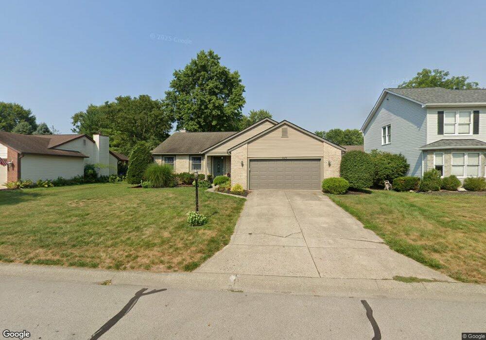
425 White Path St Pataskala, OH 43062
Estimated Value: $337,591 - $400,000
3
Beds
2
Baths
1,536
Sq Ft
$233/Sq Ft
Est. Value
About This Home
This home is located at 425 White Path St, Pataskala, OH 43062 and is currently estimated at $358,648, approximately $233 per square foot. 425 White Path St is a home located in Licking County with nearby schools including Pataskala Elementary School, Etna Elementary School, and Watkins Middle School.
Ownership History
Date
Name
Owned For
Owner Type
Purchase Details
Closed on
Jul 18, 2025
Sold by
Wingler Joshua D and Wingler Holly E
Bought by
Walke Joyce
Current Estimated Value
Purchase Details
Closed on
May 17, 2005
Sold by
Levacy Nancy D and Levacy Richard S
Bought by
Wingler Joshua D and Wingler Holly E
Home Financials for this Owner
Home Financials are based on the most recent Mortgage that was taken out on this home.
Original Mortgage
$155,665
Interest Rate
6.05%
Mortgage Type
FHA
Purchase Details
Closed on
Oct 24, 1995
Sold by
Balser John E
Bought by
Ballard David C and Ballard Nancy D
Create a Home Valuation Report for This Property
The Home Valuation Report is an in-depth analysis detailing your home's value as well as a comparison with similar homes in the area
Home Values in the Area
Average Home Value in this Area
Purchase History
| Date | Buyer | Sale Price | Title Company |
|---|---|---|---|
| Walke Joyce | $365,000 | None Listed On Document | |
| Wingler Joshua D | $78,500 | -- | |
| Ballard David C | $130,000 | -- |
Source: Public Records
Mortgage History
| Date | Status | Borrower | Loan Amount |
|---|---|---|---|
| Previous Owner | Wingler Joshua D | $155,665 |
Source: Public Records
Tax History
| Year | Tax Paid | Tax Assessment Tax Assessment Total Assessment is a certain percentage of the fair market value that is determined by local assessors to be the total taxable value of land and additions on the property. | Land | Improvement |
|---|---|---|---|---|
| 2024 | $4,307 | $103,680 | $24,470 | $79,210 |
| 2023 | $4,304 | $103,680 | $24,470 | $79,210 |
| 2022 | $3,314 | $68,290 | $16,560 | $51,730 |
| 2021 | $3,413 | $68,290 | $16,560 | $51,730 |
| 2020 | $3,465 | $68,290 | $16,560 | $51,730 |
| 2019 | $3,043 | $55,370 | $12,250 | $43,120 |
| 2018 | $3,053 | $0 | $0 | $0 |
| 2017 | $2,729 | $0 | $0 | $0 |
| 2016 | $2,525 | $0 | $0 | $0 |
| 2015 | $2,433 | $0 | $0 | $0 |
| 2014 | $3,096 | $0 | $0 | $0 |
| 2013 | $2,633 | $0 | $0 | $0 |
Source: Public Records
Map
Nearby Homes
- 388 S Township Rd
- 116 Ruby Rd
- 258 S Main St
- 300 Shawnee Loop S
- 245 Granville St
- 0 Blacks Rd Unit 215031989
- 0 Blacks Rd Unit Lot 10
- 218 Blacks Rd
- 303 Levi Dr Unit Lot 7
- 186 Markway Dr Unit Lot 12
- 188 Markway Dr Unit Lot 13
- 263 International Dr
- 0 E Broad St
- 950 Villas Dr Unit 950
- 456 Joseph van Dorn Ct
- 306 Reign Way
- 309 Reign Way
- 302 Reign Way
- 308 Reign Way
- 314 Reign Way
- 431 White Path St
- 419 White Path St
- 428 Township Rd
- 420 Township Rd
- 437 White Path St
- 413 White Path St
- 422 White Path St
- 430 Township Rd
- 414 S Township Rd
- 436 Township Rd
- 438 S Township Rd
- 428 White Path St
- 438 Township Rd
- 412 S Township Rd
- 443 White Path St
- 444 S Township Rd
- 434 White Path St
- 215 S Fork Cir
- 407 White Path St
- 444 Township Rd
Your Personal Tour Guide
Ask me questions while you tour the home.