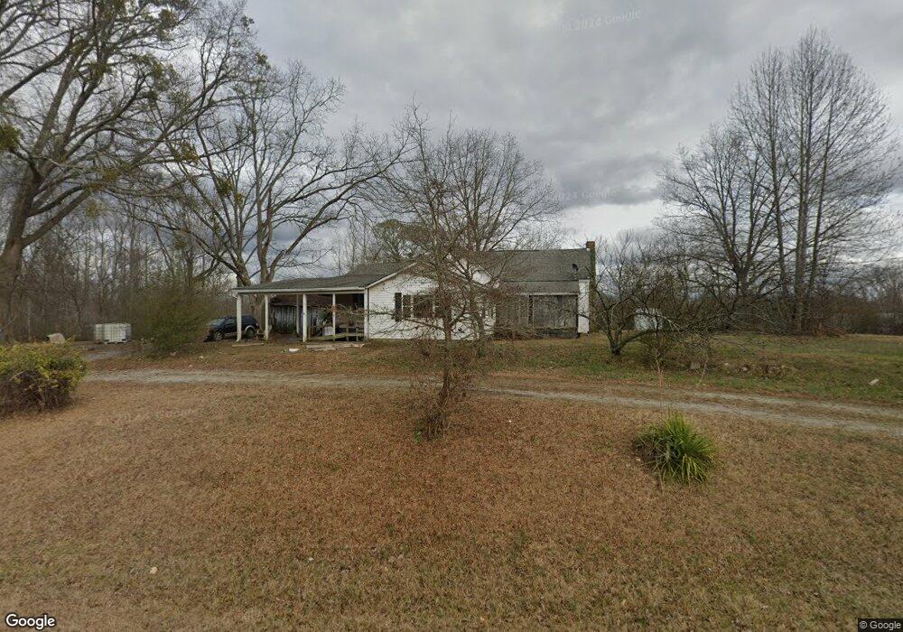
425 Wildcat Rd Buchanan, GA 30113
Estimated Value: $381,000 - $745,565
3
Beds
2
Baths
1,920
Sq Ft
$300/Sq Ft
Est. Value
About This Home
This home is located at 425 Wildcat Rd, Buchanan, GA 30113 and is currently estimated at $576,855, approximately $300 per square foot. 425 Wildcat Rd is a home located in Haralson County with nearby schools including Haralson County High School.
Ownership History
Date
Name
Owned For
Owner Type
Purchase Details
Closed on
May 26, 2020
Sold by
Poteat Raymond L
Bought by
Walker Brian Lovel and Walker Regenia Robinson
Current Estimated Value
Purchase Details
Closed on
Feb 13, 2015
Sold by
Poteat Gary Eugene
Bought by
Poteat Raymond Leonard
Purchase Details
Closed on
Feb 13, 2012
Sold by
Poteat Orene S
Bought by
Poteat Gary Eugene
Purchase Details
Closed on
Apr 8, 2009
Sold by
Poteat Stanley S Estate
Bought by
Poteat Orene
Purchase Details
Closed on
Aug 8, 1959
Sold by
Holcombe Josie Mrs
Bought by
Poteat Stanley S and Poteat Orene
Create a Home Valuation Report for This Property
The Home Valuation Report is an in-depth analysis detailing your home's value as well as a comparison with similar homes in the area
Home Values in the Area
Average Home Value in this Area
Purchase History
| Date | Buyer | Sale Price | Title Company |
|---|---|---|---|
| Walker Brian Lovel | $42,000 | -- | |
| Poteat Raymond Leonard | -- | -- | |
| Poteat Gary Eugene | -- | -- | |
| Poteat Orene | -- | -- | |
| Poteat Stanley S | -- | -- |
Source: Public Records
Tax History Compared to Growth
Tax History
| Year | Tax Paid | Tax Assessment Tax Assessment Total Assessment is a certain percentage of the fair market value that is determined by local assessors to be the total taxable value of land and additions on the property. | Land | Improvement |
|---|---|---|---|---|
| 2024 | $5,358 | $236,526 | $46,351 | $190,175 |
| 2023 | $4,839 | $241,642 | $72,039 | $169,603 |
| 2022 | $702 | $55,342 | $44,613 | $10,729 |
| 2021 | $480 | $53,552 | $43,314 | $10,238 |
| 2020 | $757 | $53,989 | $43,314 | $10,675 |
| 2019 | $724 | $53,505 | $43,150 | $10,355 |
| 2018 | $722 | $46,312 | $35,957 | $10,355 |
| 2017 | $734 | $44,843 | $35,957 | $8,886 |
| 2016 | $937 | $65,575 | $48,269 | $17,306 |
| 2015 | $911 | $67,822 | $50,984 | $16,838 |
| 2014 | $887 | $67,864 | $50,984 | $16,880 |
Source: Public Records
Map
Nearby Homes
- 0 Susie Pope Rd Unit 10499156
- 0 Susie Pope Rd Unit 10399491
- 661 Wildcat Rd
- 6934 Georgia 100
- Tract3 Georgia Highway 100
- 7780 Georgia Highway 100
- 00001 Haralson County Scenic Byway
- 7711 Highway 100
- 0 Bethlehem Church Rd Unit 7655973
- 0 Bethlehem Church Rd Unit 7645984
- 0 Hagood Rd Unit 10506449
- 0 Hagood Rd Unit 5670400
- 0 Cross Roads Church Rd Unit 7629947
- 0 Cross Roads Church Rd Unit 10580810
- 0 Carnes Rd Unit 147233
- 1200 Roy Brown Rd
- 0 W Us Hwy 78 Unit 147720
- 00 Us Hwy 78
- 0 Highway 78 E Unit 10511524
- 60 + - Acres at 295 J Davis Rd
- 390 Wildcat Rd
- 435 Wildcat Rd
- 515 Wildcat Rd
- 44 Duncan Rd
- 35 Surrett Rd
- 0 Susie Pope Rd Unit 7229566
- 0 Duncan Rd Unit 7452853
- 0 Duncan Rd Unit 7572533
- 0 Duncan Rd Unit 8040622
- 0 Susie Pope Rd Unit 5257323
- 0 Duncan Rd Unit 5334634
- 0 Duncan Rd Unit 5538392
- 0 Duncan Rd Unit 5634848
- 0 Susie Pope Rd Unit (TRACT II) 10338788
- 0 Susie Pope Rd Unit (TRACT I) 10338796
- 0 Duncan Rd Unit 5724325
- 0 Susie Pope Rd Unit 20110989
- 0 Susie Pope Rd Unit 144974
- 0 Susie Pope Rd Unit 20158145
- 0 Susie Pope Rd Unit 10169156