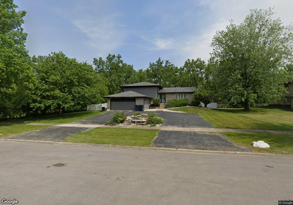
4250 216th St Matteson, IL 60443
Old Matteson NeighborhoodEstimated Value: $220,000 - $299,000
3
Beds
2
Baths
1,358
Sq Ft
$198/Sq Ft
Est. Value
About This Home
This home is located at 4250 216th St, Matteson, IL 60443 and is currently estimated at $268,420, approximately $197 per square foot. 4250 216th St is a home located in Cook County with nearby schools including Illinois School, Matteson Elementary School, and Sauk Elementary School.
Ownership History
Date
Name
Owned For
Owner Type
Purchase Details
Closed on
May 7, 2021
Sold by
Kuntu Kwau A and Kuntu Alfreda
Bought by
Robinson Ashleigh
Current Estimated Value
Home Financials for this Owner
Home Financials are based on the most recent Mortgage that was taken out on this home.
Original Mortgage
$213,750
Outstanding Balance
$191,830
Interest Rate
2.9%
Mortgage Type
New Conventional
Estimated Equity
$76,590
Create a Home Valuation Report for This Property
The Home Valuation Report is an in-depth analysis detailing your home's value as well as a comparison with similar homes in the area
Home Values in the Area
Average Home Value in this Area
Purchase History
| Date | Buyer | Sale Price | Title Company |
|---|---|---|---|
| Robinson Ashleigh | $233,000 | Chicago Title |
Source: Public Records
Mortgage History
| Date | Status | Borrower | Loan Amount |
|---|---|---|---|
| Open | Robinson Ashleigh | $213,750 |
Source: Public Records
Tax History
| Year | Tax Paid | Tax Assessment Tax Assessment Total Assessment is a certain percentage of the fair market value that is determined by local assessors to be the total taxable value of land and additions on the property. | Land | Improvement |
|---|---|---|---|---|
| 2025 | $8,136 | $23,000 | $7,040 | $15,960 |
| 2024 | $8,136 | $23,000 | $7,040 | $15,960 |
| 2023 | $5,715 | $23,000 | $7,040 | $15,960 |
| 2022 | $5,715 | $13,954 | $6,160 | $7,794 |
| 2021 | $4,011 | $13,954 | $6,160 | $7,794 |
| 2020 | $3,947 | $13,954 | $6,160 | $7,794 |
| 2019 | $4,127 | $14,833 | $5,720 | $9,113 |
| 2018 | $4,120 | $14,833 | $5,720 | $9,113 |
| 2017 | $5,357 | $14,833 | $5,720 | $9,113 |
| 2016 | $5,114 | $13,611 | $5,280 | $8,331 |
| 2015 | $4,991 | $13,611 | $5,280 | $8,331 |
| 2014 | $4,868 | $13,611 | $5,280 | $8,331 |
| 2013 | $5,530 | $16,193 | $5,280 | $10,913 |
Source: Public Records
Map
Nearby Homes
- 21616 Richmond Rd
- 4022 Richmond Ct
- 21406 S Jean Ave
- 3919 214th St
- 4430 Maple Ave
- 4448 Maple Ave
- 21308 Tower Ave
- 4459 Balmoral Dr
- 4443 Ascot Ct
- 3727 214th Place Unit 2
- 22048 Jordan Ln
- 4423 Camden Ct
- 3704 215th St Unit 205
- 4613 Lindenwood Ct
- 22100 Karlov Ave
- 4210 Birchwood Rd
- 3624 216th St
- 4201 Birchwood Rd
- 3615 214th St
- 22121 Karlov Ave
- 4238 216th St
- 4249 216th St
- 4226 216th St
- 4239 216th St
- 21350 Kildare Ave
- 4227 216th St
- 21347 Kildare Ave
- 4212 Charleston Rd
- 4221 216th St
- 21348 Kildare Ave
- 21345 Kildare Ave
- 4215 216th St
- 4204 Charleston Rd
- 4205 Charleston Rd
- 21343 Kildare Ave
- 21346 Kildare Ave
- 4213 216th St
- 21433 Kildare Ave
- 4160 Charleston Rd
- 21344 Kildare Ave
Your Personal Tour Guide
Ask me questions while you tour the home.