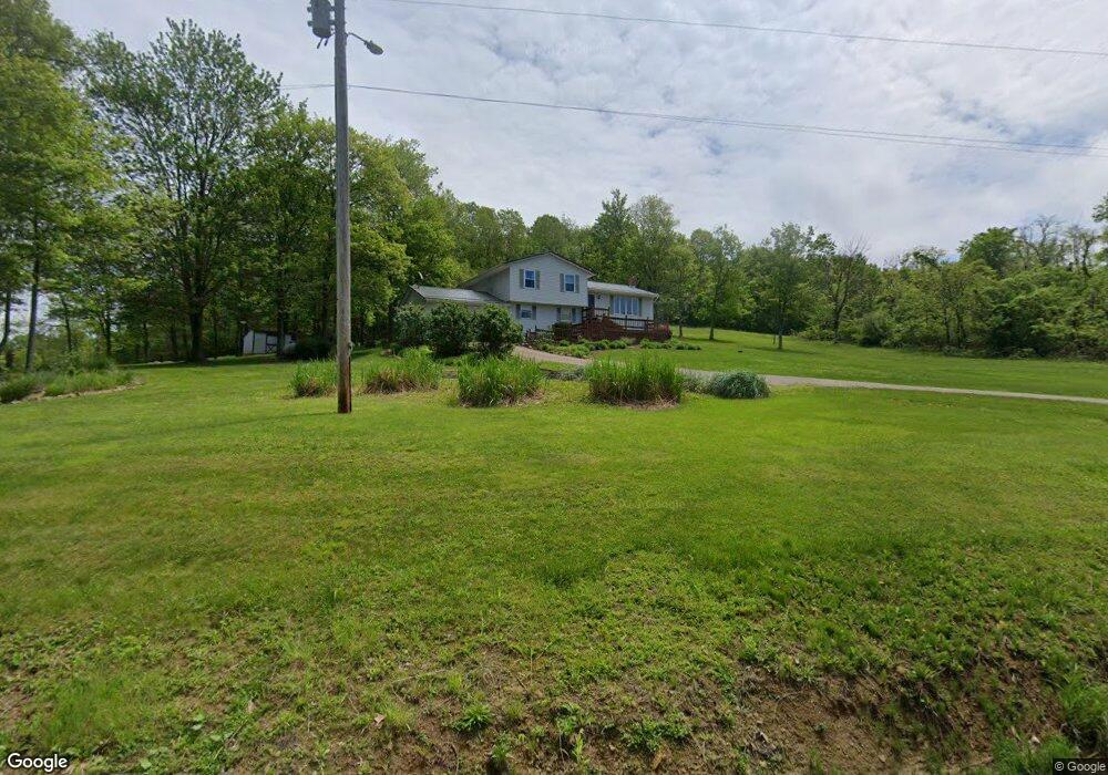
4250 Oak Ridge Ln Cambridge, OH 43725
Estimated Value: $256,000 - $271,000
--
Bed
1
Bath
1,521
Sq Ft
$173/Sq Ft
Est. Value
About This Home
This home is located at 4250 Oak Ridge Ln, Cambridge, OH 43725 and is currently estimated at $263,311, approximately $173 per square foot. 4250 Oak Ridge Ln is a home with nearby schools including Pike Elementary School, Larry Miller Intermediate Elementary School, and East Muskingum Middle School.
Ownership History
Date
Name
Owned For
Owner Type
Purchase Details
Closed on
Jun 9, 2005
Sold by
Lowe John R and Lowe Deborah D
Bought by
Lowe John R and Lowe Deborah D
Current Estimated Value
Home Financials for this Owner
Home Financials are based on the most recent Mortgage that was taken out on this home.
Original Mortgage
$96,000
Interest Rate
5.87%
Mortgage Type
New Conventional
Create a Home Valuation Report for This Property
The Home Valuation Report is an in-depth analysis detailing your home's value as well as a comparison with similar homes in the area
Home Values in the Area
Average Home Value in this Area
Purchase History
| Date | Buyer | Sale Price | Title Company |
|---|---|---|---|
| Lowe John R | -- | -- |
Source: Public Records
Mortgage History
| Date | Status | Borrower | Loan Amount |
|---|---|---|---|
| Closed | Lowe John R | $96,000 |
Source: Public Records
Tax History Compared to Growth
Tax History
| Year | Tax Paid | Tax Assessment Tax Assessment Total Assessment is a certain percentage of the fair market value that is determined by local assessors to be the total taxable value of land and additions on the property. | Land | Improvement |
|---|---|---|---|---|
| 2024 | $2,152 | $64,922 | $20,748 | $44,174 |
| 2023 | $2,152 | $51,937 | $16,597 | $35,340 |
| 2022 | $1,836 | $51,920 | $16,590 | $35,330 |
| 2021 | $2,134 | $51,920 | $16,590 | $35,330 |
| 2020 | $1,812 | $43,650 | $12,490 | $31,160 |
| 2019 | $1,679 | $43,650 | $12,490 | $31,160 |
| 2018 | $1,642 | $43,650 | $12,490 | $31,160 |
| 2017 | $1,561 | $37,860 | $10,860 | $27,000 |
| 2016 | $1,562 | $37,860 | $10,860 | $27,000 |
| 2015 | $1,562 | $37,860 | $10,860 | $27,000 |
| 2014 | -- | $34,220 | $9,580 | $24,640 |
| 2013 | $1,434 | $34,220 | $9,580 | $24,640 |
Source: Public Records
Map
Nearby Homes
- 0 Haught Rd Unit LOTWP001 24504411
- 0 Haught Rd
- 4480 Peters Creek Rd
- 5617 Skyline Dr
- 5628 Bloomfield Rd
- 63041 Ridgewood Dr
- 64895 Lovers Lane Rd
- 6065 Skyline Dr
- 3859 Mayfair Ln
- 62063 Savage Rd
- 148 Merrick Rd
- 64391 Morrison Rd
- 0 Water St
- 0 Pigeon Gap Rd
- 61220 Kadon Dr
- 445 N 3rd St
- Lot 18 & 19 Greenbriar Dr
- 428 Foster Ave
- 209 Jefferson Ave
- 427 N 5th St
- 4200 Oak Ridge Ln
- 4300 Oak Ridge Ln
- 4175 Oak Ridge Ln
- 4195 Oak Ridge Ln
- 4155 Oak Ridge Ln
- 4400 Oak Ridge Ln
- 4150 Oak Ridge Ln
- 4350 Oak Ridge Ln
- 4450 Oak Hill Ln
- 4100 Oak Ridge Ln
- 4101 Oak Ridge Ln
- 63500 Bobs Run Rd
- 63774 Bobs Run Rd
- 63882 Bobs Run Rd
- 63422 Bobs Run Rd
- 63364 Bobs Run Rd
- 63555 Bobs Run Rd
- 63400 Bobs Run Rd
- 64064 Bobs Run Rd
- 64278 Haught Rd