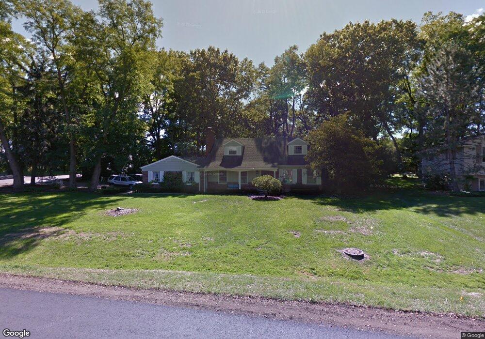
4250 W Newland Dr Unit Bldg-Unit West Bloomfield, MI 48323
Estimated Value: $431,000 - $552,000
3
Beds
3
Baths
1,938
Sq Ft
$254/Sq Ft
Est. Value
About This Home
This home is located at 4250 W Newland Dr Unit Bldg-Unit, West Bloomfield, MI 48323 and is currently estimated at $492,541, approximately $254 per square foot. 4250 W Newland Dr Unit Bldg-Unit is a home located in Oakland County with nearby schools including West Hills Middle School, Bloomfield Hills High School, and Brookfield Academy - West Bloomfield Campus.
Ownership History
Date
Name
Owned For
Owner Type
Purchase Details
Closed on
Mar 12, 2018
Sold by
Komives Paul
Bought by
Mcghee Geraldine and Mcghee Melanie
Current Estimated Value
Home Financials for this Owner
Home Financials are based on the most recent Mortgage that was taken out on this home.
Original Mortgage
$310,650
Outstanding Balance
$265,186
Interest Rate
4.22%
Mortgage Type
New Conventional
Estimated Equity
$227,355
Purchase Details
Closed on
Sep 18, 2015
Sold by
Riess Rebecca L and Cox Rebecca L
Bought by
Komives Paul
Purchase Details
Closed on
Jan 13, 1998
Sold by
Cox James E
Bought by
Cox Rebecca L
Create a Home Valuation Report for This Property
The Home Valuation Report is an in-depth analysis detailing your home's value as well as a comparison with similar homes in the area
Home Values in the Area
Average Home Value in this Area
Purchase History
| Date | Buyer | Sale Price | Title Company |
|---|---|---|---|
| Mcghee Geraldine | $327,000 | Title Connect Llc | |
| Komives Paul | $312,000 | Devon Title Agency | |
| Cox Rebecca L | -- | -- |
Source: Public Records
Mortgage History
| Date | Status | Borrower | Loan Amount |
|---|---|---|---|
| Open | Mcghee Geraldine | $310,650 |
Source: Public Records
Tax History Compared to Growth
Tax History
| Year | Tax Paid | Tax Assessment Tax Assessment Total Assessment is a certain percentage of the fair market value that is determined by local assessors to be the total taxable value of land and additions on the property. | Land | Improvement |
|---|---|---|---|---|
| 2024 | $2,970 | $159,560 | $0 | $0 |
| 2022 | $2,885 | $153,870 | $56,110 | $97,760 |
| 2021 | $5,321 | $149,250 | $0 | $0 |
| 2020 | $2,639 | $143,310 | $56,110 | $87,200 |
| 2018 | $4,764 | $137,890 | $38,960 | $98,930 |
| 2015 | -- | $98,040 | $0 | $0 |
| 2014 | -- | $92,890 | $0 | $0 |
| 2011 | -- | $82,460 | $0 | $0 |
Source: Public Records
Map
Nearby Homes
- 4182 Prescott Park Cir
- 0000 Middlebelt Rd
- 0 Wendell Rd Unit 20250033815
- 4170 Prescott Park Cir
- 4274 Wendell Rd
- 2943 Moon Lake Dr Unit 52
- 2045 Bordeaux St Unit 5
- 2164 Bordeaux St
- 4033 Fox Lake Dr
- 4539 Middleton Ct
- 1992 Bent Tree Trail
- 4297 Wabeek Lake Dr S Unit 26
- 3468 Pine Estates Dr
- 3092 Woodland Ridge Dr
- 4641 Cove Rd
- 3367 Lone Pine Rd
- 2276 Shore Hill Dr
- 3075 Bloomfield Park Dr
- 1795 Golf Ridge Dr Unit 19
- 4670 Cove Rd
- 4250 W Newland Dr
- 4230 W Newland Dr
- 5666 Newlane Trail
- 4134 Wendell Rd
- 4133 Winterset Ln
- 4275 E Newland Dr
- 4245 W Newland Dr
- 4125 Wendell Rd
- 4127 Winterset Ln
- 4210 W Newland Dr
- 4241 Portland Ct
- 4205 W Newland Dr
- 4121 Winterset Ln
- 4144 Wendell Rd
- 4141 Wendell Rd
- 4190 Blackburn Dr
- 4132 Winterset Ln
- 2618 Peterboro Ct
- 4229 Portland Ct
- 2602 Peterboro Ct