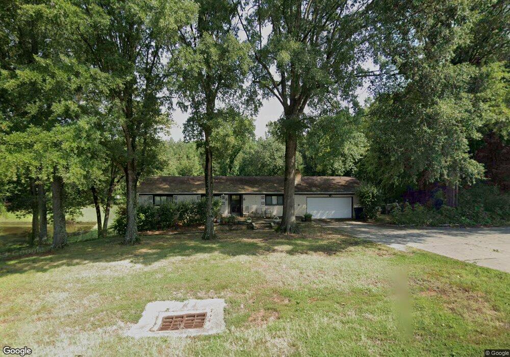
4255 Highway 49 N Concord, NC 28025
Estimated Value: $337,000 - $393,000
3
Beds
2
Baths
1,431
Sq Ft
$255/Sq Ft
Est. Value
About This Home
This home is located at 4255 Highway 49 N, Concord, NC 28025 and is currently estimated at $364,233, approximately $254 per square foot. 4255 Highway 49 N is a home located in Cabarrus County with nearby schools including W.M. Irvin Elementary School, Mount Pleasant Middle School, and Mount Pleasant High School.
Ownership History
Date
Name
Owned For
Owner Type
Purchase Details
Closed on
Feb 27, 2025
Sold by
Eudy Nancy M
Bought by
Towery Joseph Eugene and Gault Towery Flora
Current Estimated Value
Purchase Details
Closed on
Apr 1, 1991
Bought by
Eudy Norman L and Wife Nancy M
Purchase Details
Closed on
Dec 1, 1990
Create a Home Valuation Report for This Property
The Home Valuation Report is an in-depth analysis detailing your home's value as well as a comparison with similar homes in the area
Home Values in the Area
Average Home Value in this Area
Purchase History
| Date | Buyer | Sale Price | Title Company |
|---|---|---|---|
| Towery Joseph Eugene | $340,000 | Master Title | |
| Towery Joseph Eugene | $340,000 | Master Title | |
| Eudy Norman L | $115,000 | -- | |
| -- | $5,000 | -- |
Source: Public Records
Tax History
| Year | Tax Paid | Tax Assessment Tax Assessment Total Assessment is a certain percentage of the fair market value that is determined by local assessors to be the total taxable value of land and additions on the property. | Land | Improvement |
|---|---|---|---|---|
| 2025 | $2,212 | $322,500 | $71,060 | $251,440 |
| 2024 | $2,212 | $322,500 | $71,060 | $251,440 |
| 2023 | $1,742 | $209,870 | $48,620 | $161,250 |
| 2022 | $1,742 | $209,870 | $48,620 | $161,250 |
| 2021 | $1,710 | $209,870 | $48,620 | $161,250 |
| 2020 | $1,710 | $209,870 | $48,620 | $161,250 |
| 2019 | $1,490 | $182,780 | $41,140 | $141,640 |
| 2018 | $1,453 | $182,780 | $41,140 | $141,640 |
| 2017 | $1,380 | $182,780 | $41,140 | $141,640 |
| 2016 | $1,380 | $173,570 | $41,140 | $132,430 |
| 2015 | $1,293 | $173,570 | $41,140 | $132,430 |
| 2014 | $1,293 | $173,570 | $41,140 | $132,430 |
Source: Public Records
Map
Nearby Homes
- 2750 & 2760 Tilley Rd
- 1930 Cold Springs Rd
- 1695 Lemming Dr
- 5123 Beckenham Ln
- 3261 Fairmead Dr
- 3225 Fairmead Dr
- 2909 Arbor Knoll
- 3109 Fairmead Dr
- 1800 Lake Lynn Rd
- 2365 Baxter Place SE
- 2628 State Highway 49
- 2568 Chelsea Dr
- 2795 Cold Springs Rd
- 1223 Walker Rd
- 425 Krimminger Ave SE
- 1162 Crestmont Dr SE
- 1160 Crestmont Dr SE Unit A3
- 3354 Westview Rd
- 4165 Laurelwood Ct
- 348 Pleasant View Ln SE
- 4255 State Highway 49
- 4334 Old Airport Rd
- 4334 Old Airport Rd
- 4280 Highway 49 N
- 4300 Highway 49 N
- 4330 Old Airport Rd
- 4488 Highway 49 N
- 2216 Ward Ave
- 2222 Ward Ave
- 2226 Ward Ave
- 2504 Ward Ave
- 2223 Ward Ave
- 2211 Ward Ave
- 2475 Tilley Rd
- 3950 Highway 49 N
- 2404 Ward Ave
- 0000 Ward Ave
- Off Ward Ave
- 4080 Old Airport Rd
- 4080 Old Airport Rd
Your Personal Tour Guide
Ask me questions while you tour the home.