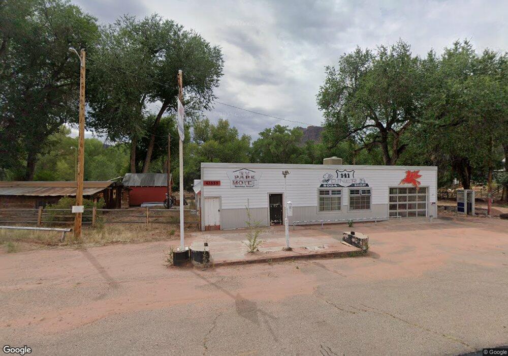
42555 Highway 141 Gateway, CO 81522
Estimated Value: $353,000 - $423,362
2
Beds
1
Bath
3,654
Sq Ft
$106/Sq Ft
Est. Value
About This Home
This home is located at 42555 Highway 141, Gateway, CO 81522 and is currently estimated at $388,181, approximately $106 per square foot. 42555 Highway 141 is a home located in Mesa County with nearby schools including Gateway School.
Ownership History
Date
Name
Owned For
Owner Type
Purchase Details
Closed on
Jun 25, 1998
Sold by
Sanford Alfred Dean
Bought by
Mann Gary A
Current Estimated Value
Purchase Details
Closed on
Jun 23, 1998
Sold by
Mann Gary A
Bought by
Johnson Donald L
Purchase Details
Closed on
Jun 21, 1998
Sold by
Prosser Lela M
Bought by
Casto Richard C
Purchase Details
Closed on
Aug 1, 1996
Sold by
Mann Gary A
Bought by
Johnson Donald L
Home Financials for this Owner
Home Financials are based on the most recent Mortgage that was taken out on this home.
Original Mortgage
$150,000
Interest Rate
5%
Mortgage Type
Seller Take Back
Purchase Details
Closed on
Jul 18, 1996
Sold by
Mann Howard A
Bought by
Mann Gary A
Home Financials for this Owner
Home Financials are based on the most recent Mortgage that was taken out on this home.
Original Mortgage
$150,000
Interest Rate
5%
Mortgage Type
Seller Take Back
Create a Home Valuation Report for This Property
The Home Valuation Report is an in-depth analysis detailing your home's value as well as a comparison with similar homes in the area
Home Values in the Area
Average Home Value in this Area
Purchase History
| Date | Buyer | Sale Price | Title Company |
|---|---|---|---|
| Mann Gary A | -- | -- | |
| Johnson Donald L | -- | -- | |
| Mann Gary A | -- | -- | |
| Casto Richard C | -- | -- | |
| Johnson Donald L | $175,000 | -- | |
| Mann Gary A | -- | -- |
Source: Public Records
Mortgage History
| Date | Status | Borrower | Loan Amount |
|---|---|---|---|
| Previous Owner | Johnson Donald L | $150,000 |
Source: Public Records
Tax History Compared to Growth
Tax History
| Year | Tax Paid | Tax Assessment Tax Assessment Total Assessment is a certain percentage of the fair market value that is determined by local assessors to be the total taxable value of land and additions on the property. | Land | Improvement |
|---|---|---|---|---|
| 2024 | $3,951 | $36,750 | $8,100 | $28,650 |
| 2023 | $3,951 | $53,520 | $7,970 | $45,550 |
| 2022 | $6,594 | $72,380 | $16,270 | $56,110 |
| 2021 | $5,295 | $72,380 | $16,270 | $56,110 |
| 2020 | $4,968 | $69,500 | $16,270 | $53,230 |
| 2019 | $4,710 | $69,500 | $16,270 | $53,230 |
| 2018 | $4,829 | $65,760 | $14,970 | $50,790 |
| 2017 | $3,736 | $65,760 | $14,970 | $50,790 |
| 2016 | $3,736 | $56,980 | $19,960 | $37,020 |
| 2015 | $3,502 | $56,980 | $19,960 | $37,020 |
| 2014 | $2,293 | $37,650 | $17,960 | $19,690 |
Source: Public Records
Map
Nearby Homes
- 40275 Highway 141
- Co-141
- 40275 Co-141
- Co-141
- 410 Gateway Center Dr
- 26101 & 246 16 1 10 Rd
- 26101 & 246 16 1 10ths Rd
- 26101 Highway 141
- 410 Z6 Rd
- 2586 26 1 10 Rd
- TBD Divide Rd
- TBD Divide Rd Unit Mont's Draw
- 000 Divide (Louie Pasture) Rd
- 000 Divide (Mont's Draw) Rd
- TBD Divide (Mont's Draw) Rd
- 0 Tbd Divide Road 39
- 5551 S 9 8 10 Rd
- TBD Divide Rd
- TBD Divide Rd Unit Entire Package
- TBD Divide Rd Unit Louie Pasture
- 42555 Highway 141 Unit 42557
- 42600 Highway 141
- 42601 Highway 141
- 433 Foy Rd
- 435 Foy Rd
- 42711 & 42707 Hwy 141
- 445 Foy Rd
- 440 Foy Rd
- 451 Foy Rd
- 42711 Co-141
- 42711/07 Highway 141
- 42711 Highway 141
- 0 Foy Rd Unit 750129
- 0 Foy Rd Unit 704824
- 0 Foy Rd Unit 717293
- 0 Foy Rd Unit 645207
- 42906/4 Colorado 141
- 42711 Colorado 141
- 42711/07 Colorado 141
- 42401 Highway 141