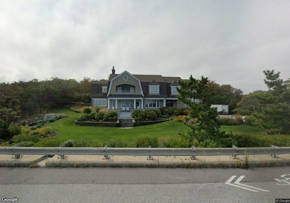
426 Atlantic Ave Cohasset, MA 02025
Estimated Value: $3,050,000 - $4,388,000
4
Beds
4
Baths
3,966
Sq Ft
$935/Sq Ft
Est. Value
About This Home
This home is located at 426 Atlantic Ave, Cohasset, MA 02025 and is currently estimated at $3,707,594, approximately $934 per square foot. 426 Atlantic Ave is a home located in Norfolk County with nearby schools including Joseph Osgood School, Deer Hill School, and Cohasset Middle School.
Ownership History
Date
Name
Owned For
Owner Type
Purchase Details
Closed on
Nov 14, 2008
Sold by
Cavanaro Cynthia L and Cavanaro William J
Bought by
Danny & Sandy Bane Ft
Current Estimated Value
Home Financials for this Owner
Home Financials are based on the most recent Mortgage that was taken out on this home.
Original Mortgage
$2,381,250
Outstanding Balance
$1,566,968
Interest Rate
6.13%
Mortgage Type
Purchase Money Mortgage
Estimated Equity
$2,140,626
Purchase Details
Closed on
Mar 28, 2005
Sold by
Kozol Paula M and Morse Paula
Bought by
Cavanaro Cynthia L and Cavanaro William J
Home Financials for this Owner
Home Financials are based on the most recent Mortgage that was taken out on this home.
Original Mortgage
$1,000,000
Interest Rate
5.56%
Mortgage Type
Purchase Money Mortgage
Create a Home Valuation Report for This Property
The Home Valuation Report is an in-depth analysis detailing your home's value as well as a comparison with similar homes in the area
Home Values in the Area
Average Home Value in this Area
Purchase History
| Date | Buyer | Sale Price | Title Company |
|---|---|---|---|
| Danny & Sandy Bane Ft | $3,175,000 | -- | |
| Cavanaro Cynthia L | $1,550,000 | -- |
Source: Public Records
Mortgage History
| Date | Status | Borrower | Loan Amount |
|---|---|---|---|
| Open | Danny & Sandy Bane Ft | $2,381,250 | |
| Previous Owner | Cavanaro Cynthia L | $1,000,000 |
Source: Public Records
Tax History Compared to Growth
Tax History
| Year | Tax Paid | Tax Assessment Tax Assessment Total Assessment is a certain percentage of the fair market value that is determined by local assessors to be the total taxable value of land and additions on the property. | Land | Improvement |
|---|---|---|---|---|
| 2025 | $40,364 | $3,485,700 | $2,065,200 | $1,420,500 |
| 2024 | $42,235 | $3,470,400 | $2,350,900 | $1,119,500 |
| 2023 | $39,760 | $3,369,500 | $2,260,400 | $1,109,100 |
| 2022 | $40,419 | $3,218,100 | $2,260,400 | $957,700 |
| 2021 | $41,485 | $3,181,400 | $2,260,400 | $921,000 |
| 2020 | $40,495 | $3,122,200 | $1,587,700 | $1,534,500 |
| 2019 | $40,276 | $3,122,200 | $1,587,700 | $1,534,500 |
| 2018 | $39,933 | $3,122,200 | $1,587,700 | $1,534,500 |
| 2017 | $41,253 | $3,158,700 | $1,511,800 | $1,646,900 |
| 2016 | $40,684 | $3,158,700 | $1,511,800 | $1,646,900 |
| 2015 | $40,147 | $3,158,700 | $1,511,800 | $1,646,900 |
| 2014 | $39,610 | $3,158,700 | $1,511,800 | $1,646,900 |
Source: Public Records
Map
Nearby Homes
- 101 Nichols Rd
- 356 Atlantic Ave
- 17 Mohawk Way
- 247 Forest Ave
- 135 Beach St
- 25 Mohawk Way
- 146 N Main St Unit 146
- 11 Beach St
- 577 Jerusalem Rd
- 25 Ripley Rd
- 29 Heather Dr
- 152 Forest Ave
- 89 Ripley Rd
- 296 N Main St
- 15 Cushing Rd
- 128 Elm St Unit 211
- 21-23 Elm Ct
- 4 Margin St Unit A
- 104 Howard Gleason Rd
- 87 Elm St Unit 215
- 428 Atlantic Ave
- 428 Atlantic Ave Unit 1
- 428 Atlantic Ave Unit 428
- 430 Atlantic Ave Unit 1
- 430 Atlantic Ave
- 430 Atlantic Ave
- 430 Atlantic Ave Unit 2
- 430 Atlantic Ave Unit BH
- 430 Atlantic Ave Unit 2
- 430 Atlantic Ave Unit 1
- 430B Atlantic Ave
- 399 Atlantic Ave Unit House & Gar
- 399 Atlantic Ave
- WEEKLY 399 Atlantic Ave Unit 1
- 399 Atlantic Ave Unit 1
- 400 Atlantic Ave
- 391 Atlantic Ave
- 394 Atlantic Ave
- 385 Atlantic Ave
- 385 Atlantic Ave