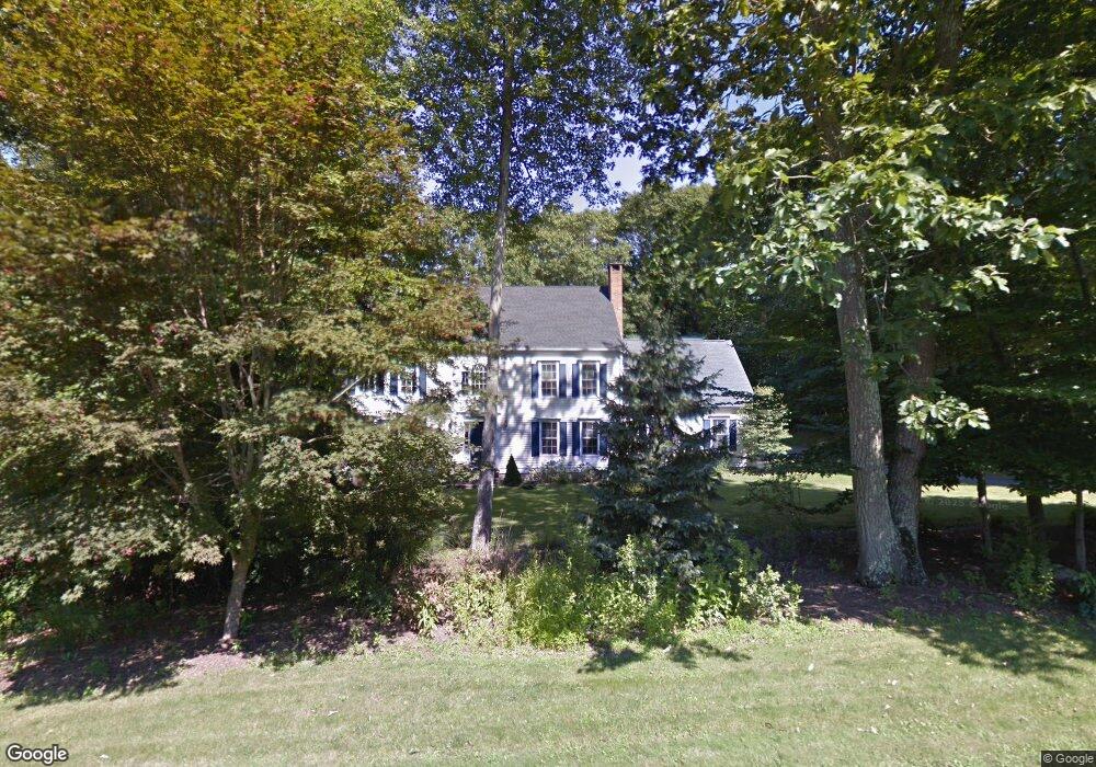
426 Bartlett Dr Madison, CT 06443
Estimated Value: $895,360 - $1,043,000
4
Beds
3
Baths
2,806
Sq Ft
$346/Sq Ft
Est. Value
About This Home
This home is located at 426 Bartlett Dr, Madison, CT 06443 and is currently estimated at $971,090, approximately $346 per square foot. 426 Bartlett Dr is a home located in New Haven County with nearby schools including Walter C. Polson Upper Middle School, Daniel Hand High School, and The Country School.
Ownership History
Date
Name
Owned For
Owner Type
Purchase Details
Closed on
Dec 2, 2003
Sold by
Bernal Bonnie L
Bought by
Anderson Robert J and Anderson Cheryl
Current Estimated Value
Home Financials for this Owner
Home Financials are based on the most recent Mortgage that was taken out on this home.
Original Mortgage
$322,000
Outstanding Balance
$151,394
Interest Rate
6.09%
Estimated Equity
$819,696
Purchase Details
Closed on
Feb 10, 1997
Sold by
Macdougald Joseph A and Macdougald Lisa M
Bought by
Bernal Bonnie L
Purchase Details
Closed on
Jun 29, 1993
Sold by
Vigliotti John A
Bought by
Macdougald Joseph A and Macdougald Lisa M
Home Financials for this Owner
Home Financials are based on the most recent Mortgage that was taken out on this home.
Original Mortgage
$150,000
Interest Rate
7.37%
Mortgage Type
Unknown
Create a Home Valuation Report for This Property
The Home Valuation Report is an in-depth analysis detailing your home's value as well as a comparison with similar homes in the area
Home Values in the Area
Average Home Value in this Area
Purchase History
| Date | Buyer | Sale Price | Title Company |
|---|---|---|---|
| Anderson Robert J | $550,000 | -- | |
| Bernal Bonnie L | $315,000 | -- | |
| Macdougald Joseph A | $294,300 | -- |
Source: Public Records
Mortgage History
| Date | Status | Borrower | Loan Amount |
|---|---|---|---|
| Open | Macdougald Joseph A | $200,000 | |
| Open | Macdougald Joseph A | $322,000 | |
| Previous Owner | Macdougald Joseph A | $150,000 |
Source: Public Records
Tax History
| Year | Tax Paid | Tax Assessment Tax Assessment Total Assessment is a certain percentage of the fair market value that is determined by local assessors to be the total taxable value of land and additions on the property. | Land | Improvement |
|---|---|---|---|---|
| 2025 | $11,437 | $509,900 | $144,100 | $365,800 |
| 2024 | $11,218 | $509,900 | $144,100 | $365,800 |
| 2023 | $11,104 | $370,500 | $113,100 | $257,400 |
| 2022 | $10,896 | $370,500 | $113,100 | $257,400 |
| 2021 | $10,689 | $370,500 | $113,100 | $257,400 |
| 2020 | $10,504 | $370,500 | $113,100 | $257,400 |
| 2019 | $10,504 | $370,500 | $113,100 | $257,400 |
| 2018 | $5,702 | $377,400 | $125,600 | $251,800 |
| 2017 | $5,684 | $377,400 | $125,600 | $251,800 |
| 2016 | $9,997 | $377,400 | $125,600 | $251,800 |
| 2015 | $9,722 | $377,400 | $125,600 | $251,800 |
| 2014 | $10,619 | $421,900 | $138,000 | $283,900 |
Source: Public Records
Map
Nearby Homes
- 76 Bartlett Dr
- 24 Echo Point Rd
- 87 White Birch Dr
- 64 Dohm Ave
- 874 Nut Plains Rd Unit Lot 2 - Style A
- 286 Opening Hill Rd
- 247 C Old Toll Rd
- 85 Legend Hill Rd Unit 85
- 507 Little Meadow Rd
- 1281 Durham Rd
- 70 High Hill Cir
- 11 Lantern Hill Ln
- 75 Half Mile Rd
- 132 Summer Hill Rd
- 728 Durham Rd
- 25 Williamsburg Cir
- 77 Pinebrook Cir
- 26 Opening Hill Rd
- 38 Opening Hill Rd
- 625 State St
- 418 Bartlett Dr
- 453 Bartlett Dr
- 443 Bartlett Dr
- 454 Bartlett Dr
- 465 Bartlett Dr
- 406 Bartlett Dr
- 412 Bartlett Dr
- 433 Bartlett Dr
- 447 Bartlett Dr
- 477 Bartlett Dr
- 394 Bartlett Dr
- 456 Bartlett Dr
- 481 Bartlett Dr
- 421 Bartlett Dr
- 458 Bartlett Dr
- 368 Bartlett Dr
- 73 Milano Pond Dr
- 382 Bartlett Dr
- 427 Bartlett Dr
- 67 Milano Pond Dr
Your Personal Tour Guide
Ask me questions while you tour the home.