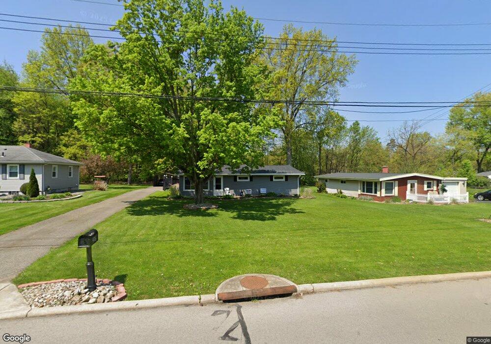
426 Cedar Dr Cortland, OH 44410
Estimated Value: $140,000 - $183,000
3
Beds
1
Bath
1,384
Sq Ft
$116/Sq Ft
Est. Value
About This Home
This home is located at 426 Cedar Dr, Cortland, OH 44410 and is currently estimated at $160,177, approximately $115 per square foot. 426 Cedar Dr is a home located in Trumbull County with nearby schools including Lakeview Elementary School, Lakeview Middle School, and Lakeview High School.
Ownership History
Date
Name
Owned For
Owner Type
Purchase Details
Closed on
Aug 8, 2025
Sold by
Meixelberger Shawn M
Bought by
Meixelberger Shawn M and Meixelberger Laurie
Current Estimated Value
Purchase Details
Closed on
Nov 26, 2014
Sold by
Meixelberger Melissa
Bought by
Meixelberger Shawn M
Home Financials for this Owner
Home Financials are based on the most recent Mortgage that was taken out on this home.
Original Mortgage
$85,500
Interest Rate
3.99%
Mortgage Type
New Conventional
Purchase Details
Closed on
Mar 31, 2006
Sold by
Armstrong Daniel L and Armstrong Christine L
Bought by
Meixelberger Melissa
Home Financials for this Owner
Home Financials are based on the most recent Mortgage that was taken out on this home.
Original Mortgage
$89,000
Interest Rate
6.38%
Mortgage Type
New Conventional
Purchase Details
Closed on
Mar 30, 2006
Sold by
Armstrong Daniel L and Armstrong Christine L
Bought by
Meixelberger Melissa
Home Financials for this Owner
Home Financials are based on the most recent Mortgage that was taken out on this home.
Original Mortgage
$89,000
Interest Rate
6.38%
Mortgage Type
New Conventional
Purchase Details
Closed on
Sep 9, 2005
Sold by
Us Bank Na
Bought by
Armstrong Daniel L and Armstrong Christine L
Purchase Details
Closed on
Sep 7, 2005
Sold by
Us Bank Na
Bought by
Armstrong Daniel L and Armstrong Christine L
Purchase Details
Closed on
Jun 22, 2005
Sold by
Lane Robert P and Lane Robert
Bought by
U S Bank Na
Purchase Details
Closed on
Aug 6, 1998
Sold by
Ogram Jess R
Bought by
Lane Robert P and Lane Rebecca J
Home Financials for this Owner
Home Financials are based on the most recent Mortgage that was taken out on this home.
Original Mortgage
$59,918
Interest Rate
7.05%
Purchase Details
Closed on
Feb 3, 1998
Sold by
Rising Nancy K
Bought by
Ogram Jess R
Purchase Details
Closed on
Jan 1, 1990
Bought by
Nancy K Rising
Create a Home Valuation Report for This Property
The Home Valuation Report is an in-depth analysis detailing your home's value as well as a comparison with similar homes in the area
Home Values in the Area
Average Home Value in this Area
Purchase History
| Date | Buyer | Sale Price | Title Company |
|---|---|---|---|
| Meixelberger Shawn M | -- | None Listed On Document | |
| Meixelberger Shawn M | -- | None Available | |
| Meixelberger Melissa | $89,000 | None Available | |
| Meixelberger Melissa | $89,000 | None Available | |
| Armstrong Daniel L | $45,000 | Sovereign Title | |
| Armstrong Daniel L | $45,000 | Sovereign Title | |
| U S Bank Na | $60,000 | -- | |
| Lane Robert P | $60,000 | -- | |
| Ogram Jess R | $27,500 | -- | |
| Nancy K Rising | -- | -- |
Source: Public Records
Mortgage History
| Date | Status | Borrower | Loan Amount |
|---|---|---|---|
| Previous Owner | Meixelberger Shawn M | $85,500 | |
| Previous Owner | U S Bank Na | $89,000 | |
| Previous Owner | Meixelberger Melissa | $89,000 | |
| Previous Owner | Lane Robert P | $59,918 |
Source: Public Records
Tax History
| Year | Tax Paid | Tax Assessment Tax Assessment Total Assessment is a certain percentage of the fair market value that is determined by local assessors to be the total taxable value of land and additions on the property. | Land | Improvement |
|---|---|---|---|---|
| 2024 | $2,153 | $38,890 | $6,160 | $32,730 |
| 2023 | $2,092 | $38,890 | $6,160 | $32,730 |
| 2022 | $1,691 | $26,360 | $6,160 | $20,200 |
| 2021 | $1,698 | $26,360 | $6,160 | $20,200 |
| 2020 | $1,706 | $26,360 | $6,160 | $20,200 |
| 2019 | $1,472 | $22,190 | $6,160 | $16,030 |
| 2018 | $1,479 | $22,190 | $6,160 | $16,030 |
| 2017 | $1,477 | $22,190 | $6,160 | $16,030 |
| 2016 | $1,714 | $24,890 | $6,160 | $18,730 |
| 2015 | $1,709 | $24,890 | $6,160 | $18,730 |
| 2014 | $1,508 | $24,890 | $6,160 | $18,730 |
| 2013 | $1,535 | $24,890 | $6,160 | $18,730 |
Source: Public Records
Map
Nearby Homes
- 384 Fowler St Unit 384
- 151 Cedar Cir
- 319 Russell Ave
- 140 Leckrone Way
- 248 Robbies Run
- 104 Diamond Way Unit 104
- 289 Cricklewood Dr
- 111 Emerald Ln
- 2 Harneds Landing
- 336 S Colonial Dr
- 152 Grove St
- 278 Rosewae Ave
- 324 Greenbriar Dr
- 700 Lakeview Dr Unit 700
- 723 Lakeview Dr
- 232 Bayview Dr Unit 232
- 220 Wae Trail
- 155 Heritage Ln
- 120 Winter Ln
- 0 N High St
Your Personal Tour Guide
Ask me questions while you tour the home.