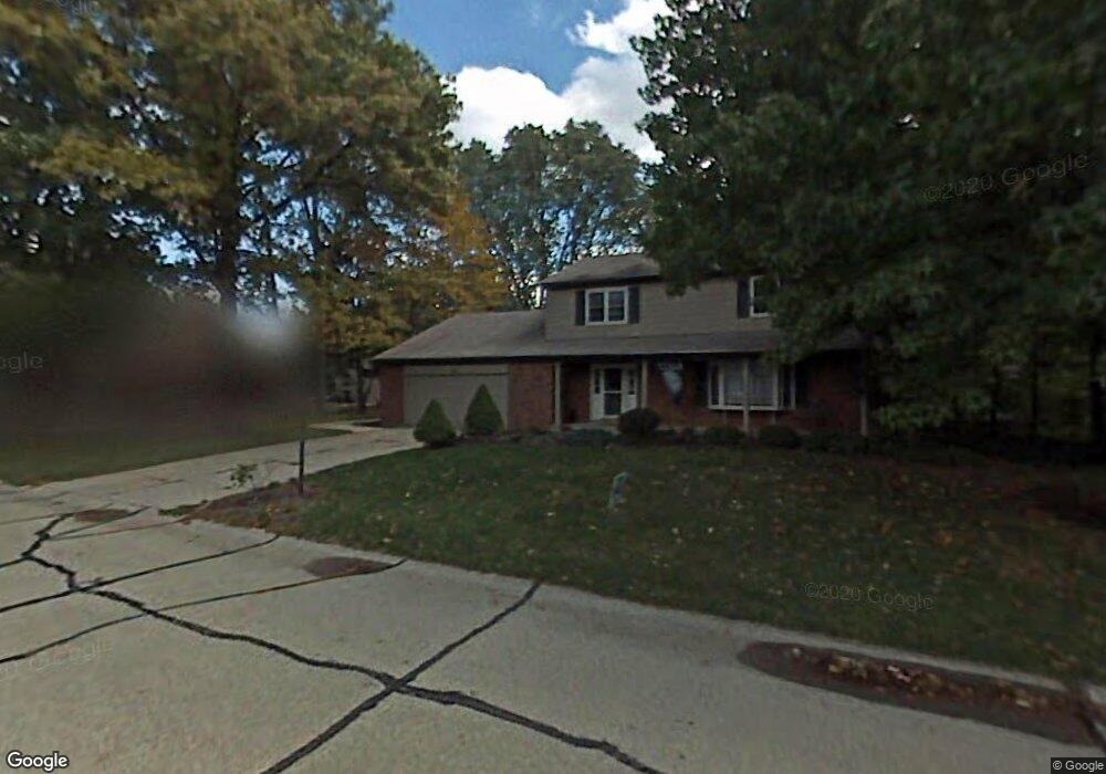
426 Cedarleaf Dr Dayton, OH 45459
Estimated Value: $360,000 - $440,000
4
Beds
3
Baths
2,310
Sq Ft
$169/Sq Ft
Est. Value
About This Home
This home is located at 426 Cedarleaf Dr, Dayton, OH 45459 and is currently estimated at $390,587, approximately $169 per square foot. 426 Cedarleaf Dr is a home located in Montgomery County with nearby schools including Primary Village North, Stingley Elementary School, and Tower Heights Middle School.
Ownership History
Date
Name
Owned For
Owner Type
Purchase Details
Closed on
Aug 30, 2017
Sold by
Gourley Julia K and Gourley David S
Bought by
Gourley Julia K and Gourley David S
Current Estimated Value
Home Financials for this Owner
Home Financials are based on the most recent Mortgage that was taken out on this home.
Original Mortgage
$177,248
Outstanding Balance
$146,670
Interest Rate
3.92%
Mortgage Type
FHA
Estimated Equity
$243,917
Purchase Details
Closed on
Sep 4, 1998
Sold by
Kendall Clay A and Kendall Joanna C
Bought by
Wilkie Geoffrey S and Wilkie Julia K
Home Financials for this Owner
Home Financials are based on the most recent Mortgage that was taken out on this home.
Original Mortgage
$166,250
Interest Rate
7.04%
Create a Home Valuation Report for This Property
The Home Valuation Report is an in-depth analysis detailing your home's value as well as a comparison with similar homes in the area
Purchase History
| Date | Buyer | Sale Price | Title Company |
|---|---|---|---|
| Gourley Julia K | -- | Hallmark Title | |
| Wilkie Geoffrey S | $175,000 | -- | |
| Wilkie Geoffrey S | $175,000 | -- |
Source: Public Records
Mortgage History
| Date | Status | Borrower | Loan Amount |
|---|---|---|---|
| Open | Gourley Julia K | $177,248 | |
| Closed | Wilkie Geoffrey S | $166,250 |
Source: Public Records
Tax History
| Year | Tax Paid | Tax Assessment Tax Assessment Total Assessment is a certain percentage of the fair market value that is determined by local assessors to be the total taxable value of land and additions on the property. | Land | Improvement |
|---|---|---|---|---|
| 2025 | $6,607 | $104,080 | $20,170 | $83,910 |
| 2024 | $6,041 | $104,080 | $20,170 | $83,910 |
| 2023 | $6,041 | $104,080 | $20,170 | $83,910 |
| 2022 | $5,538 | $75,650 | $14,620 | $61,030 |
| 2021 | $5,553 | $75,650 | $14,620 | $61,030 |
| 2020 | $5,545 | $75,650 | $14,620 | $61,030 |
| 2019 | $5,637 | $68,640 | $14,620 | $54,020 |
| 2018 | $4,996 | $68,640 | $14,620 | $54,020 |
| 2017 | $4,938 | $68,640 | $14,620 | $54,020 |
| 2016 | $5,037 | $66,090 | $14,620 | $51,470 |
| 2015 | $4,985 | $66,090 | $14,620 | $51,470 |
| 2014 | $4,985 | $66,090 | $14,620 | $51,470 |
| 2012 | -- | $64,200 | $14,480 | $49,720 |
Source: Public Records
Map
Nearby Homes
- 7215 Whitetail Trail Unit 108108
- 7128 Hartcrest Ln Unit 130130
- 955 Elk Hollow Ln Unit 4040
- 7036 Far Hills Ave
- 6865 Cedar Cove Dr Unit 3686
- 6834 Cedar Cove Dr Unit 3175
- 190 Lyons Dr
- 1237 Chevington Ct Unit 1515
- 1160 Smugglers Way Unit 1433
- 211 Whittington Dr
- 100 Weller Ave
- 7035 Bluffs Dr Unit 27035
- 1420 Lake Pointe Way Unit 3
- 1311 Hollow Run Unit 6
- 104 Martha Ave
- 6935 Paragon Rd
- 251 Glenburn Dr
- 51 Winchester (#E) Place
- 6620 Green Branch Dr Unit 8
- 57 Shadybrook Dr
- 440 Cedarleaf Dr
- 414 Cedarleaf Dr
- 316 Cedarleaf Ct
- 305 Blackstone Dr
- 427 Cedarleaf Dr
- 439 Cedarleaf Dr
- 415 Cedarleaf Dr
- 326 Cedarleaf Ct
- 452 Cedarleaf Dr
- 306 Cedarleaf Ct
- 451 Cedarleaf Dr
- 294 Blackstone Dr
- 426 Willowhurst Dr
- 284 Blackstone Dr
- 436 Willowhurst Dr
- 333 Blackstone Dr
- 381 Silvertree Ln
- 263 Blackstone Dr
- 446 Willowhurst Dr
- 336 Cedarleaf Ct
Your Personal Tour Guide
Ask me questions while you tour the home.