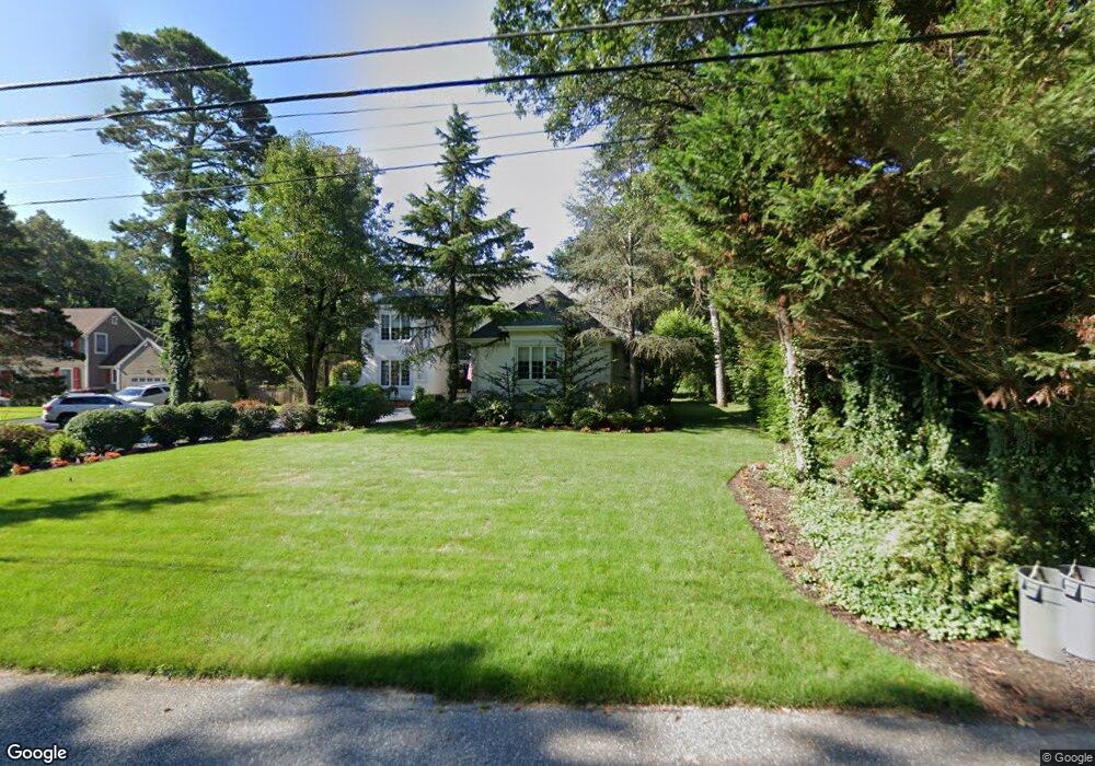
426 Clarkstown Rd Mays Landing, NJ 08330
Estimated Value: $685,000 - $779,088
4
Beds
4
Baths
3,666
Sq Ft
$202/Sq Ft
Est. Value
About This Home
This home is located at 426 Clarkstown Rd, Mays Landing, NJ 08330 and is currently estimated at $741,029, approximately $202 per square foot. 426 Clarkstown Rd is a home located in Atlantic County with nearby schools including George L. Hess Educational Complex, Joseph Shaner School, and William Davies Middle School.
Ownership History
Date
Name
Owned For
Owner Type
Purchase Details
Closed on
Sep 16, 2004
Sold by
Brunk Lewis C and Thomas Linda A
Bought by
Mancuso George
Current Estimated Value
Purchase Details
Closed on
Mar 31, 1989
Sold by
Nelson Jeffrey C and Nelson Eileen M
Bought by
Mancuso George C and Mancuso Elizabeth
Create a Home Valuation Report for This Property
The Home Valuation Report is an in-depth analysis detailing your home's value as well as a comparison with similar homes in the area
Home Values in the Area
Average Home Value in this Area
Purchase History
| Date | Buyer | Sale Price | Title Company |
|---|---|---|---|
| Mancuso George | $95,000 | Fidelity National | |
| Mancuso George C | $55,000 | -- |
Source: Public Records
Tax History Compared to Growth
Tax History
| Year | Tax Paid | Tax Assessment Tax Assessment Total Assessment is a certain percentage of the fair market value that is determined by local assessors to be the total taxable value of land and additions on the property. | Land | Improvement |
|---|---|---|---|---|
| 2025 | $11,665 | $340,000 | $75,000 | $265,000 |
| 2024 | $11,665 | $340,000 | $75,000 | $265,000 |
| 2023 | $10,968 | $340,000 | $75,000 | $265,000 |
| 2022 | $10,968 | $340,000 | $75,000 | $265,000 |
| 2021 | $10,945 | $340,000 | $75,000 | $265,000 |
| 2020 | $10,945 | $340,000 | $75,000 | $265,000 |
| 2019 | $10,972 | $340,000 | $75,000 | $265,000 |
| 2018 | $10,588 | $340,000 | $75,000 | $265,000 |
| 2017 | $10,421 | $340,000 | $75,000 | $265,000 |
| 2016 | $10,129 | $340,000 | $75,000 | $265,000 |
| 2015 | $10,113 | $351,400 | $75,000 | $276,400 |
| 2014 | $9,457 | $360,000 | $85,000 | $275,000 |
Source: Public Records
Map
Nearby Homes
- 570 North St
- 1303 W Riverside Dr
- 116 Post Rd
- 1410 Cantillon Blvd
- 15 Lowell St
- 246 Old River Rd
- 355 Penny Ln
- 1403 Loretta Ave
- 1404 Loretta Ave
- 1 Lafayette Ave
- 1305 Matthews Ave
- 225 Old River Rd
- 504 Meadowbrook Dr
- 5745 2nd St
- 148 Marucci Place
- 109 Deal Ln
- Rt 50 and Old Mays Landing Rd
- 112 Giunta Walk
- 98 Gasko Rd
- 0 3rd St
- 430 Clarkstown Rd
- 422 Clarkstown Rd
- 423 Highland Dr
- 407 Highland Dr
- 434 Clarkstown Rd
- 427 Highland Dr
- 411 Highland Dr
- 431 Highland Dr
- 425 Clarkstown Rd
- 419 Clarkstown Rd
- 431 Clarkstown Rd
- 456 Ridge Ln
- 439 Clarkstown Rd
- 435 Highland Dr
- 445 Clarkstown Rd
- 408 Highland Dr
- 404 Highland Dr
- 424 Highland Dr
- 420 Highland Dr
- 460 Ridge Ln