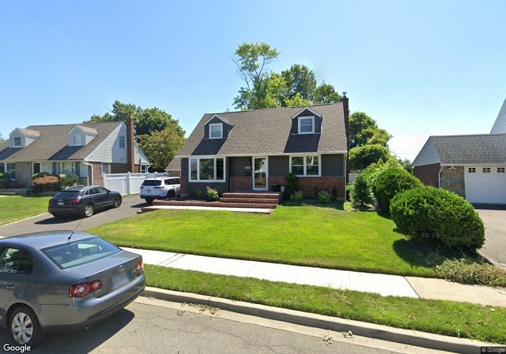
426 Coleridge St Levittown, NY 11756
Estimated Value: $573,000 - $677,341
--
Bed
2
Baths
1,299
Sq Ft
$481/Sq Ft
Est. Value
About This Home
This home is located at 426 Coleridge St, Levittown, NY 11756 and is currently estimated at $625,171, approximately $481 per square foot. 426 Coleridge St is a home located in Nassau County with nearby schools including Michael F. Stokes Elementary School, J Fred Sparke Elementary School, and Island Trees Middle School.
Ownership History
Date
Name
Owned For
Owner Type
Purchase Details
Closed on
Jul 14, 2022
Sold by
Dellera Rose and Dellera Dominick
Bought by
Kaminski Jonathan and Kaminski Anna
Current Estimated Value
Home Financials for this Owner
Home Financials are based on the most recent Mortgage that was taken out on this home.
Original Mortgage
$384,000
Outstanding Balance
$365,772
Interest Rate
5.23%
Mortgage Type
New Conventional
Estimated Equity
$259,399
Create a Home Valuation Report for This Property
The Home Valuation Report is an in-depth analysis detailing your home's value as well as a comparison with similar homes in the area
Home Values in the Area
Average Home Value in this Area
Purchase History
| Date | Buyer | Sale Price | Title Company |
|---|---|---|---|
| Kaminski Jonathan | $480,000 | Fidelity National Ttl Ins Co |
Source: Public Records
Mortgage History
| Date | Status | Borrower | Loan Amount |
|---|---|---|---|
| Open | Kaminski Jonathan | $384,000 |
Source: Public Records
Tax History Compared to Growth
Tax History
| Year | Tax Paid | Tax Assessment Tax Assessment Total Assessment is a certain percentage of the fair market value that is determined by local assessors to be the total taxable value of land and additions on the property. | Land | Improvement |
|---|---|---|---|---|
| 2025 | $11,501 | $495 | $278 | $217 |
| 2024 | $4,478 | $495 | $278 | $217 |
| 2023 | $3,922 | $495 | $278 | $217 |
| 2022 | $3,922 | $495 | $278 | $217 |
| 2021 | $4,197 | $472 | $265 | $207 |
| 2020 | $4,780 | $832 | $599 | $233 |
| 2019 | $2,906 | $832 | $599 | $233 |
| 2018 | $1,472 | $832 | $0 | $0 |
| 2017 | $1,096 | $832 | $599 | $233 |
| 2016 | $3,842 | $832 | $599 | $233 |
| 2015 | $2,441 | $832 | $599 | $233 |
| 2014 | $2,441 | $832 | $599 | $233 |
| 2013 | $2,284 | $832 | $599 | $233 |
Source: Public Records
Map
Nearby Homes
- 432 Coleridge St
- 420 Coleridge St
- 438 Mansfield Ave
- 442 Mansfield Ave
- 414 Coleridge St
- 438 Coleridge St
- 432 Mansfield Ave
- 427 Coleridge St
- 419 Coleridge St
- 429 Parker Ave
- 426 Mansfield Ave
- 437 Coleridge St
- 435 Parker Ave
- 444 Coleridge St
- 411 Parker Ave
- 448 Mansfield Ave
- 413 Coleridge St
- 441 Parker Ave
- 420 Mansfield Ave
- 443 Coleridge St