Estimated Value: $270,417 - $580,000
--
Bed
--
Bath
849
Sq Ft
$565/Sq Ft
Est. Value
About This Home
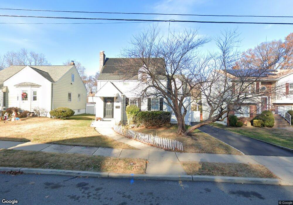
This home is located at 426 Conant Ave, Union, NJ 07083 and is currently estimated at $479,354, approximately $564 per square foot. 426 Conant Ave is a home located in Union County with nearby schools including Washington Elementary School, Union High School, and Jewish Educational Center Lower School.
Ownership History
Date
Name
Owned For
Owner Type
Purchase Details
Closed on
Nov 20, 2021
Sold by
Susie Azevedo
Bought by
Azevedo Susie and King Duane
Current Estimated Value
Home Financials for this Owner
Home Financials are based on the most recent Mortgage that was taken out on this home.
Original Mortgage
$177,700
Interest Rate
3.09%
Mortgage Type
New Conventional
Purchase Details
Closed on
Nov 3, 2010
Sold by
King Duane C and Azevedo Susie
Bought by
Azevedo Susie and King Duane
Home Financials for this Owner
Home Financials are based on the most recent Mortgage that was taken out on this home.
Original Mortgage
$228,000
Interest Rate
4.24%
Mortgage Type
New Conventional
Purchase Details
Closed on
Jun 30, 2003
Sold by
Reitz Michael
Bought by
King Duane and Lopez Suzie
Home Financials for this Owner
Home Financials are based on the most recent Mortgage that was taken out on this home.
Original Mortgage
$238,500
Interest Rate
5.28%
Create a Home Valuation Report for This Property
The Home Valuation Report is an in-depth analysis detailing your home's value as well as a comparison with similar homes in the area
Home Values in the Area
Average Home Value in this Area
Purchase History
| Date | Buyer | Sale Price | Title Company |
|---|---|---|---|
| Azevedo Susie | -- | Puleo Delisle Pllc | |
| Azevedo Susie | -- | Victorian Title Agency Inc | |
| King Duane | $265,000 | -- |
Source: Public Records
Mortgage History
| Date | Status | Borrower | Loan Amount |
|---|---|---|---|
| Previous Owner | Azevedo Susie | $177,700 | |
| Previous Owner | Azevedo Susie | $228,000 | |
| Previous Owner | King Duane | $238,500 |
Source: Public Records
Tax History Compared to Growth
Tax History
| Year | Tax Paid | Tax Assessment Tax Assessment Total Assessment is a certain percentage of the fair market value that is determined by local assessors to be the total taxable value of land and additions on the property. | Land | Improvement |
|---|---|---|---|---|
| 2025 | $9,142 | $40,900 | $20,000 | $20,900 |
| 2024 | $8,776 | $40,900 | $20,000 | $20,900 |
| 2023 | $8,776 | $40,500 | $20,000 | $20,500 |
| 2022 | $8,471 | $40,500 | $20,000 | $20,500 |
| 2021 | $8,266 | $40,500 | $20,000 | $20,500 |
| 2020 | $8,101 | $40,500 | $20,000 | $20,500 |
| 2019 | $7,992 | $40,500 | $20,000 | $20,500 |
| 2018 | $7,856 | $40,500 | $20,000 | $20,500 |
| 2017 | $7,740 | $40,500 | $20,000 | $20,500 |
| 2016 | $7,551 | $40,500 | $20,000 | $20,500 |
| 2015 | $7,426 | $40,500 | $20,000 | $20,500 |
| 2014 | $7,259 | $40,500 | $20,000 | $20,500 |
Source: Public Records
Map
Nearby Homes
- 309 Palisade Rd Unit 323
- 275 Clermont Terrace
- 1031 Lowden Ave
- 138 Monmouth Rd Unit 40
- 1084 Woodland Ave
- 1134-1138 Kipling Rd
- 45 Summit Rd Unit 47
- 749 Cleveland Ave Unit 751
- 137-139 Monmouth Rd
- 757 Floral Ave Unit 59
- 161 Morristown Rd Unit 63
- 686 Gates Terrace
- 13-15 Hillside Rd
- 819 Greenwich Ln
- 717 Winchester Ave
- 795 Colonial Arms Rd
- 790 Green Ln Unit A1
- 536 Lehigh Ave
- 13 Berkeley Place Unit 15
- 578 Winchester Ave
- 434 Conant Ave
- 424 Conant Ave
- 420 Conant Ave
- 447 Shearer Ave
- 438 Conant Ave
- 441 Shearer Ave
- 453 Shearer Ave
- 414 Conant Ave
- 444 Conant Ave
- 435 Shearer Ave
- 425 Conant Ave
- 435 Conant Ave
- 459 Shearer Ave
- 437 Conant Ave
- 410 Conant Ave
- 423 Conant Ave
- 441 Conant Ave
- 429 Shearer Ave
- 417 Conant Ave
- 450 Conant Ave