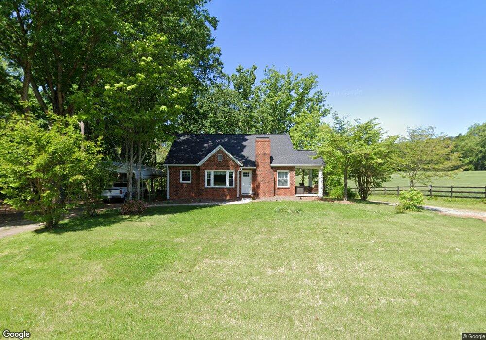
426 E Monbo Rd Statesville, NC 28677
Estimated Value: $237,678 - $329,000
3
Beds
1
Bath
1,491
Sq Ft
$193/Sq Ft
Est. Value
About This Home
This home is located at 426 E Monbo Rd, Statesville, NC 28677 and is currently estimated at $287,670, approximately $192 per square foot. 426 E Monbo Rd is a home located in Iredell County with nearby schools including Troutman Elementary School, Troutman Middle School, and South Iredell High School.
Ownership History
Date
Name
Owned For
Owner Type
Purchase Details
Closed on
Jul 29, 2020
Sold by
Warren Maxine Ostwalt
Bought by
Warren Brent Leslie and Warren Carolyn B
Current Estimated Value
Purchase Details
Closed on
Feb 22, 2017
Sold by
Warren Maxine Ostwalt
Bought by
Warren Larry B
Purchase Details
Closed on
Feb 12, 2008
Sold by
Warren Larry B
Bought by
Warren Maxine Ostwalt
Purchase Details
Closed on
Jun 1, 1963
Create a Home Valuation Report for This Property
The Home Valuation Report is an in-depth analysis detailing your home's value as well as a comparison with similar homes in the area
Home Values in the Area
Average Home Value in this Area
Purchase History
| Date | Buyer | Sale Price | Title Company |
|---|---|---|---|
| Warren Brent Leslie | -- | None Available | |
| Warren Maxine Ostwalt | -- | None Available | |
| Warren Larry B | -- | None Available | |
| Warren Maxine Ostwalt | -- | None Available | |
| -- | -- | -- |
Source: Public Records
Tax History Compared to Growth
Tax History
| Year | Tax Paid | Tax Assessment Tax Assessment Total Assessment is a certain percentage of the fair market value that is determined by local assessors to be the total taxable value of land and additions on the property. | Land | Improvement |
|---|---|---|---|---|
| 2024 | $871 | $135,130 | $60,130 | $75,000 |
| 2023 | $871 | $135,130 | $60,130 | $75,000 |
| 2022 | $563 | $78,890 | $26,000 | $52,890 |
| 2021 | $551 | $78,890 | $26,000 | $52,890 |
| 2020 | $516 | $73,240 | $26,000 | $47,240 |
| 2019 | $497 | $73,240 | $26,000 | $47,240 |
| 2018 | $474 | $70,630 | $26,000 | $44,630 |
| 2017 | $474 | $70,630 | $26,000 | $44,630 |
| 2016 | $474 | $70,630 | $26,000 | $44,630 |
| 2015 | $474 | $70,630 | $26,000 | $44,630 |
| 2014 | $485 | $78,790 | $26,000 | $52,790 |
Source: Public Records
Map
Nearby Homes
- 124 N Sina St
- 173 Wembury Ln
- 125 Jacobs Hill Place
- 129 Jacobs Hill Place
- 139 Jacobs Hill Place
- 134 Jacobs Hill Place
- 142 Jacobs Hill Place
- 144 Jacobs Hill Place
- 116 Kennford Trail
- 111 Sandypark Ct
- 112 Dartmoor Park Ln
- 113 Sandypark Ct
- 104 Sandypark Ct
- 114 Sandypark Ct
- 101 Rills Crossing Way
- 105 Rills Crossing Way
- 112 Sandypark Ct
- 109 Rills Crossing Way
- 102 Dartmoor Park Ln
- 120 Rills Crossing Way
- 441 E Monbo Rd
- 000 Parkwood Ln
- 78 Parkwood Ln
- 462 E Monbo Rd
- 466 E Monbo Rd
- Lot 1 Stone House Ln
- 470 Monbo Rd E Unit 7
- 199 Stonegate Ln
- 470 & 474 E Monbo Rd
- 715 E Monbo Rd
- 00 E East Monbo Rd
- 474 Monbo Rd E Unit 6
- 482 E Monbo Rd
- 486 E Monbo Rd
- 365 E Monbo Rd
- 490 E Monbo Rd
- 494 E Monbo Rd
- 139 Wootie Dr
- 179 Wootie Dr
- 155 Wootie Dr