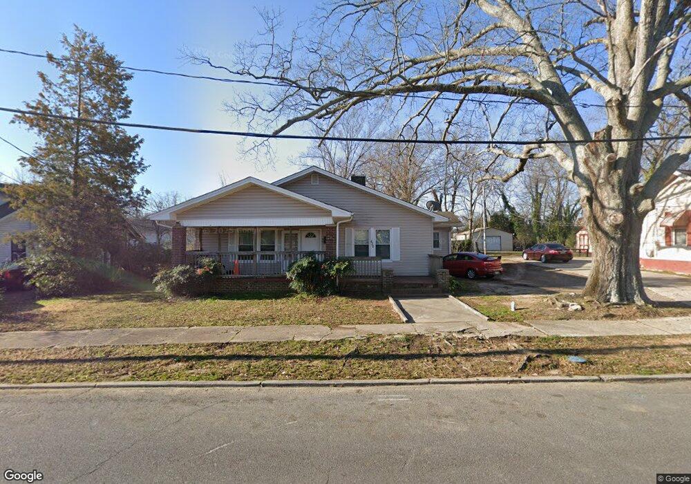
426 Flint St Rock Hill, SC 29730
Estimated Value: $178,207 - $210,000
--
Bed
--
Bath
1,292
Sq Ft
$146/Sq Ft
Est. Value
About This Home
This home is located at 426 Flint St, Rock Hill, SC 29730 and is currently estimated at $188,052, approximately $145 per square foot. 426 Flint St is a home with nearby schools including Rawlinson Road Middle School and Northwestern High School.
Ownership History
Date
Name
Owned For
Owner Type
Purchase Details
Closed on
Jun 13, 2023
Sold by
Mccoy Jason N
Bought by
Mccoy Family Living Trust
Current Estimated Value
Purchase Details
Closed on
Jan 28, 2005
Sold by
Citifinancial Mortgage Co Inc
Bought by
Mccoy Jason
Purchase Details
Closed on
Sep 8, 2004
Sold by
Mccleave Sheldon L
Bought by
Citi Financial Mortgage Co Inc
Purchase Details
Closed on
Jul 21, 1999
Sold by
Zuppo Gerald
Bought by
Mccleave Sheldon L
Create a Home Valuation Report for This Property
The Home Valuation Report is an in-depth analysis detailing your home's value as well as a comparison with similar homes in the area
Home Values in the Area
Average Home Value in this Area
Purchase History
| Date | Buyer | Sale Price | Title Company |
|---|---|---|---|
| Mccoy Family Living Trust | -- | None Listed On Document | |
| Mccoy Jason | $22,000 | -- | |
| Citi Financial Mortgage Co Inc | $39,900 | -- | |
| Mccleave Sheldon L | $50,000 | -- |
Source: Public Records
Tax History Compared to Growth
Tax History
| Year | Tax Paid | Tax Assessment Tax Assessment Total Assessment is a certain percentage of the fair market value that is determined by local assessors to be the total taxable value of land and additions on the property. | Land | Improvement |
|---|---|---|---|---|
| 2024 | $2,046 | $4,623 | $1,060 | $3,563 |
| 2023 | $2,049 | $4,623 | $1,060 | $3,563 |
| 2022 | $1,953 | $4,623 | $1,060 | $3,563 |
| 2021 | -- | $4,623 | $1,060 | $3,563 |
| 2020 | $1,913 | $4,623 | $0 | $0 |
| 2019 | $1,706 | $4,020 | $0 | $0 |
| 2018 | $1,681 | $4,020 | $0 | $0 |
| 2017 | $1,623 | $4,020 | $0 | $0 |
| 2016 | $1,591 | $4,020 | $0 | $0 |
| 2014 | $1,582 | $4,020 | $1,080 | $2,940 |
| 2013 | $1,582 | $4,170 | $1,080 | $3,090 |
Source: Public Records
Map
Nearby Homes
- 301 S Spruce St
- 368 Chestnut St
- 517 E Main St
- 606 E Black St
- 560 Walnut St
- 621 Flint St
- 720 Arch Dr
- 131 N Confederate Ave
- 229 Marion St
- 724 Chestnut St
- 402 Keels Ave
- 215 Keels Ave
- 334 Whitner St
- 459 Green St
- 210 Marshall St
- 234 Marshall St
- 416 Locust St Unit 8
- 758 Jefferson Ave
- 757 Carolina Ave
- 658 Rockwood Dr
- 430 Flint St
- 418 Flint St
- 432 Flint St
- 312 S Spruce St
- 414 Flint St
- 412 Flint St Unit 3
- 311 S Spruce St
- 305 S Spruce St
- 309 S Confederate Ave
- 225 S Spruce St
- 402 Flint St
- 415 Chestnut St
- 417 Chestnut St
- 313 S Confederate Ave
- 326 S Spruce St
- 317 S Confederate Ave
- 214 S Spruce St
- 217 S Spruce St
- 221 S Spruce St
- 315 S Spruce St