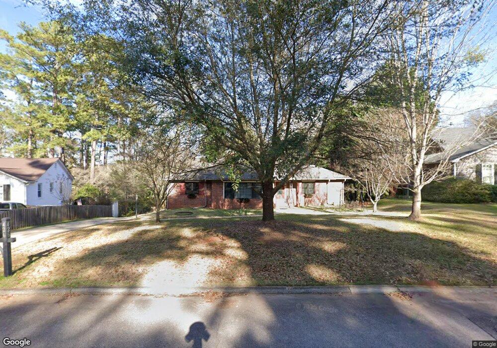
426 Gordon Cir Lagrange, GA 30240
Estimated Value: $276,565 - $322,000
3
Beds
3
Baths
1,644
Sq Ft
$184/Sq Ft
Est. Value
About This Home
This home is located at 426 Gordon Cir, Lagrange, GA 30240 and is currently estimated at $302,391, approximately $183 per square foot. 426 Gordon Cir is a home located in Troup County with nearby schools including Hollis Hand Elementary School, Franklin Forest Elementary School, and Ethel W. Kight Elementary School.
Ownership History
Date
Name
Owned For
Owner Type
Purchase Details
Closed on
Sep 20, 2005
Sold by
Yearta Emmett D
Bought by
Yearta Emmett
Current Estimated Value
Purchase Details
Closed on
Jul 26, 1988
Sold by
Kenneth E Cosper
Bought by
Yerta Gail H
Purchase Details
Closed on
Aug 1, 1987
Sold by
Mrs W M Slaughter
Bought by
Kenneth E Cosper
Purchase Details
Closed on
Jan 1, 1949
Sold by
Allen B Walburn
Bought by
Mrs W M Slaughter
Create a Home Valuation Report for This Property
The Home Valuation Report is an in-depth analysis detailing your home's value as well as a comparison with similar homes in the area
Purchase History
| Date | Buyer | Sale Price | Title Company |
|---|---|---|---|
| Yearta Emmett | -- | -- | |
| Yearta Emmett D | -- | -- | |
| Yerta Gail H | $86,500 | -- | |
| Kenneth E Cosper | $70,000 | -- | |
| Mrs W M Slaughter | -- | -- |
Source: Public Records
Tax History
| Year | Tax Paid | Tax Assessment Tax Assessment Total Assessment is a certain percentage of the fair market value that is determined by local assessors to be the total taxable value of land and additions on the property. | Land | Improvement |
|---|---|---|---|---|
| 2025 | $2,350 | $120,760 | $18,000 | $102,760 |
| 2024 | $1,970 | $99,120 | $14,000 | $85,120 |
| 2023 | $1,625 | $86,480 | $14,000 | $72,480 |
| 2022 | $1,576 | $82,840 | $14,000 | $68,840 |
| 2021 | $1,411 | $56,720 | $14,000 | $42,720 |
| 2020 | $1,350 | $54,720 | $12,000 | $42,720 |
| 2019 | $1,296 | $52,920 | $12,000 | $40,920 |
| 2018 | $1,237 | $50,960 | $12,000 | $38,960 |
| 2017 | $1,049 | $44,720 | $12,000 | $32,720 |
| 2016 | $1,034 | $44,215 | $12,000 | $32,215 |
| 2015 | $1,038 | $44,215 | $12,000 | $32,215 |
| 2014 | $917 | $40,159 | $10,000 | $30,159 |
| 2013 | -- | $43,938 | $10,000 | $33,938 |
Source: Public Records
Map
Nearby Homes
- 105 Saynor Cir
- 120 Saynor Cir
- 598 Edmondson Ave
- 222 Beechwood Cir
- 609 Ridley Ave
- 707 Ridley Ave
- 611 Ridley Ave
- 615 Ridley Ave
- 709 Ridley Ave
- 0 Ridley Ave Unit 10550104
- 206 Broad St
- 705 Piney Woods Dr
- 219 Banks St
- 203 Waverly Way
- 216 E Lane Cir
- 109 Thomas St
- 301 E Bacon St
- 405 W Broome St Unit 2
- 405 W Broome St Unit 3
- 405 W Broome St Unit 4
- 424 Gordon Cir
- 428 Gordon Cir
- 430 Gordon Cir
- 423 Gordon Cir
- 443 Gordon St
- 422 Gordon Cir
- 420 Gordon Cir
- 419 Gordon Cir
- 432 Gordon Cir
- 417 Gordon Cir
- 412 Gordon St
- 429 Gordon Cir
- 434 Gordon Cir
- 415 Gordon St
- 107 Dilly Hill
- 100 Dilly Hill
- 409 Gordon St
- 408 Gordon St
- 108 Dilly Hill
- 0 Gordon Cir Unit 7609789
Your Personal Tour Guide
Ask me questions while you tour the home.