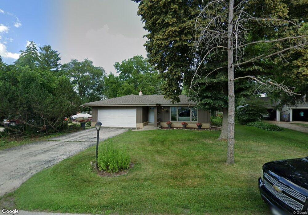
426 High St Pewaukee, WI 53072
Estimated Value: $353,450 - $459,000
Studio
--
Bath
--
Sq Ft
28,750
Sq Ft Lot
About This Home
This home is located at 426 High St, Pewaukee, WI 53072 and is currently estimated at $407,863. 426 High St is a home located in Waukesha County with nearby schools including Pewaukee Lake Elementary School, Asa Clark Middle School, and Pewaukee High School.
Ownership History
Date
Name
Owned For
Owner Type
Purchase Details
Closed on
Jan 12, 2010
Sold by
Rondeau Daniel T and Rondeau Annabel Rose
Bought by
Keyes Karen G
Current Estimated Value
Home Financials for this Owner
Home Financials are based on the most recent Mortgage that was taken out on this home.
Original Mortgage
$105,000
Outstanding Balance
$67,825
Interest Rate
4.87%
Mortgage Type
New Conventional
Estimated Equity
$340,038
Create a Home Valuation Report for This Property
The Home Valuation Report is an in-depth analysis detailing your home's value as well as a comparison with similar homes in the area
Home Values in the Area
Average Home Value in this Area
Purchase History
| Date | Buyer | Sale Price | Title Company |
|---|---|---|---|
| Keyes Karen G | $200,000 | None Available |
Source: Public Records
Mortgage History
| Date | Status | Borrower | Loan Amount |
|---|---|---|---|
| Open | Keyes Karen G | $105,000 |
Source: Public Records
Tax History
| Year | Tax Paid | Tax Assessment Tax Assessment Total Assessment is a certain percentage of the fair market value that is determined by local assessors to be the total taxable value of land and additions on the property. | Land | Improvement |
|---|---|---|---|---|
| 2024 | $2,878 | $255,700 | $72,500 | $183,200 |
| 2023 | $2,599 | $212,500 | $70,000 | $142,500 |
| 2022 | $2,668 | $212,500 | $70,000 | $142,500 |
| 2021 | $2,799 | $207,700 | $68,000 | $139,700 |
| 2020 | $3,088 | $207,700 | $68,000 | $139,700 |
| 2019 | $2,954 | $207,700 | $68,000 | $139,700 |
| 2018 | $2,622 | $185,800 | $68,000 | $117,800 |
| 2017 | $2,702 | $185,800 | $68,000 | $117,800 |
| 2016 | $3,228 | $196,900 | $56,500 | $140,400 |
| 2015 | $3,242 | $196,900 | $56,500 | $140,400 |
| 2014 | $3,934 | $196,900 | $56,500 | $140,400 |
| 2013 | $3,934 | $206,800 | $56,500 | $150,300 |
Source: Public Records
Map
Nearby Homes
- 394 Sandy Cir
- 450 Sandy Cir
- 207 Parkview Ct
- 321 Park Hill Dr Unit E
- 384 Park Hill Dr Unit E
- 360 Park Hill Dr Unit C
- 358 Park Hill Dr Unit B
- 327 Sandy Cir
- 130 W Wisconsin Ave Unit 23
- 100 Main St Unit 204
- 616 Kopmeier Dr
- 132 Caldwell St
- 127 Clark St
- W226N1933 Cedar Court Ct Unit 202
- W226N2020 Cedar Lane Ln Unit 1002
- 1114 Oxbow Ct
- W226N2020 Cedar Lane Ln Unit 1004
- W226N2020 Cedar Lane Ln Unit 1001
- W226N2020 Cedar Lane Ln Unit 1003
- 231 Prospect Ave
- 433 Sandy Cir
- 415 Sandy Cir
- 444 Sandy Cir
- 437 Sandy Cir
- 456 Sandy Cir
- 433 Sandy Cir Unit 433
- 437 Sandy Cir Unit 437
- 444 Sandy Cir Unit 444
- 456 Sandy Cir Unit 456
- 415 Sandy Cir Unit 415
- 434 High St
- 414 High St
- 419 High St
- 410 High St
- 442 High St
- 435 High St
- 427 High St
- 413 High St
- 453 High St
- 453 High St Unit 453
Your Personal Tour Guide
Ask me questions while you tour the home.