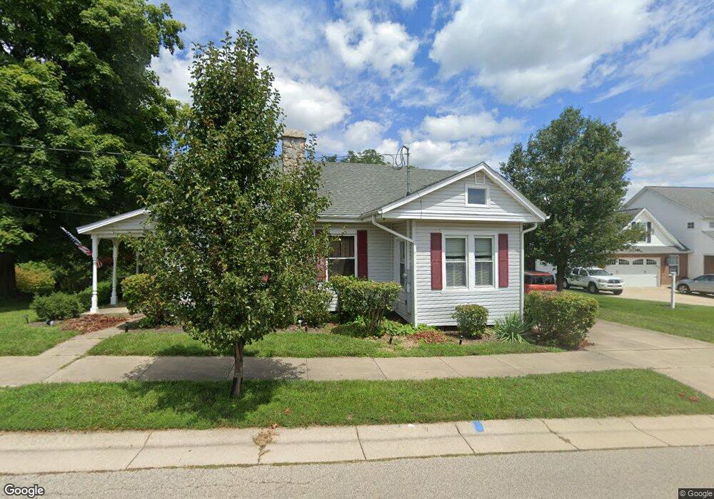
426 Jacob Dr Oxford, OH 45056
Estimated Value: $240,513 - $273,000
3
Beds
2
Baths
1,099
Sq Ft
$239/Sq Ft
Est. Value
About This Home
This home is located at 426 Jacob Dr, Oxford, OH 45056 and is currently estimated at $263,128, approximately $239 per square foot. 426 Jacob Dr is a home located in Butler County with nearby schools including Talawanda Middle School, Talawanda High School, and Mcguffey Montessori School.
Ownership History
Date
Name
Owned For
Owner Type
Purchase Details
Closed on
May 11, 2009
Sold by
Potter Alyce J
Bought by
Potter G Coe and Potter Alyce J
Current Estimated Value
Purchase Details
Closed on
Apr 8, 2005
Sold by
Potter Alyce J
Bought by
Potter G Coe and Potter Alyce J
Home Financials for this Owner
Home Financials are based on the most recent Mortgage that was taken out on this home.
Original Mortgage
$144,000
Interest Rate
5.62%
Mortgage Type
Stand Alone Refi Refinance Of Original Loan
Create a Home Valuation Report for This Property
The Home Valuation Report is an in-depth analysis detailing your home's value as well as a comparison with similar homes in the area
Home Values in the Area
Average Home Value in this Area
Purchase History
| Date | Buyer | Sale Price | Title Company |
|---|---|---|---|
| Potter G Coe | -- | Attorney | |
| Potter G Coe | -- | -- |
Source: Public Records
Mortgage History
| Date | Status | Borrower | Loan Amount |
|---|---|---|---|
| Closed | Potter G Coe | $144,000 |
Source: Public Records
Tax History Compared to Growth
Tax History
| Year | Tax Paid | Tax Assessment Tax Assessment Total Assessment is a certain percentage of the fair market value that is determined by local assessors to be the total taxable value of land and additions on the property. | Land | Improvement |
|---|---|---|---|---|
| 2024 | $2,551 | $67,490 | $22,910 | $44,580 |
| 2023 | $2,450 | $67,690 | $22,910 | $44,780 |
| 2022 | $2,225 | $55,850 | $22,910 | $32,940 |
| 2021 | $2,119 | $55,850 | $22,910 | $32,940 |
| 2020 | $2,216 | $55,850 | $22,910 | $32,940 |
| 2019 | $4,001 | $52,960 | $20,810 | $32,150 |
| 2018 | $2,216 | $52,960 | $20,810 | $32,150 |
| 2017 | $1,996 | $52,960 | $20,810 | $32,150 |
| 2016 | $2,020 | $51,870 | $20,810 | $31,060 |
| 2015 | $2,056 | $51,870 | $20,810 | $31,060 |
| 2014 | $1,855 | $51,870 | $20,810 | $31,060 |
| 2013 | $1,855 | $45,950 | $18,490 | $27,460 |
Source: Public Records
Map
Nearby Homes
- 6200 Hester Rd
- 5400 Hester Rd
- 107 Melanee Dr
- 843 Dufour Ln
- 9 Angela Ct
- 5280 Hester Rd
- 5285 College Corner Pike
- 215 Country Club Dr
- 5700 Forest Ridge Dr
- 138 N Ridge Dr
- 136 N Ridge Dr
- 126 Northridge Dr Unit 126
- 5706 Forest Ridge Dr
- 141 Prevalent Dr
- 435 Lincoln Ave
- 4 Olde Stone Ct
- 111 Prevalent Dr
- 327 N College Ave
- 6529 Todd Rd
- 115 W Sycamore St