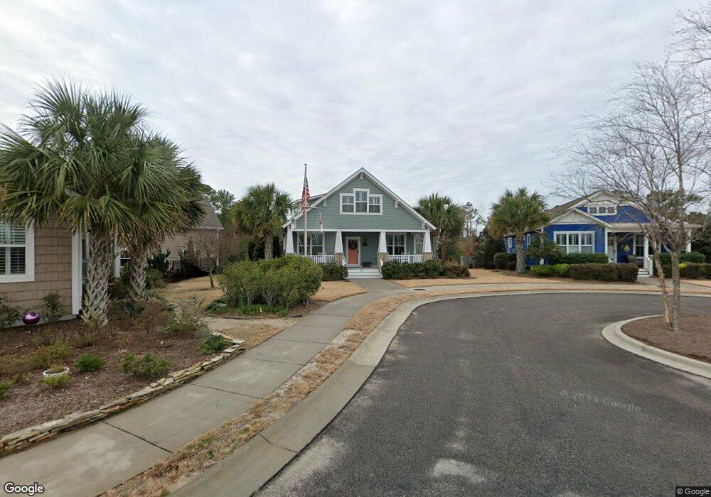
426 Lord Charles Dr Southport, NC 28461
Estimated Value: $725,706 - $881,000
4
Beds
3
Baths
2,760
Sq Ft
$284/Sq Ft
Est. Value
About This Home
This home is located at 426 Lord Charles Dr, Southport, NC 28461 and is currently estimated at $783,677, approximately $283 per square foot. 426 Lord Charles Dr is a home with nearby schools including Southport Elementary School, South Brunswick Middle School, and South Brunswick High School.
Ownership History
Date
Name
Owned For
Owner Type
Purchase Details
Closed on
Apr 14, 2014
Sold by
Cardinal Builders Co
Bought by
Hale Thomas R and Hale Mary E
Current Estimated Value
Home Financials for this Owner
Home Financials are based on the most recent Mortgage that was taken out on this home.
Original Mortgage
$324,000
Outstanding Balance
$246,856
Interest Rate
4.4%
Mortgage Type
New Conventional
Estimated Equity
$536,821
Create a Home Valuation Report for This Property
The Home Valuation Report is an in-depth analysis detailing your home's value as well as a comparison with similar homes in the area
Home Values in the Area
Average Home Value in this Area
Purchase History
| Date | Buyer | Sale Price | Title Company |
|---|---|---|---|
| Hale Thomas R | $381,000 | None Available |
Source: Public Records
Mortgage History
| Date | Status | Borrower | Loan Amount |
|---|---|---|---|
| Open | Hale Thomas R | $324,000 |
Source: Public Records
Tax History Compared to Growth
Tax History
| Year | Tax Paid | Tax Assessment Tax Assessment Total Assessment is a certain percentage of the fair market value that is determined by local assessors to be the total taxable value of land and additions on the property. | Land | Improvement |
|---|---|---|---|---|
| 2025 | $4,679 | $618,280 | $80,000 | $538,280 |
| 2024 | $4,679 | $618,280 | $80,000 | $538,280 |
| 2023 | $4,714 | $618,280 | $80,000 | $538,280 |
| 2022 | $4,714 | $468,600 | $65,000 | $403,600 |
| 2021 | $4,120 | $468,600 | $65,000 | $403,600 |
| 2020 | $4,120 | $468,600 | $65,000 | $403,600 |
| 2019 | $4,120 | $66,550 | $65,000 | $1,550 |
| 2018 | $3,311 | $61,770 | $60,000 | $1,770 |
| 2017 | $3,286 | $61,770 | $60,000 | $1,770 |
| 2016 | $3,051 | $61,770 | $60,000 | $1,770 |
| 2015 | $3,051 | $369,960 | $60,000 | $309,960 |
| 2014 | $1,185 | $135,710 | $30,000 | $105,710 |
Source: Public Records
Map
Nearby Homes
- 813 Cades Trail
- 818 Cades Trail
- 420 Cades Trail
- 1100 Spincast Rd
- 1028 Downrigger Trail
- 2008 Robert Ruark Dr SE
- 304 W 11th St
- 1200 N Caswell Ave
- 1214 N Caswell Ave
- 2451 Lake Ridge Dr
- 1218 N Caswell Ave
- Ellsworth Plan at Osprey Landing - Signature
- Marshall Plan at Osprey Landing - Signature
- Hadley Plan at Osprey Landing - Village
- Ashton Plan at Osprey Landing - Signature
- Ansley Plan at Osprey Landing - Signature
- Finley Plan at Osprey Landing - Signature
- Lanai Plan at Osprey Landing - Signature
- Scout Plan at Osprey Landing - Signature
- Hanover Plan at Osprey Landing - Village
- 418 Lord Charles Dr
- 430 Lord Charles Dr
- 414 Lord Charles Dr
- 414 Lord Charles Dr
- 410 Lord Charles Dr
- 406 Lord Charles Dr
- 440 Lord Charles Dr
- 501 Lord Thomas Ave
- 503 Lord Thomas Ave
- 444 Lord Charles Dr
- 448 Lord Charles Dr
- 403 Lord Thomas Ave
- 452 Lord Charles Dr
- 801 Cades Trail
- 406 Lord Thomas Ave
- 500 Lord Thomas Ave
- 404 Lord Thomas Ave
- 502 Lord Thomas Ave
- 401 Lord Thomas Ave
- 803 Cades Trail