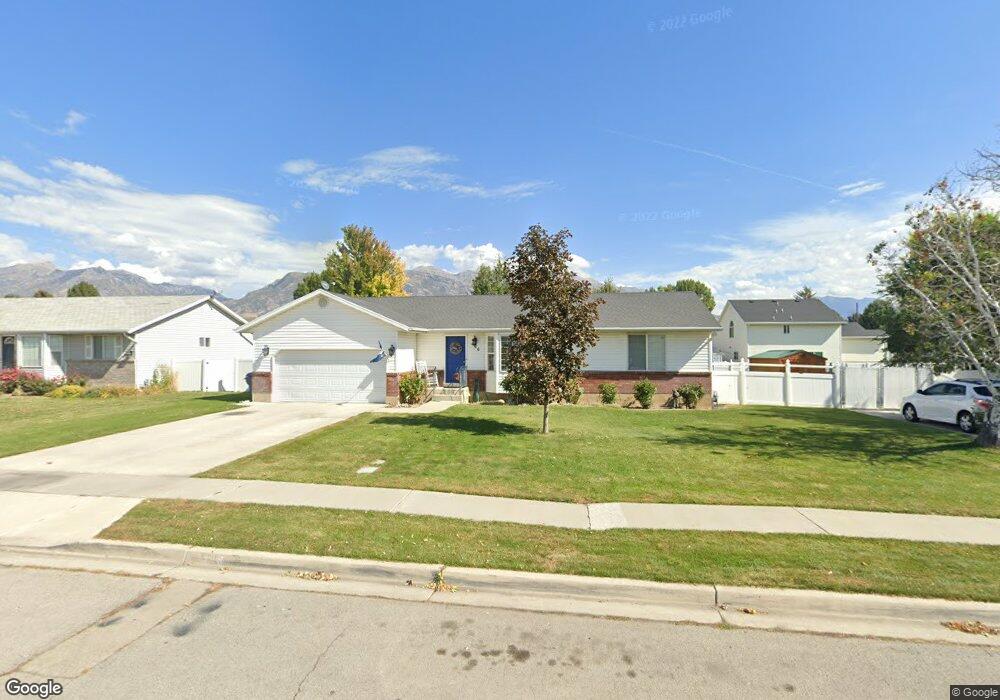
426 N 450 W American Fork, UT 84003
Estimated Value: $531,000 - $568,534
3
Beds
2
Baths
2,234
Sq Ft
$242/Sq Ft
Est. Value
About This Home
This home is located at 426 N 450 W, American Fork, UT 84003 and is currently estimated at $541,634, approximately $242 per square foot. 426 N 450 W is a home located in Utah County with nearby schools including Shelley Elementary School, American Fork Junior High School, and American Fork High School.
Ownership History
Date
Name
Owned For
Owner Type
Purchase Details
Closed on
Mar 10, 2021
Sold by
Parker Brian G and Parker Karen
Bought by
Parker Brian G and Parker Karen
Current Estimated Value
Home Financials for this Owner
Home Financials are based on the most recent Mortgage that was taken out on this home.
Original Mortgage
$327,000
Outstanding Balance
$242,377
Interest Rate
2.7%
Mortgage Type
New Conventional
Estimated Equity
$299,257
Purchase Details
Closed on
Feb 26, 2020
Sold by
Parker Brian G and Parker Karen
Bought by
Parker Brian G and Parker Karen
Home Financials for this Owner
Home Financials are based on the most recent Mortgage that was taken out on this home.
Original Mortgage
$25,000
Interest Rate
3.6%
Mortgage Type
Credit Line Revolving
Purchase Details
Closed on
Mar 23, 2018
Sold by
Parker Brian and Parker Grant
Bought by
Parker Brian G and Parker Karen
Home Financials for this Owner
Home Financials are based on the most recent Mortgage that was taken out on this home.
Original Mortgage
$235,000
Interest Rate
4.38%
Mortgage Type
New Conventional
Purchase Details
Closed on
Jul 23, 2014
Sold by
Osmun John Timothy
Bought by
Parker Brian and Parker Grant
Home Financials for this Owner
Home Financials are based on the most recent Mortgage that was taken out on this home.
Original Mortgage
$218,371
Interest Rate
4.4%
Mortgage Type
FHA
Purchase Details
Closed on
Apr 20, 2000
Sold by
Marvin N & Dorothy Osmun Family Trust and Osmun Marvin N
Bought by
Osmun Marvin N and Osmun Dorothy
Home Financials for this Owner
Home Financials are based on the most recent Mortgage that was taken out on this home.
Original Mortgage
$50,000
Interest Rate
8.24%
Mortgage Type
Credit Line Revolving
Purchase Details
Closed on
Sep 14, 1999
Sold by
Braithwaite Scott L and Braithwaite Melayne M
Bought by
Osmun Marvin N and Osmun Dorothy
Home Financials for this Owner
Home Financials are based on the most recent Mortgage that was taken out on this home.
Original Mortgage
$110,500
Interest Rate
7.89%
Create a Home Valuation Report for This Property
The Home Valuation Report is an in-depth analysis detailing your home's value as well as a comparison with similar homes in the area
Home Values in the Area
Average Home Value in this Area
Purchase History
| Date | Buyer | Sale Price | Title Company |
|---|---|---|---|
| Parker Brian G | -- | Vanguard Title Ins Agcy Llc | |
| Parker Brian G | -- | Vanguard Title Ins Agcy Llc | |
| Parker Brian G | -- | Vanguard Title Ins Agcy Llc | |
| Parker Brian G | -- | Vanguard Title Ins Agency | |
| Parker Brian | -- | Cottonwood Title Ins Ag | |
| Osmun Marvin N | -- | Backman Stewart Title | |
| Osmun Marvin N | -- | Equity Title Agency Inc |
Source: Public Records
Mortgage History
| Date | Status | Borrower | Loan Amount |
|---|---|---|---|
| Open | Parker Brian G | $327,000 | |
| Closed | Parker Brian G | $25,000 | |
| Closed | Parker Brian G | $165,000 | |
| Closed | Parker Brian G | $235,000 | |
| Closed | Parker Brian | $218,371 | |
| Previous Owner | Osmun Marvin N | $50,000 | |
| Previous Owner | Osmun Marvin N | $110,500 |
Source: Public Records
Tax History Compared to Growth
Tax History
| Year | Tax Paid | Tax Assessment Tax Assessment Total Assessment is a certain percentage of the fair market value that is determined by local assessors to be the total taxable value of land and additions on the property. | Land | Improvement |
|---|---|---|---|---|
| 2025 | $2,346 | $282,645 | $235,200 | $278,700 |
| 2024 | $2,346 | $260,645 | $0 | $0 |
| 2023 | $2,203 | $259,490 | $0 | $0 |
| 2022 | $2,445 | $284,185 | $0 | $0 |
| 2021 | $2,091 | $379,600 | $168,800 | $210,800 |
| 2020 | $1,954 | $344,100 | $150,700 | $193,400 |
| 2019 | $1,793 | $326,500 | $139,400 | $187,100 |
| 2018 | $1,691 | $294,500 | $131,800 | $162,700 |
| 2017 | $1,613 | $151,635 | $0 | $0 |
| 2016 | $1,534 | $133,980 | $0 | $0 |
| 2015 | $1,575 | $130,515 | $0 | $0 |
| 2014 | $1,141 | $118,085 | $0 | $0 |
Source: Public Records
Map
Nearby Homes
- 356 N 480 W
- 540 N 300 W
- 641 N 420 W
- 370 W Pacific Dr Unit 1
- 399 W Pacific Dr
- 365 N 100 W
- 120 N 350 W Unit 127
- 120 N 350 W Unit 133
- 120 N 350 W Unit 130
- 621 N 100 W
- 777 W State Rd
- 782 N 200 W
- 796 N 200 W
- 962 N 780 St W Unit 508
- 974 N 780 St W Unit 509
- 916 N 780 St W Unit 501
- 129 W Pacific Dr
- 105 N 100 W
- 374 N Center St
- 914 N 400 W Unit A