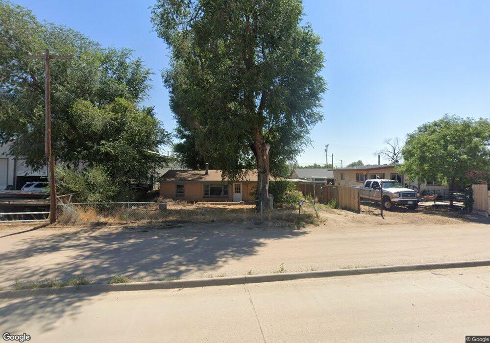
426 S 2nd St La Salle, CO 80645
LaSalle NeighborhoodEstimated Value: $215,245 - $376,000
3
Beds
1
Bath
1,221
Sq Ft
$267/Sq Ft
Est. Value
About This Home
This home is located at 426 S 2nd St, La Salle, CO 80645 and is currently estimated at $326,061, approximately $267 per square foot. 426 S 2nd St is a home located in Weld County with nearby schools including Valley High School, Union Colony Elementary School, and Salida Del Sol Academy.
Ownership History
Date
Name
Owned For
Owner Type
Purchase Details
Closed on
Mar 31, 2000
Sold by
United Companies Lending Corp
Bought by
Brown Richelle Renae
Current Estimated Value
Home Financials for this Owner
Home Financials are based on the most recent Mortgage that was taken out on this home.
Original Mortgage
$64,048
Interest Rate
8.19%
Mortgage Type
Unknown
Purchase Details
Closed on
Dec 6, 1999
Sold by
Anthony Hernandez David and Anthony Sylvia
Bought by
United Companies Lending Corp
Purchase Details
Closed on
Dec 18, 1987
Sold by
Dunker Robert L and Dunker Tammy M
Bought by
Hernandez David Anthony and Hernandez Sylv
Purchase Details
Closed on
Mar 27, 1987
Purchase Details
Closed on
Jun 5, 1985
Create a Home Valuation Report for This Property
The Home Valuation Report is an in-depth analysis detailing your home's value as well as a comparison with similar homes in the area
Home Values in the Area
Average Home Value in this Area
Purchase History
| Date | Buyer | Sale Price | Title Company |
|---|---|---|---|
| Brown Richelle Renae | $60,000 | -- | |
| United Companies Lending Corp | $94,021 | -- | |
| Hernandez David Anthony | $30,000 | -- | |
| -- | -- | -- | |
| -- | -- | -- |
Source: Public Records
Mortgage History
| Date | Status | Borrower | Loan Amount |
|---|---|---|---|
| Open | Brown Richelle Renae | $87,900 | |
| Closed | Brown Richelle Renae | $64,048 | |
| Previous Owner | Hernandez David Anthony | $83,200 | |
| Previous Owner | Hernandez David | $62,000 |
Source: Public Records
Tax History Compared to Growth
Tax History
| Year | Tax Paid | Tax Assessment Tax Assessment Total Assessment is a certain percentage of the fair market value that is determined by local assessors to be the total taxable value of land and additions on the property. | Land | Improvement |
|---|---|---|---|---|
| 2025 | $290 | $9,270 | $3,960 | $5,310 |
| 2024 | $290 | $9,270 | $3,960 | $5,310 |
| 2023 | $250 | $9,520 | $3,870 | $5,650 |
| 2022 | $365 | $7,240 | $3,070 | $4,170 |
| 2021 | $387 | $7,450 | $3,160 | $4,290 |
| 2020 | $434 | $8,850 | $2,800 | $6,050 |
| 2019 | $459 | $8,850 | $2,800 | $6,050 |
| 2018 | $340 | $6,200 | $1,250 | $4,950 |
| 2017 | $337 | $6,200 | $1,250 | $4,950 |
| 2016 | $313 | $5,970 | $1,090 | $4,880 |
| 2015 | $263 | $5,970 | $1,090 | $4,880 |
| 2014 | $201 | $4,570 | $1,160 | $3,410 |
Source: Public Records
Map
Nearby Homes
- 236 W Taylor Ave
- 272 Ley Dr
- 213 S 4th St
- 115 Main St
- 346 Sunset Dr
- 229 E Union Ave
- 933 W Independent Ave
- 932 Dove Hill Rd
- 242 Todd Ave
- 323 1/2 2nd Ave
- 326 3rd Ave
- 325 N 4th St
- 19089 County Road 50
- 23003 County Road 39
- 22563 County Road 39
- 22419 County Road 39
- 23730 County Road 41
- 4319 Mariposa Ln
- 1600 42nd St Unit 12
- 1600 42nd St Unit 11
- 428 S 2nd St
- 430 S 2nd St
- 432 S 2nd St
- 420 S 2nd St
- 436 S 2nd St
- 440 S 2nd St
- 400 S 2nd St
- 400 2 St
- 500 Rail Road Dr
- 402 Rail Road Dr
- 300 W Union Ave
- 306 W Union Ave
- 312 W Union Ave
- 318 W Union Ave
- 324 W Union Ave
- 330 W Union Ave
- 0 Highway 85 Unit 360716
- 0 Highway 85 Unit 803376
- 336 W Union Ave
- 256 Ley Dr