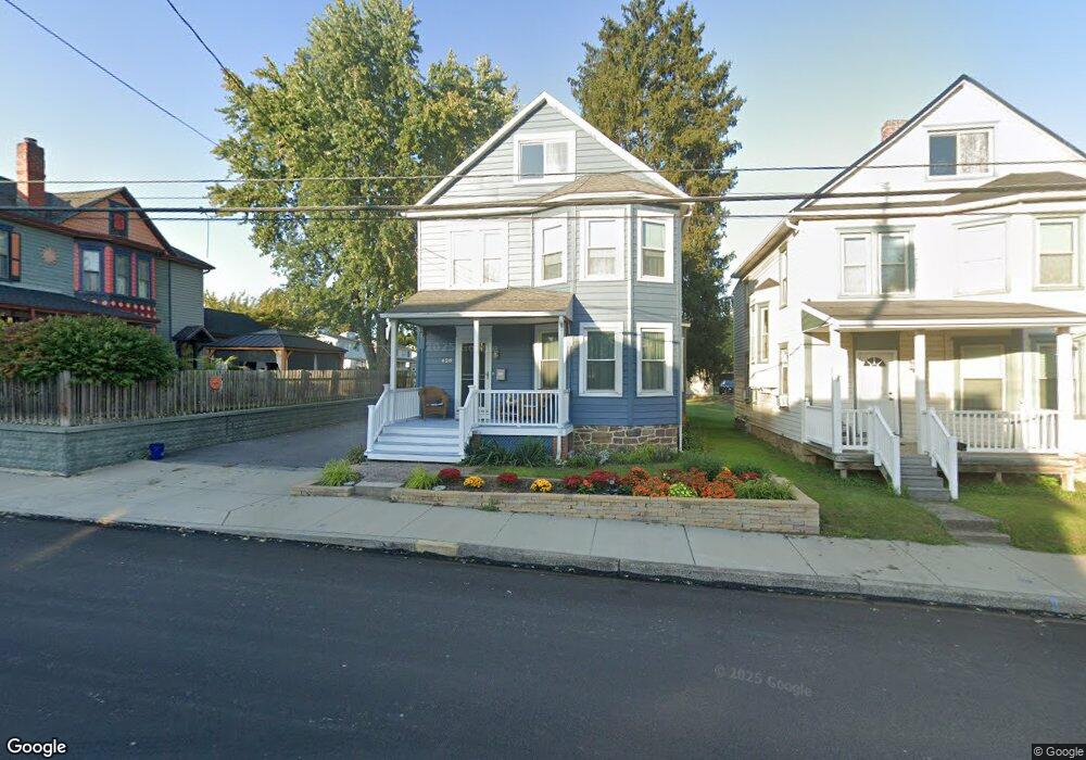
426 S Queen St Littlestown, PA 17340
Estimated Value: $211,000 - $254,000
3
Beds
1
Bath
1,390
Sq Ft
$167/Sq Ft
Est. Value
About This Home
This home is located at 426 S Queen St, Littlestown, PA 17340 and is currently estimated at $231,962, approximately $166 per square foot. 426 S Queen St is a home located in Adams County with nearby schools including Rolling Acres El School, Maple Avenue Middle School, and Littlestown Senior High School.
Ownership History
Date
Name
Owned For
Owner Type
Purchase Details
Closed on
Feb 20, 1990
Bought by
North Jeffrey R and North Barbara H
Current Estimated Value
Create a Home Valuation Report for This Property
The Home Valuation Report is an in-depth analysis detailing your home's value as well as a comparison with similar homes in the area
Home Values in the Area
Average Home Value in this Area
Purchase History
| Date | Buyer | Sale Price | Title Company |
|---|---|---|---|
| North Jeffrey R | $59,900 | -- |
Source: Public Records
Tax History Compared to Growth
Tax History
| Year | Tax Paid | Tax Assessment Tax Assessment Total Assessment is a certain percentage of the fair market value that is determined by local assessors to be the total taxable value of land and additions on the property. | Land | Improvement |
|---|---|---|---|---|
| 2025 | $3,542 | $154,100 | $40,500 | $113,600 |
| 2024 | $3,414 | $154,100 | $40,500 | $113,600 |
| 2023 | $3,281 | $154,100 | $40,500 | $113,600 |
| 2022 | $3,262 | $154,100 | $40,500 | $113,600 |
| 2021 | $3,165 | $154,100 | $40,500 | $113,600 |
| 2020 | $3,127 | $154,100 | $40,500 | $113,600 |
| 2019 | $3,033 | $154,100 | $40,500 | $113,600 |
| 2018 | $2,978 | $154,100 | $40,500 | $113,600 |
| 2017 | $2,902 | $154,100 | $40,500 | $113,600 |
| 2016 | -- | $154,100 | $40,500 | $113,600 |
| 2015 | -- | $154,100 | $40,500 | $113,600 |
| 2014 | -- | $154,100 | $40,500 | $113,600 |
Source: Public Records
Map
Nearby Homes
- 28 Gettysburg Ct Unit 60
- 118 Mount Carmel Dr Unit 192
- 117 Charles St
- 115 Charles St
- 74 W King St
- 211 E King St
- 129 W King St
- 22 Rita Marie Ave
- 15 Yorktowne Ct Unit 97
- 235 W Myrtle St
- 15 Brandywine Ct Unit 34
- 449 Glenwyn Dr
- 567 Lumber St
- 52 Stayman Way Unit 81
- 135 Apple Grove Ln Unit 438
- 41 Smith Cir
- 440 N Queen St
- 58 N Gala Unit 397
- 162 Newark St
- 5 Manor Cir Unit 103
- 432 S Queen St
- 432 S Queen St Unit 2
- 420 S Queen St
- 431 S Queen St
- 439 S Queen St Unit 6
- 413 S Queen St
- 408 S Queen St
- 409 S Queen St
- 435 S Queen St
- 32 Starlite Dr Unit 16
- 417 S Queen St
- 10 E Lakeview Dr Unit 15
- 402 S Queen St
- 30 Starlite Dr Unit 17
- 423 S Queen St
- 12 E Lakeview Dr Unit 14
- 503 S Queen St
- 28 Starlite Dr Unit 18
- 33 Starlite Dr Unit 50
- 14 E Lakeview Dr Unit 13