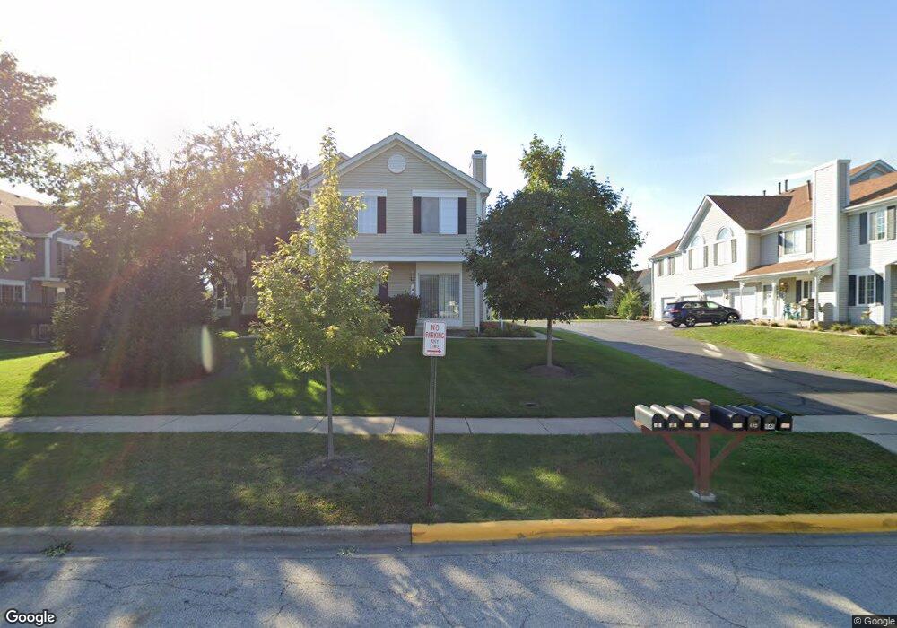
426 Sandhurst Ln Unit 4 South Elgin, IL 60177
Estimated Value: $206,000 - $232,000
2
Beds
1
Bath
1,059
Sq Ft
$208/Sq Ft
Est. Value
About This Home
This home is located at 426 Sandhurst Ln Unit 4, South Elgin, IL 60177 and is currently estimated at $220,291, approximately $208 per square foot. 426 Sandhurst Ln Unit 4 is a home located in Kane County with nearby schools including Fox Meadow Elementary School, Kenyon Woods Middle School, and South Elgin High School.
Ownership History
Date
Name
Owned For
Owner Type
Purchase Details
Closed on
Apr 5, 2024
Sold by
Patsy J Dotson Revocable Trust and Krabbe Kim
Bought by
Ahmed Rashid
Current Estimated Value
Purchase Details
Closed on
Feb 13, 2023
Sold by
Dotson Patsy J
Bought by
Patsy J Dotson Revocable Trust
Purchase Details
Closed on
Aug 3, 1998
Sold by
Judd Donna and Will Of Irene E Pelletier
Bought by
Dotson Patsy J
Home Financials for this Owner
Home Financials are based on the most recent Mortgage that was taken out on this home.
Original Mortgage
$25,000
Interest Rate
7.05%
Create a Home Valuation Report for This Property
The Home Valuation Report is an in-depth analysis detailing your home's value as well as a comparison with similar homes in the area
Home Values in the Area
Average Home Value in this Area
Purchase History
| Date | Buyer | Sale Price | Title Company |
|---|---|---|---|
| Ahmed Rashid | $170,000 | None Listed On Document | |
| Patsy J Dotson Revocable Trust | -- | -- | |
| Dotson Patsy J | $89,100 | -- |
Source: Public Records
Mortgage History
| Date | Status | Borrower | Loan Amount |
|---|---|---|---|
| Previous Owner | Dotson Patsy J | $25,000 |
Source: Public Records
Tax History Compared to Growth
Tax History
| Year | Tax Paid | Tax Assessment Tax Assessment Total Assessment is a certain percentage of the fair market value that is determined by local assessors to be the total taxable value of land and additions on the property. | Land | Improvement |
|---|---|---|---|---|
| 2024 | $2,907 | $52,841 | $15,921 | $36,920 |
| 2023 | $775 | $47,737 | $14,383 | $33,354 |
| 2022 | $1,225 | $43,528 | $13,115 | $30,413 |
| 2021 | $1,240 | $40,696 | $12,262 | $28,434 |
| 2020 | $1,264 | $37,558 | $11,706 | $25,852 |
| 2019 | $2,233 | $35,777 | $11,151 | $24,626 |
| 2018 | $2,140 | $33,704 | $10,505 | $23,199 |
| 2017 | $1,986 | $31,862 | $9,931 | $21,931 |
| 2016 | $1,402 | $29,559 | $9,213 | $20,346 |
| 2015 | -- | $27,094 | $8,445 | $18,649 |
| 2014 | -- | $25,239 | $8,341 | $16,898 |
| 2013 | -- | $25,905 | $8,561 | $17,344 |
Source: Public Records
Map
Nearby Homes
- 435 Sandhurst Ln Unit 3
- 1458 Woodland Dr
- 8N594 S Mclean Blvd
- 1370 Marleigh Ln
- 1419 S Pembroke Dr
- 1063 Manchester Ct Unit 1
- 590 Fenwick Ln
- 126 Kingsport Dr
- 387 S Pointe Ave
- 671 Fieldcrest Dr
- 281 Kingsport Dr
- 285 Kingsport Dr
- 283 Kingsport Dr
- 289 Kingsport Dr
- 291 Kingsport Dr
- 287 Kingsport Dr
- 280 Kingsport Dr
- 282 Kingsport Dr
- 286 Kingsport Dr
- 301 Kingsport Dr
- 424 Sandhurst Ln Unit 3
- 422 Sandhurst Ln Unit 2
- 420 Sandhurst Ln
- 446 Sandhurst Ln Unit 4
- 444 Sandhurst Ln Unit 3
- 404 Sandhurst Ln Unit 3
- 402 Sandhurst Ln Unit 2
- 406 Sandhurst Ln Unit 4
- 440 Sandhurst Ln Unit 1
- 400 Sandhurst Ln Unit 1
- 442 Sandhurst Ln Unit 2
- 425 Hobart Dr
- 433 Hobart Dr
- 411 Hobart Dr
- 441 Hobart Dr
- 411 Sandhurst Ln Unit 1
- 431 Sandhurst Ln Unit 1
- 391 Hobart Dr
- 484 Sandhurst Ln Unit C
- 480 Sandhurst Ln Unit 1