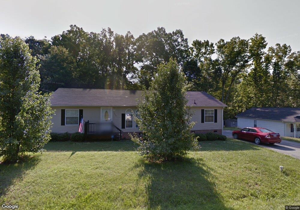
426 Tate Ave Mebane, NC 27302
Estimated Value: $239,000 - $318,000
3
Beds
2
Baths
1,650
Sq Ft
$166/Sq Ft
Est. Value
About This Home
This home is located at 426 Tate Ave, Mebane, NC 27302 and is currently estimated at $273,333, approximately $165 per square foot. 426 Tate Ave is a home located in Alamance County with nearby schools including South Mebane Elementary School, Woodlawn Middle School, and Eastern Alamance High School.
Ownership History
Date
Name
Owned For
Owner Type
Purchase Details
Closed on
Jun 19, 2012
Sold by
Deutsche Bank Natioanl Tr Co
Bought by
Terrell Marilyn
Current Estimated Value
Home Financials for this Owner
Home Financials are based on the most recent Mortgage that was taken out on this home.
Original Mortgage
$42,400
Outstanding Balance
$29,205
Interest Rate
3.7%
Mortgage Type
New Conventional
Estimated Equity
$244,128
Create a Home Valuation Report for This Property
The Home Valuation Report is an in-depth analysis detailing your home's value as well as a comparison with similar homes in the area
Home Values in the Area
Average Home Value in this Area
Purchase History
| Date | Buyer | Sale Price | Title Company |
|---|---|---|---|
| Terrell Marilyn | $53,000 | -- |
Source: Public Records
Mortgage History
| Date | Status | Borrower | Loan Amount |
|---|---|---|---|
| Open | Terrell Marilyn | $42,400 |
Source: Public Records
Tax History Compared to Growth
Tax History
| Year | Tax Paid | Tax Assessment Tax Assessment Total Assessment is a certain percentage of the fair market value that is determined by local assessors to be the total taxable value of land and additions on the property. | Land | Improvement |
|---|---|---|---|---|
| 2025 | $1,482 | $262,767 | $27,630 | $235,137 |
| 2024 | $1,416 | $262,767 | $27,630 | $235,137 |
| 2023 | $1,312 | $262,767 | $27,630 | $235,137 |
| 2022 | $946 | $125,971 | $14,250 | $111,721 |
| 2021 | $959 | $125,971 | $14,250 | $111,721 |
| 2020 | $971 | $125,971 | $14,250 | $111,721 |
| 2019 | $976 | $125,971 | $14,250 | $111,721 |
| 2018 | $0 | $125,971 | $14,250 | $111,721 |
| 2017 | $859 | $125,971 | $14,250 | $111,721 |
| 2016 | $924 | $134,955 | $22,125 | $112,830 |
| 2015 | $940 | $137,973 | $22,125 | $115,848 |
| 2014 | -- | $137,973 | $22,125 | $115,848 |
Source: Public Records
Map
Nearby Homes
- 714 W Mckinley St
- 0 Roosevelt St
- 0 Smith Dr
- 426 Fitch Dr
- 605 Roosevelt St
- 456 Stonewall Dr
- 413 Mckinley Place
- 421 W Holt St
- 307 W Austin St
- 1005 Stuart Dr
- 213 Beauregard Ln
- 308 W Jackson St
- 109 Briarwood Dr
- 0 Dyson Dr Unit TBD Dyson 2519207
- 415 S Third St
- 402 W Clay St
- 1107 Briarwood Dr
- 0 W Lake Trail Unit 10126145
- 0 W Lake Trail Unit 10127843
- Lot# 2 Highway 70 E
- 530 Tate Ave
- 0 Tate Ave Unit G329127
- 0 Tate Ave Unit 1118051
- 0 Tate Ave Unit 128451
- 0 Tate Ave Unit 2530986
- 0 Tate Ave Unit 38442
- 0 Tate Ave Unit 40280
- 0 Tate Ave Unit TR745118
- 0 Tate Ave Unit 43692
- 0 Tate Ave Unit CD TR1960329
- 0 Tate Ave Unit AB TR1960334
- 0 Tate Ave Unit TR1960323
- 0 Tate Ave Unit 100924
- 0 Tate Ave Unit 1600731
- 0 Tate Ave Unit 1875678
- 0 Tate Ave Unit AB
- 0 Tate Ave
- 416 Tate Ave
- 415 Tate Ave
- 507 Tate Ave