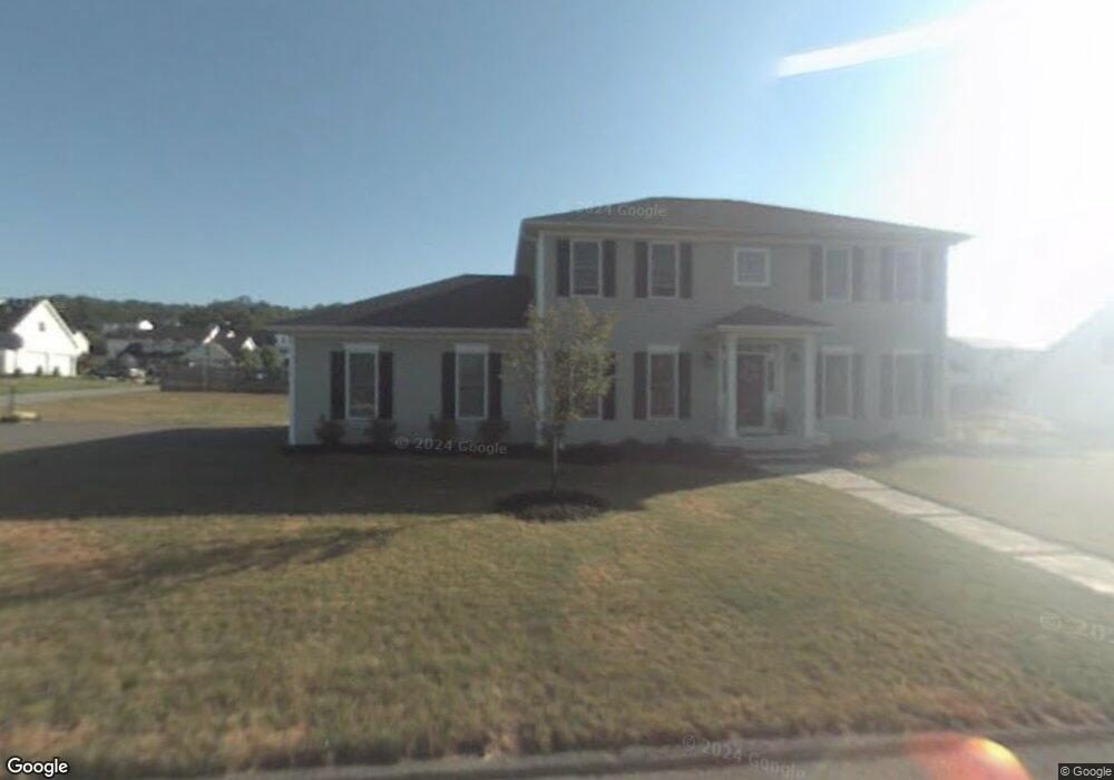
426 W Church St Archbald, PA 18403
Estimated Value: $437,000 - $606,248
--
Bed
--
Bath
--
Sq Ft
0.31
Acres
About This Home
This home is located at 426 W Church St, Archbald, PA 18403 and is currently estimated at $506,812. 426 W Church St is a home located in Lackawanna County with nearby schools including Valley View Intermediate School, Valley View Middle School, and Valley View High School.
Ownership History
Date
Name
Owned For
Owner Type
Purchase Details
Closed on
Sep 26, 2014
Sold by
Thomson Edwin and Thomson Linda
Bought by
Musial Robert P and Musial Alicia
Current Estimated Value
Home Financials for this Owner
Home Financials are based on the most recent Mortgage that was taken out on this home.
Original Mortgage
$251,200
Outstanding Balance
$192,652
Interest Rate
4.11%
Mortgage Type
New Conventional
Estimated Equity
$314,160
Create a Home Valuation Report for This Property
The Home Valuation Report is an in-depth analysis detailing your home's value as well as a comparison with similar homes in the area
Home Values in the Area
Average Home Value in this Area
Purchase History
| Date | Buyer | Sale Price | Title Company |
|---|---|---|---|
| Musial Robert P | $314,000 | None Available |
Source: Public Records
Mortgage History
| Date | Status | Borrower | Loan Amount |
|---|---|---|---|
| Open | Musial Robert P | $251,200 |
Source: Public Records
Tax History Compared to Growth
Tax History
| Year | Tax Paid | Tax Assessment Tax Assessment Total Assessment is a certain percentage of the fair market value that is determined by local assessors to be the total taxable value of land and additions on the property. | Land | Improvement |
|---|---|---|---|---|
| 2025 | $6,573 | $25,550 | $9,550 | $16,000 |
| 2024 | $5,639 | $25,550 | $9,550 | $16,000 |
| 2023 | $5,639 | $25,550 | $9,550 | $16,000 |
| 2022 | $5,463 | $25,550 | $9,550 | $16,000 |
| 2021 | $5,450 | $25,550 | $9,550 | $16,000 |
| 2020 | $5,348 | $25,550 | $9,550 | $16,000 |
| 2019 | $4,960 | $25,550 | $9,550 | $16,000 |
| 2018 | $4,871 | $25,550 | $9,550 | $16,000 |
| 2017 | $4,845 | $25,550 | $9,550 | $16,000 |
| 2016 | $2,842 | $25,550 | $9,550 | $16,000 |
| 2015 | -- | $25,550 | $9,550 | $16,000 |
| 2014 | -- | $25,550 | $9,550 | $16,000 |
Source: Public Records
Map
Nearby Homes
- 0 Lower Celli Dr (Lot 41)
- 0 Tenley Ln
- 0 Julian Ln
- 125 Hyland Hill Dr
- 0 Celli Dr
- 446 Kennedy Dr
- 0 Joel (Lot 49) Dr Unit GSBSC3076
- 0 Lower Celli Dr (Lot 48)
- 0 Dr Unit GSBSC3064
- 0 Jamie (Lot 14) Dr Unit GSBSC3058
- 0 Jamie (Lot 21) Dr Unit GSBSC3063
- 0 Joel (Lot 8) Dr Unit GSBSC3082
- 0 Jamie (Lot 3) Dr
- 0 Jamie (Lot 12) Dr Unit GSBSC3056
- 0 Joel (Lot 7) Dr Unit GSBSC3081
- 0 Dr
- 0 Jamie (Lot 15) Dr Unit GSBSC3059
- 0 Dr Unit GSBSC3067
- 0 Jamie (Lot 17) Dr Unit GSBSC3061
- 0 Joel (Lot 35) Dr Unit GSBSC3074
- 428 W Church St
- 425 Deer Run Dr
- 427 Deer Run Dr
- 427 W Church St
- 429 W Church St
- 424 W Church St
- 96 White Birch Dr
- 108 White Birch Dr
- 423 Deer Run Dr
- 430 W Church St
- 430 W Church L 167 St
- 429 Deer Run Dr
- 428 Deer Run Dr
- 431 W Church St
- 430 Deer Run Dr Unit L107
- 422 W Church St
- 421 Deer Run Dr
- 436 W Church St Unit L170
- 432 W Church St
- 431 Deer Run Dr