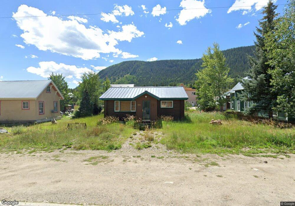
426 Whiterock Ave Crested Butte, CO 81224
Estimated Value: $972,575 - $1,262,000
1
Bed
1
Bath
560
Sq Ft
$2,001/Sq Ft
Est. Value
About This Home
This home is located at 426 Whiterock Ave, Crested Butte, CO 81224 and is currently estimated at $1,120,644, approximately $2,001 per square foot. 426 Whiterock Ave is a home located in Gunnison County with nearby schools including Gunnison Elementary School, Crested Butte Community School, and Gunnison Middle School.
Ownership History
Date
Name
Owned For
Owner Type
Purchase Details
Closed on
Nov 2, 2020
Sold by
White Rock Trust
Bought by
Mcclelland James David and Taylor Devin Franklin
Current Estimated Value
Home Financials for this Owner
Home Financials are based on the most recent Mortgage that was taken out on this home.
Original Mortgage
$510,400
Outstanding Balance
$454,183
Interest Rate
2.8%
Mortgage Type
New Conventional
Estimated Equity
$666,461
Purchase Details
Closed on
Sep 1, 1999
Sold by
Yaklich Fred J
Bought by
Yaklich Ferdinand J
Create a Home Valuation Report for This Property
The Home Valuation Report is an in-depth analysis detailing your home's value as well as a comparison with similar homes in the area
Home Values in the Area
Average Home Value in this Area
Purchase History
| Date | Buyer | Sale Price | Title Company |
|---|---|---|---|
| Mcclelland James David | $696,000 | Land Title Guarantee Co | |
| Yaklich Ferdinand J | -- | -- |
Source: Public Records
Mortgage History
| Date | Status | Borrower | Loan Amount |
|---|---|---|---|
| Open | Mcclelland James David | $510,400 |
Source: Public Records
Tax History Compared to Growth
Tax History
| Year | Tax Paid | Tax Assessment Tax Assessment Total Assessment is a certain percentage of the fair market value that is determined by local assessors to be the total taxable value of land and additions on the property. | Land | Improvement |
|---|---|---|---|---|
| 2024 | $4,066 | $61,370 | $23,590 | $37,780 |
| 2023 | $4,066 | $57,690 | $22,170 | $35,520 |
| 2022 | $3,671 | $46,840 | $17,270 | $29,570 |
| 2021 | $3,325 | $48,190 | $17,770 | $30,420 |
| 2020 | $2,465 | $36,070 | $18,880 | $17,190 |
| 2019 | $2,416 | $36,070 | $18,880 | $17,190 |
| 2018 | $1,842 | $26,570 | $14,410 | $12,160 |
| 2017 | $1,854 | $26,570 | $14,410 | $12,160 |
| 2016 | $1,665 | $25,090 | $14,340 | $10,750 |
| 2015 | -- | $25,090 | $14,340 | $10,750 |
| 2014 | -- | $27,840 | $16,250 | $11,590 |
Source: Public Records
Map
Nearby Homes
- 602 & 604 Fourth St
- 418 Elk Ave
- 309 Belleview #2-C Residential Unit 2-C
- 309 Belleview #2-B Residential Unit 2-B
- 309 Belleview #2-A Residential Unit 2-A
- 308 Whiterock Ave
- 513 Third St
- 414 Maroon Ave
- 422 Belleview Ave
- 315 Elk Ave
- 223 Sopris Ave
- 209 Whiterock Ave
- 721 Whiterock Ave
- 398 Journey's End Rd
- 609 2nd St
- 218 Maroon Ave Unit E
- 413 2nd St
- 310 2nd St
- 721 Maroon Ave
- 520 Teocalli Ave
- 430 Whiterock Ave
- 418 Whiterock Ave Unit Lots 8-10, Block 38
- 423 Belleview Ave Unit 1
- 423 Belleview Ave Unit 1
- 423 Belleview Ave Unit 2
- 502 Whiterock Ave
- 412 Whiterock Ave
- 425 Whiterock Ave
- 421 Whiterock Ave Unit 6, Bonnie Kate
- 421 Whiterock Ave Unit 2
- 421 Whiterock Ave Unit 5
- 421 Whiterock Ave Unit 4
- 429 Whiterock Ave
- 505 Whiterock Ave
- 417 and 41 Whiterock Ave
- 409 Whiterock Ave
- 408 Whiterock Ave
- 503 Belleview Unit 3
- 417 Whiterock Ave
- 406 Whiterock Ave