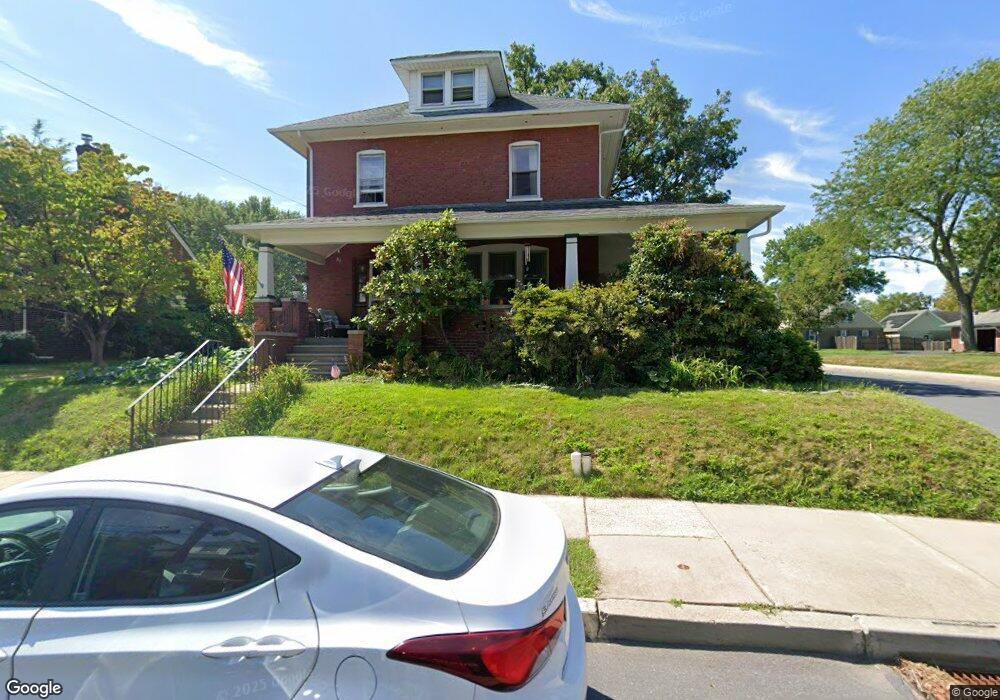
426 York Ave Lansdale, PA 19446
Estimated Value: $442,000 - $512,000
6
Beds
2
Baths
2,298
Sq Ft
$208/Sq Ft
Est. Value
About This Home
This home is located at 426 York Ave, Lansdale, PA 19446 and is currently estimated at $478,051, approximately $208 per square foot. 426 York Ave is a home located in Montgomery County with nearby schools including York Avenue Elementary School, Penndale Middle School, and North Penn Senior High School.
Ownership History
Date
Name
Owned For
Owner Type
Purchase Details
Closed on
Jan 13, 2012
Sold by
Jacques Chris and Doyle Linda M
Bought by
Ockershausen Laine Sean and Ockershausen Jennifer Christine
Current Estimated Value
Home Financials for this Owner
Home Financials are based on the most recent Mortgage that was taken out on this home.
Original Mortgage
$113,725
Outstanding Balance
$77,817
Interest Rate
3.94%
Estimated Equity
$400,234
Purchase Details
Closed on
Aug 31, 1995
Sold by
Doyle Linda M
Bought by
Doyle Linda M and Jacques Christopher
Create a Home Valuation Report for This Property
The Home Valuation Report is an in-depth analysis detailing your home's value as well as a comparison with similar homes in the area
Home Values in the Area
Average Home Value in this Area
Purchase History
| Date | Buyer | Sale Price | Title Company |
|---|---|---|---|
| Ockershausen Laine Sean | $183,500 | None Available | |
| Doyle Linda M | -- | -- |
Source: Public Records
Mortgage History
| Date | Status | Borrower | Loan Amount |
|---|---|---|---|
| Open | Ockershausen Laine Sean | $113,725 |
Source: Public Records
Tax History Compared to Growth
Tax History
| Year | Tax Paid | Tax Assessment Tax Assessment Total Assessment is a certain percentage of the fair market value that is determined by local assessors to be the total taxable value of land and additions on the property. | Land | Improvement |
|---|---|---|---|---|
| 2025 | $5,701 | $135,520 | $45,610 | $89,910 |
| 2024 | $5,701 | $135,520 | $45,610 | $89,910 |
| 2023 | $5,332 | $135,520 | $45,610 | $89,910 |
| 2022 | $5,163 | $135,520 | $45,610 | $89,910 |
| 2021 | $4,953 | $135,520 | $45,610 | $89,910 |
| 2020 | $4,803 | $135,520 | $45,610 | $89,910 |
| 2019 | $4,724 | $135,520 | $45,610 | $89,910 |
| 2018 | $1,267 | $135,520 | $45,610 | $89,910 |
| 2017 | $4,410 | $135,520 | $45,610 | $89,910 |
| 2016 | $4,357 | $135,520 | $45,610 | $89,910 |
| 2015 | $4,043 | $135,520 | $45,610 | $89,910 |
| 2014 | $4,043 | $135,520 | $45,610 | $89,910 |
Source: Public Records
Map
Nearby Homes
- 521 Columbia Ave
- 405 Derstine Ave
- 403 Derstine Ave
- 723 Columbia Ave
- 118 Green St
- 307 Perkiomen Ave
- 521 Green St
- 128 S Broad St
- 920 Columbia Ave
- 118 S Broad St
- 21 S Valley Forge Rd Unit 213
- 831 W Main St
- 545 Winding Rd
- 100 Penn St
- 742 S Towamencin Ave
- 833 W 4th St
- 750 Annes Ct
- 101 E Main St
- 503 Walnut St
- 1113 York Ave