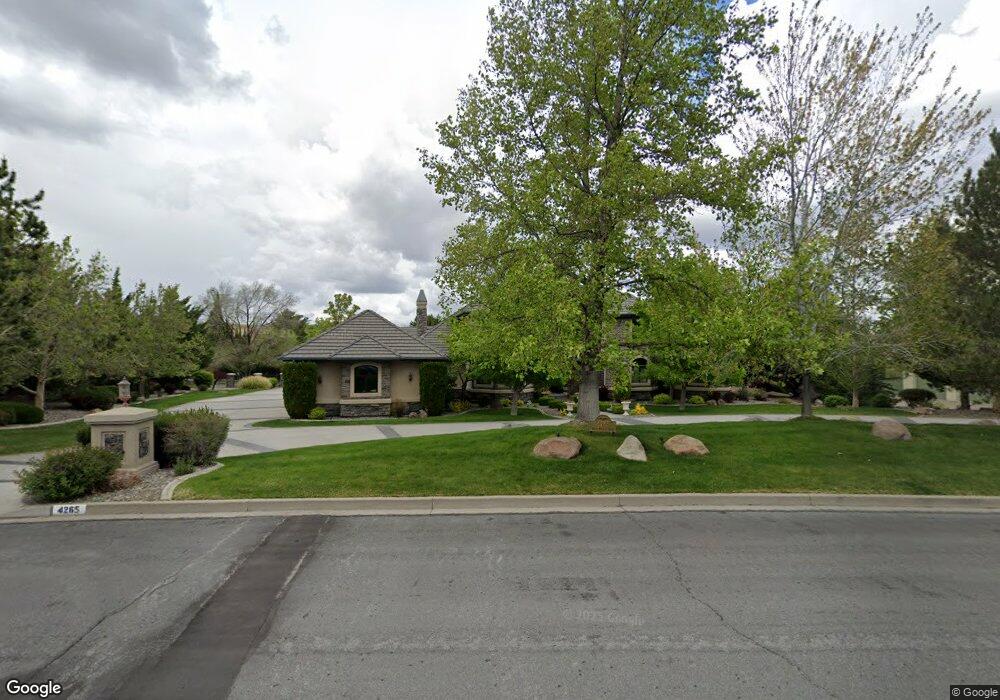
4265 Meadowgate Trail Reno, NV 89519
South Outer Reno NeighborhoodEstimated Value: $1,955,943 - $2,236,000
4
Beds
6
Baths
4,964
Sq Ft
$418/Sq Ft
Est. Value
About This Home
This home is located at 4265 Meadowgate Trail, Reno, NV 89519 and is currently estimated at $2,076,236, approximately $418 per square foot. 4265 Meadowgate Trail is a home located in Washoe County with nearby schools including Roy Gomm Elementary School, Darrell C Swope Middle School, and Reno High School.
Ownership History
Date
Name
Owned For
Owner Type
Purchase Details
Closed on
Sep 14, 2024
Sold by
Michael And Christine Ogara Family Trust and Ogara John Michael
Bought by
Michael And Christine Ogara Family Trust and Ogara
Current Estimated Value
Purchase Details
Closed on
May 18, 2012
Sold by
Ogara John M and Ogara Christine O
Bought by
Ogara Dds John Michael and Ogara Christine
Purchase Details
Closed on
Jul 17, 1997
Sold by
Hunter Creek Development Company
Bought by
Ogara John M and Ogara Christine
Create a Home Valuation Report for This Property
The Home Valuation Report is an in-depth analysis detailing your home's value as well as a comparison with similar homes in the area
Home Values in the Area
Average Home Value in this Area
Purchase History
| Date | Buyer | Sale Price | Title Company |
|---|---|---|---|
| Michael And Christine Ogara Family Trust | -- | None Listed On Document | |
| Ogara Dds John Michael | -- | None Available | |
| Ogara John M | $113,500 | First American Title Co |
Source: Public Records
Tax History
| Year | Tax Paid | Tax Assessment Tax Assessment Total Assessment is a certain percentage of the fair market value that is determined by local assessors to be the total taxable value of land and additions on the property. | Land | Improvement |
|---|---|---|---|---|
| 2026 | $11,190 | $484,905 | $144,375 | $340,530 |
| 2024 | $14,521 | $474,524 | $123,200 | $351,324 |
| 2023 | $14,095 | $448,824 | $115,500 | $333,324 |
| 2022 | $13,700 | $380,082 | $102,025 | $278,057 |
| 2021 | $13,290 | $363,883 | $86,625 | $277,258 |
| 2020 | $12,897 | $365,050 | $86,625 | $278,425 |
| 2019 | $12,526 | $350,225 | $77,000 | $273,225 |
| 2018 | $12,167 | $355,307 | $77,000 | $278,307 |
| 2017 | $11,816 | $354,590 | $77,000 | $277,590 |
| 2016 | $11,505 | $356,677 | $71,225 | $285,452 |
| 2015 | $2,906 | $333,446 | $43,159 | $290,287 |
| 2014 | $11,160 | $303,893 | $33,495 | $270,398 |
| 2013 | -- | $307,395 | $33,495 | $273,900 |
Source: Public Records
Map
Nearby Homes
- 7440 W 4th St Unit 7
- 7440 W 4th St Unit 73
- 7440 W 4th St Unit 45
- 7440 W 4th St Unit 46
- 0 Woodchuck Cir Unit 41-051-24
- 265 Anselmo Dr
- 4840 Keshmiri Place
- 4930 Woodchuck Cir Unit 4
- 4055 Plateau Rd
- 4890 Woodchuck Cir Unit 3
- 4260 Longknife Rd
- 4820 Woodchuck Cir Unit 2
- 4895 Woodchuck Cir Unit 16
- 4760 Woodchuck Cir Unit 1
- 4825 Woodchuck Cir Unit 17
- 5045 Hunters Peak Rd Unit 13
- 4387 Sharps Rd
- 4005 Nemaha Creek Ct
- 6850 Sharlands Ave Unit 2039
- 6850 Sharlands Ave Unit U2123
- 4255 Meadowgate Trail
- 6288 Canyon Dr
- 6272 Canyon Dr
- 6285 Canyon Dr
- 6224 Canyon Dr
- 6280 Canyon Dr
- 4285 Meadowgate Trail
- 5425 Canyon Dr
- 4270 Meadowgate Trail
- 4245 Meadowgate Trail
- 4260 Meadowgate Trail
- 5415 Canyon Dr
- 605 Canyon Cir
- 4280 Meadowgate Trail
- 5405 Canyon Dr
- 615 Canyon Cir
- 5300 Canyon Dr
- 630 Canyon Cir
- 4290 Meadowgate Trail
- 4305 Meadowgate Trail
Your Personal Tour Guide
Ask me questions while you tour the home.