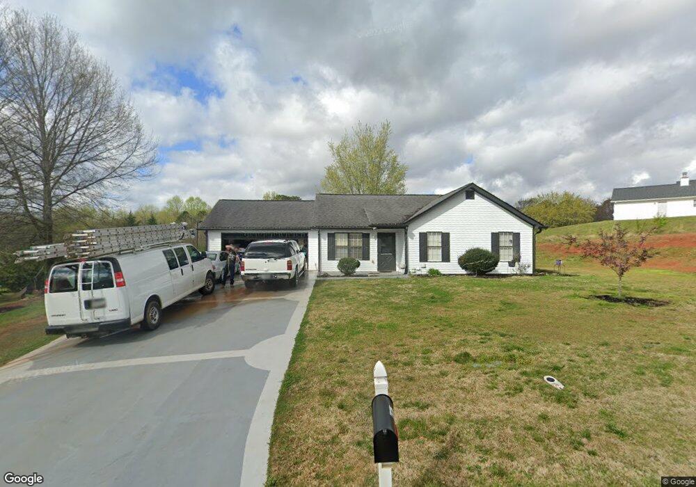
4266 Rolling Ridge Dr Unit 11 Gillsville, GA 30543
Southeast Gainesville NeighborhoodEstimated Value: $272,000 - $316,000
3
Beds
2
Baths
1,094
Sq Ft
$262/Sq Ft
Est. Value
About This Home
This home is located at 4266 Rolling Ridge Dr Unit 11, Gillsville, GA 30543 and is currently estimated at $286,534, approximately $261 per square foot. 4266 Rolling Ridge Dr Unit 11 is a home located in Hall County with nearby schools including Sugar Hill Elementary School, East Hall Middle School, and East Hall High School.
Ownership History
Date
Name
Owned For
Owner Type
Purchase Details
Closed on
Jan 19, 2001
Sold by
Silverwood Properties Inc
Bought by
Rodriguez Claudia
Current Estimated Value
Home Financials for this Owner
Home Financials are based on the most recent Mortgage that was taken out on this home.
Original Mortgage
$82,448
Outstanding Balance
$29,621
Interest Rate
7.53%
Mortgage Type
FHA
Estimated Equity
$256,913
Purchase Details
Closed on
Aug 23, 2000
Sold by
Curtin Starr Stephens Llc
Bought by
Silverwood Properties Inc
Create a Home Valuation Report for This Property
The Home Valuation Report is an in-depth analysis detailing your home's value as well as a comparison with similar homes in the area
Home Values in the Area
Average Home Value in this Area
Purchase History
| Date | Buyer | Sale Price | Title Company |
|---|---|---|---|
| Rodriguez Claudia | $83,100 | -- | |
| Silverwood Properties Inc | $283,200 | -- |
Source: Public Records
Mortgage History
| Date | Status | Borrower | Loan Amount |
|---|---|---|---|
| Open | Rodriguez Claudia | $82,448 |
Source: Public Records
Tax History Compared to Growth
Tax History
| Year | Tax Paid | Tax Assessment Tax Assessment Total Assessment is a certain percentage of the fair market value that is determined by local assessors to be the total taxable value of land and additions on the property. | Land | Improvement |
|---|---|---|---|---|
| 2025 | $2,356 | $113,240 | $20,080 | $93,160 |
| 2024 | $2,490 | $97,080 | $17,080 | $80,000 |
| 2023 | $2,029 | $94,120 | $17,560 | $76,560 |
| 2022 | $2,303 | $85,960 | $17,560 | $68,400 |
| 2021 | $1,848 | $67,040 | $13,560 | $53,480 |
| 2020 | $1,642 | $57,600 | $6,840 | $50,760 |
| 2019 | $1,568 | $54,400 | $8,160 | $46,240 |
| 2018 | $1,415 | $47,280 | $8,160 | $39,120 |
| 2017 | $1,284 | $43,120 | $8,160 | $34,960 |
| 2016 | $1,044 | $35,360 | $2,040 | $33,320 |
| 2015 | $905 | $30,120 | $2,040 | $28,080 |
| 2014 | $905 | $30,120 | $2,040 | $28,080 |
Source: Public Records
Map
Nearby Homes
- 4359 Saddlewood Ct
- 4661 Turning Leaf Dr
- 4418 Leafview Way
- 4781 Turning Leaf Dr
- 4506 Turning Leaf Dr
- 4239 Mangum Mill Rd
- 4073 Twin Springs Rd
- 4274 Pillsbury Rd
- 3738 Harmony Church Rd
- 4390 Campbell Rd
- 4149 Meadow Point Dr
- 4201 Holly Springs Rd
- 3425 One Horse Ln
- 1620 Pond Fork Church Rd
- Lot 3 Old State Rd
- 3358 Pennington Point Dr
- 259 Cochran Rd
- 3300 Athens Hwy
- 3323 Thousand Oaks Dr
- 3004 Lipscomb Lake Rd
- 4272 Rolling Ridge Dr Unit 11
- 4241 Briarhills Ct Unit 49
- 4241 Briarhills Ct
- 4265 Rolling Ridge Dr Unit 11
- 4269 Rolling Ridge Dr
- 4245 Briarhills Ct Unit 11
- 4261 Rolling Ridge Dr Unit 11
- 4273 Rolling Ridge Dr
- 4257 Rolling Ridge Dr
- 4278 Rolling Ridge Dr Unit 11
- 4286 Fox Ridge Trail
- 4238 Rolling Ridge Dr
- 4253 Rolling Ridge Dr Unit 11
- 4277 Rolling Ridge Dr Unit 11
- 4237 Rolling Ridge Dr Unit 11
- 0 Rolling Ridge Dr Unit 7002363
- 0 Rolling Ridge Dr Unit 7165973
- 0 Rolling Ridge Dr Unit 7289615
- 0 Rolling Ridge Dr Unit 7636192
- 0 Rolling Ridge Dr Unit 8227282