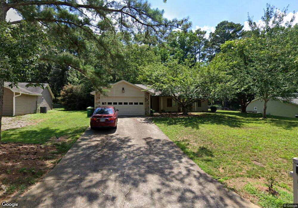
4266 Springfield Dr Unit 2 Norcross, GA 30092
Estimated Value: $357,000 - $562,000
3
Beds
2
Baths
1,714
Sq Ft
$269/Sq Ft
Est. Value
About This Home
This home is located at 4266 Springfield Dr Unit 2, Norcross, GA 30092 and is currently estimated at $460,423, approximately $268 per square foot. 4266 Springfield Dr Unit 2 is a home located in Gwinnett County with nearby schools including Simpson Elementary School, Pinckneyville Middle School, and Norcross High School.
Ownership History
Date
Name
Owned For
Owner Type
Purchase Details
Closed on
Nov 10, 2022
Sold by
Ross Laura
Bought by
Roberts Samuel Paul and Goldberg Gabriella
Current Estimated Value
Home Financials for this Owner
Home Financials are based on the most recent Mortgage that was taken out on this home.
Original Mortgage
$393,000
Outstanding Balance
$380,323
Interest Rate
7.08%
Mortgage Type
New Conventional
Estimated Equity
$80,100
Purchase Details
Closed on
May 28, 2021
Sold by
Kane Alison B
Bought by
Ross Laura
Purchase Details
Closed on
May 7, 2021
Sold by
Kane Gregory M
Bought by
Kane Alison B
Purchase Details
Closed on
Feb 25, 2000
Sold by
Asip Edward R and Asip Claudine J
Bought by
Kane Gregory M and Kane Alison B
Home Financials for this Owner
Home Financials are based on the most recent Mortgage that was taken out on this home.
Original Mortgage
$115,200
Interest Rate
8.3%
Mortgage Type
New Conventional
Create a Home Valuation Report for This Property
The Home Valuation Report is an in-depth analysis detailing your home's value as well as a comparison with similar homes in the area
Home Values in the Area
Average Home Value in this Area
Purchase History
| Date | Buyer | Sale Price | Title Company |
|---|---|---|---|
| Roberts Samuel Paul | $81,800 | -- | |
| Ross Laura | $204,580 | -- | |
| Kane Alison B | -- | -- | |
| Kane Gregory M | $144,000 | -- |
Source: Public Records
Mortgage History
| Date | Status | Borrower | Loan Amount |
|---|---|---|---|
| Open | Roberts Samuel Paul | $393,000 | |
| Previous Owner | Kane Gregory M | $115,200 |
Source: Public Records
Tax History
| Year | Tax Paid | Tax Assessment Tax Assessment Total Assessment is a certain percentage of the fair market value that is determined by local assessors to be the total taxable value of land and additions on the property. | Land | Improvement |
|---|---|---|---|---|
| 2025 | $4,195 | $146,760 | $31,920 | $114,840 |
| 2024 | $4,450 | $153,760 | $36,400 | $117,360 |
| 2023 | $4,450 | $153,760 | $36,400 | $117,360 |
| 2022 | $3,184 | $81,800 | $32,800 | $49,000 |
| 2021 | $3,379 | $119,280 | $26,240 | $93,040 |
| 2020 | $3,272 | $113,200 | $26,000 | $87,200 |
| 2019 | $3,209 | $113,200 | $26,000 | $87,200 |
| 2018 | $3,003 | $103,240 | $24,000 | $79,240 |
| 2016 | $2,504 | $81,920 | $24,000 | $57,920 |
| 2015 | $2,524 | $81,920 | $24,000 | $57,920 |
| 2014 | -- | $79,320 | $24,000 | $55,320 |
Source: Public Records
Map
Nearby Homes
- 5545 Fitzpatrick Terrace
- 4373 Fielding Ln
- 5630 Knox Ct
- 4266 Jones Bridge Cir
- 4457 Stilson Cir Unit 13
- 4531 Outer Bank Dr
- 5727 Shawn Terrace
- 5221 W Jones Bridge Rd
- 4635 Walden Trace
- 4566 Stilson Cir
- 4295 Shawn Ct
- 5350 Wickershire Dr
- 4585 Southport Crossing
- 4594 Cape Kure Ct
- 4220 Mary Ct
- 5716 Fairley Hall Ct
- 4268 Millhouse Ln NW
- 5830 Wilbanks Dr
- 5124 Bandolino Ln Unit 323
- The Adams Plan at Waterside - Condos
- 4256 Springfield Dr
- 4276 Springfield Dr
- 5537 Patrick Ct
- 5547 Patrick Ct
- 4246 Springfield Dr Unit 2
- 5527 Patrick Ct Unit 3
- 4275 Springfield Dr
- 4286 Springfield Dr
- 4255 Springfield Dr Unit 2
- 5557 Patrick Ct Unit 3
- 4403 Fielding Ln Unit 2
- 4245 Springfield Dr Unit 2
- 4236 Springfield Dr
- 4295 Springfield Dr
- 4235 Springfield Dr
- 5558 Patrick Ct
- 5567 Patrick Ct Unit 3
- 4393 Fielding Ln Unit 4393
- 4393 Fielding Ln
- 4393 Fielding Ln Unit 13
Your Personal Tour Guide
Ask me questions while you tour the home.