Estimated Value: $162,000 - $249,000
3
Beds
2
Baths
2,267
Sq Ft
$87/Sq Ft
Est. Value
About This Home
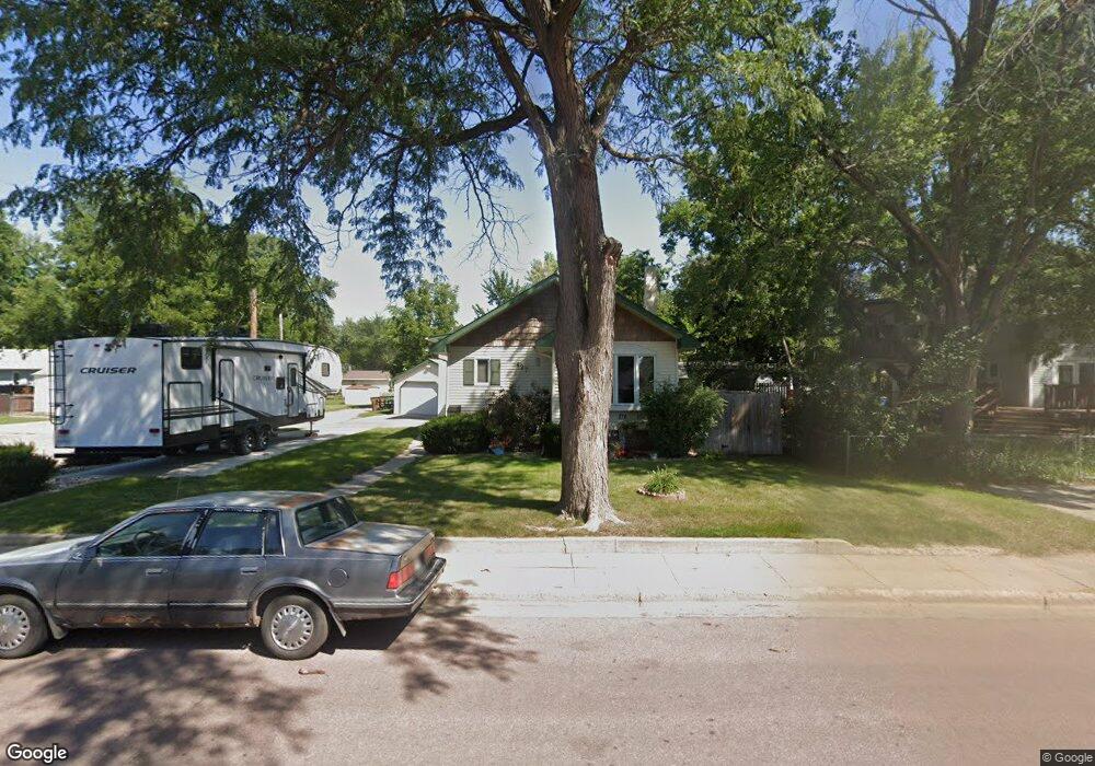
This home is located at 427 12th St SW, Huron, SD 57350 and is currently estimated at $198,331, approximately $87 per square foot. 427 12th St SW is a home with nearby schools including Huron High School, Holy Trinity Catholic Elementary School, and James Valley Christian School.
Ownership History
Date
Name
Owned For
Owner Type
Purchase Details
Closed on
Aug 23, 2017
Bought by
Schock Matthew J and Schock Kelly
Current Estimated Value
Purchase Details
Closed on
May 1, 2009
Sold by
Decker Charles and Decker Amie
Bought by
Schock Matthew J
Home Financials for this Owner
Home Financials are based on the most recent Mortgage that was taken out on this home.
Original Mortgage
$91,800
Interest Rate
4.83%
Mortgage Type
Stand Alone First
Purchase Details
Closed on
Dec 14, 2007
Sold by
Dooley Bradley D and Dooley Mary K
Bought by
Decker Charles
Home Financials for this Owner
Home Financials are based on the most recent Mortgage that was taken out on this home.
Original Mortgage
$78,850
Interest Rate
6.31%
Mortgage Type
Stand Alone First
Create a Home Valuation Report for This Property
The Home Valuation Report is an in-depth analysis detailing your home's value as well as a comparison with similar homes in the area
Home Values in the Area
Average Home Value in this Area
Purchase History
| Date | Buyer | Sale Price | Title Company |
|---|---|---|---|
| Schock Matthew J | -- | -- | |
| Schock Matthew J | $90,000 | -- | |
| Decker Charles | $83,000 | -- |
Source: Public Records
Mortgage History
| Date | Status | Borrower | Loan Amount |
|---|---|---|---|
| Previous Owner | Schock Matthew J | $91,800 | |
| Previous Owner | Decker Charles | $78,850 |
Source: Public Records
Tax History
| Year | Tax Paid | Tax Assessment Tax Assessment Total Assessment is a certain percentage of the fair market value that is determined by local assessors to be the total taxable value of land and additions on the property. | Land | Improvement |
|---|---|---|---|---|
| 2025 | $2,533 | $161,572 | $4,316 | $157,256 |
| 2024 | $2,485 | $154,084 | $4,316 | $149,768 |
| 2023 | $2,255 | $122,710 | $4,316 | $118,394 |
| 2022 | $2,282 | $122,710 | $4,316 | $118,394 |
| 2021 | $1,908 | $122,710 | $4,316 | $118,394 |
| 2020 | $1,934 | $103,502 | $4,316 | $99,186 |
| 2019 | $1,960 | $103,502 | $4,316 | $99,186 |
| 2018 | -- | $103,502 | $4,316 | $99,186 |
| 2017 | -- | $103,502 | $4,316 | $99,186 |
| 2016 | -- | $98,779 | $4,316 | $94,463 |
| 2015 | -- | $98,779 | $4,316 | $94,463 |
| 2014 | -- | $109,992 | $4,316 | $105,676 |
| 2013 | -- | $103,079 | $4,316 | $98,763 |
Source: Public Records
Map
Nearby Homes
- 1472 Ohio Ave SW
- 1023 Dakota Ave S
- 963 Dakota Ave S
- 0 S Dakota 37
- 678 Illinois Ave SW
- 675 California Ave SW
- 854 Kansas Ave SE
- 545 Montana Ave SW
- 540 18th St SW
- 740 Michigan Ave SW
- 1836 Illinois Ave SW
- 132 7th St SE
- 1729 Kansas Ave SE
- 821 Idaho Ave SE
- 551 Kansas Ave SE
- 1810 Kansas Ave
- 1980 Meadowlark Ln Unit 302
- 842 Utah Ave SE
- 931 Beach Ave SE
- 1776 Idaho Ave SE
- 1181 Nebraska Ave SW
- 457 12th St SW
- 1153 Nebraska Ave SW
- 1219 Campbell Dr
- 1188 Colorado Ave SW
- 1105 Nebraska Ave SW
- 1172 Colorado Ave SW
- 1172 Colorado Ave SW
- 1154 Colorado Ave SW
- 1137 Nebraska Ave SW
- 1251 Campbell Dr
- 1188 Nebraska Ave SW
- 1140 Colorado Ave SW
- 1125 Nebraska Ave SW
- 1160 Nebraska Ave SW
- 1148 Nebraska Ave SW
- 1115 Nebraska Ave SW
- 1234 McDonald Dr
- 1120 Colorado Ave SW
- 1218 Campbell Dr
Your Personal Tour Guide
Ask me questions while you tour the home.