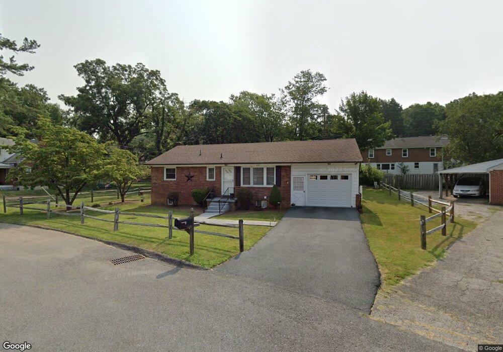
427 Benson St Staunton, VA 24401
Estimated Value: $241,000 - $263,683
3
Beds
1
Bath
1,752
Sq Ft
$145/Sq Ft
Est. Value
About This Home
This home is located at 427 Benson St, Staunton, VA 24401 and is currently estimated at $254,171, approximately $145 per square foot. 427 Benson St is a home located in Staunton City with nearby schools including Thomas C. McSwain Elementary School, Shelburne Middle School, and Staunton High School.
Ownership History
Date
Name
Owned For
Owner Type
Purchase Details
Closed on
Apr 9, 2009
Sold by
Wells Fargo Bank Na
Bought by
Wilmott Regina K
Current Estimated Value
Home Financials for this Owner
Home Financials are based on the most recent Mortgage that was taken out on this home.
Original Mortgage
$122,735
Interest Rate
4.82%
Mortgage Type
FHA
Purchase Details
Closed on
Dec 31, 2008
Sold by
Equity Trustees Llc
Bought by
Wells Fargo Bank Na
Purchase Details
Closed on
Jun 21, 2006
Sold by
Burns Homer E and Burns Debbie D
Bought by
Sargent Noah D and Sirois Susan M
Home Financials for this Owner
Home Financials are based on the most recent Mortgage that was taken out on this home.
Original Mortgage
$147,946
Interest Rate
9.72%
Mortgage Type
Purchase Money Mortgage
Purchase Details
Closed on
Jul 27, 2005
Sold by
Pullin Chad E and Pullin Sara M
Bought by
Burns Homer E and Burns Debbie D
Create a Home Valuation Report for This Property
The Home Valuation Report is an in-depth analysis detailing your home's value as well as a comparison with similar homes in the area
Purchase History
| Date | Buyer | Sale Price | Title Company |
|---|---|---|---|
| Wilmott Regina K | $125,000 | None Available | |
| Wells Fargo Bank Na | $123,250 | None Available | |
| Sargent Noah D | -- | None Available | |
| Burns Homer E | -- | None Available |
Source: Public Records
Mortgage History
| Date | Status | Borrower | Loan Amount |
|---|---|---|---|
| Previous Owner | Wilmott Regina K | $122,735 | |
| Previous Owner | Sargent Noah D | $147,946 |
Source: Public Records
Tax History
| Year | Tax Paid | Tax Assessment Tax Assessment Total Assessment is a certain percentage of the fair market value that is determined by local assessors to be the total taxable value of land and additions on the property. | Land | Improvement |
|---|---|---|---|---|
| 2025 | $2,037 | $223,840 | $43,940 | $179,900 |
| 2024 | $1,746 | $196,150 | $38,250 | $157,900 |
| 2023 | $1,746 | $196,150 | $38,250 | $157,900 |
| 2022 | $1,431 | $155,490 | $27,590 | $127,900 |
| 2021 | $1,431 | $155,490 | $27,590 | $127,900 |
| 2020 | $1,358 | $142,990 | $27,590 | $115,400 |
| 2019 | $1,358 | $142,990 | $27,590 | $115,400 |
| 2018 | $1,316 | $135,690 | $27,590 | $108,100 |
| 2017 | $1,316 | $135,690 | $27,590 | $108,100 |
| 2016 | $1,262 | $132,890 | $27,590 | $105,300 |
| 2015 | $1,262 | $132,890 | $27,590 | $105,300 |
| 2014 | $1,248 | $131,390 | $27,590 | $103,800 |
Source: Public Records
Map
Nearby Homes
- 958 Donaghe St
- 1012 Spring Hill Rd
- 1221 Donaghe St
- 1200 Spaulding St
- 1198 Spaulding St
- 725 Aintree Place
- 811 Westover Dr
- 818 N Augusta St
- 5 Trace Dr
- 908 Belmore Ave
- 625 Alleghany Ave
- 814 N Coalter St
- 317 N Madison St
- 610 A St
- 806 Randolph St
- 620 B St
- 112 Lee St
- 200 Robinhood Rd
- 201 N Market St
- 2408 Cedar St
- 940 Donaghe St
- 413 Benson St
- 429 Benson St
- 428 Benson St Unit Number A
- 428 Benson St
- 954 & 940 Donaghe St
- 938 Donaghe St
- 418 Benson St
- 954 Donaghe St
- 414 Benson St
- 432 Benson St Unit 2nd floor
- 432 Benson St
- 431 Benson St
- 408 Benson St Unit 408 Benson
- 408 Benson St Unit 409 Benson
- 408 Benson St
- 433 Benson St
- 934 Donaghe St
- 409 Carter St
- 931 Baylor St
Your Personal Tour Guide
Ask me questions while you tour the home.