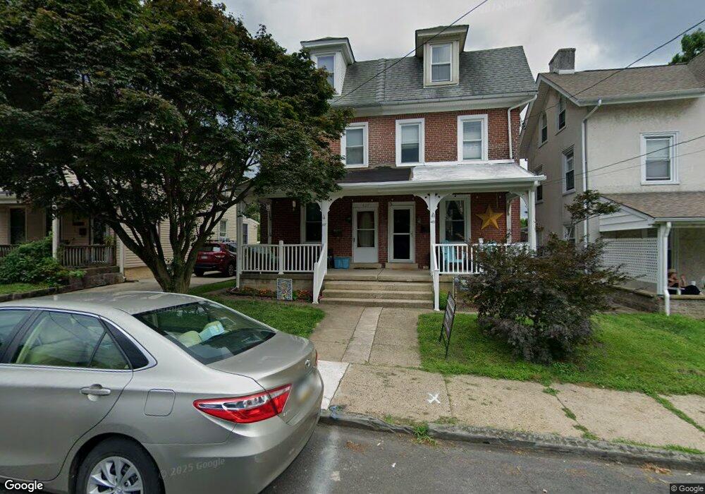
427 Maple St Jenkintown, PA 19046
Estimated Value: $323,000 - $392,000
4
Beds
2
Baths
1,848
Sq Ft
$199/Sq Ft
Est. Value
About This Home
This home is located at 427 Maple St, Jenkintown, PA 19046 and is currently estimated at $367,391, approximately $198 per square foot. 427 Maple St is a home located in Montgomery County with nearby schools including Jenkintown Elementary School, Jenkintown Middle/High School, and Abington Friends School.
Ownership History
Date
Name
Owned For
Owner Type
Purchase Details
Closed on
Mar 12, 2003
Sold by
Gelfin Ronald F and Gelfin Christina M
Bought by
Nyi Wai
Current Estimated Value
Purchase Details
Closed on
Apr 30, 1998
Sold by
Friel William A and Friel Gertrude E
Bought by
Gelfin Ronald G and Gelfin Christina M
Create a Home Valuation Report for This Property
The Home Valuation Report is an in-depth analysis detailing your home's value as well as a comparison with similar homes in the area
Home Values in the Area
Average Home Value in this Area
Purchase History
| Date | Buyer | Sale Price | Title Company |
|---|---|---|---|
| Nyi Wai | $142,000 | -- | |
| Wai Mara | $142,000 | -- | |
| Wai Nyi | $142,000 | -- | |
| Gelfin Ronald G | $102,000 | -- |
Source: Public Records
Tax History Compared to Growth
Tax History
| Year | Tax Paid | Tax Assessment Tax Assessment Total Assessment is a certain percentage of the fair market value that is determined by local assessors to be the total taxable value of land and additions on the property. | Land | Improvement |
|---|---|---|---|---|
| 2025 | $7,274 | $113,640 | $45,200 | $68,440 |
| 2024 | $7,274 | $113,640 | $45,200 | $68,440 |
| 2023 | $6,878 | $113,640 | $45,200 | $68,440 |
| 2022 | $6,554 | $113,640 | $45,200 | $68,440 |
| 2021 | $6,350 | $113,640 | $45,200 | $68,440 |
| 2020 | $6,161 | $113,640 | $45,200 | $68,440 |
| 2019 | $6,054 | $113,640 | $45,200 | $68,440 |
| 2018 | $4,173 | $113,640 | $45,200 | $68,440 |
| 2017 | $5,749 | $113,640 | $45,200 | $68,440 |
| 2016 | $5,704 | $113,640 | $45,200 | $68,440 |
| 2015 | $5,566 | $113,640 | $45,200 | $68,440 |
| 2014 | $5,450 | $113,640 | $45,200 | $68,440 |
Source: Public Records
Map
Nearby Homes
- 400 Cedar St
- 600 Runnymede Ave
- 1708 Madeira Ave
- 303 Rodman Ave
- 606 Wanamaker Rd
- 524 Greenwood Ave
- 547 Baeder Rd
- 204 Runnymede Ave
- 1635 Spring Ave
- 304 Florence Ave
- 1907 Jenkintown Rd
- 309 Florence Ave Unit 401-N
- 309 Florence Ave Unit 420N
- 309 Florence Ave Unit 511-N
- 309 Florence Ave Unit 112-N
- 309 Florence Ave Unit 229N
- 309 Florence Ave Unit 119-N
- 309 Florence Ave Unit 612-N
- 604 Pinetree Rd
- 100 West Ave Unit 326S